Alaji Basalts

Last updated
Alaji Basalts
Stratigraphic range: Miocene
Alaji Basalts near the peak of Gumawta Mt. in Dogu'a Tembien.jpg
Mt. Gumawta, Tembien highlands
Type Geological formation
Underlies Pliocene shield volcanoes, locally
Overlies Ashangi Basalts, Intra-volcanic sedimentary rock
Thickness220 m (720 ft)
Lithology
Primary Basalt, Rhyolite
Other Trachyte
Location
Coordinates 12°58′54″N39°31′11″E / 12.9817°N 39.5198°E / 12.9817; 39.5198
Region Tigray
CountryFlag of Ethiopia.svg  Ethiopia
Extent Ethiopian Highlands
Type section
Named for Imba Alaje Mountain
Named by William Thomas Blanford
Ethiopia relief location map.jpg
Blue pog.svg
Alaji Basalts (Ethiopia)

The Alaji (upper) Basalts are the youngest series of the Ethiopian flood basalts. The most recent flows are only 15 million years old. [1] [2]

Contents

Name and definition

The name was coined by geologist William Thomas Blanford, who accompanied the British Expedition to Abyssinia in 1868, [3] after the Imba Alaje mountain. So far the nomenclature has not been proposed for recognition to the International Commission on Stratigraphy.

Stratigraphic context

The Alaji Basalts are the uppermost Tertiary flood basalts in Ethiopia. Locally they are covered by Pliocene shield volcanoes, such as the Simien Mountains, or Mount Guna. These flows have been deposited on the lower Ashangi Basalts and locally on intra-volcanic sedimentary rock.

Environment

Like all volcanic rocks, the Alaji Basalts originate from initial melting of the Earth's mantle. After extrusion, the magmatic structures form at the surface. Common volcanic structures such as lava tubes or ropy lavas are absent in the Alaji Basalts, but (columnar joints) are omnipresent. The basalts comprise successive flows. During cooling, newly developed crystals within the lava solidify and develop congealing stress that favours the formation of columnar joints (intersecting fractures). They are perpendicular to the surface of the lava flow: mostly vertical, but sometimes also inclined or almost horizontal. [4] [5]

Lithology

The Bi'en ridge near Hagere Selam in the Tigray Region is composed of Alaji Basalts. Weathering of the rock has led to the occurrence of fertile Luvisols Alaji Basalts provide fertile soils.jpg
The Bi’en ridge near Hagere Selam in the Tigray Region is composed of Alaji Basalts. Weathering of the rock has led to the occurrence of fertile Luvisols

The Alaji Basalts hold alternating layers of rhyolitic and basaltic rocks. Its thickness varies between 80 and 220 metres. The upper layer is capped by trachytic materials. The lower part of the Alaji Basalts is composed of medium- to fine-grained basalts. The middle succession holds elongated plagioclase-dominated trachytes. The mineralogy of the basaltic rocks is marked by well-aligned elongated pyroxenes and micro-plagioclases. In the mineralogy of the trachytes one notices especially the by twinning of feldspar minerals and a small amount of altered pyroxenes. [4]

Rock sample of aphanitic basalt, collected at Addi Amyuq pass Rock sample 4 Aphanitic basalt Addi Amyuq pass.jpg
Rock sample of aphanitic basalt, collected at Addi Amyuq pass

Geographical extent

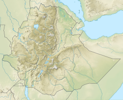
The formation outcrops widely in the Ethiopian highlands, particularly in the upper landscape positions. [6]

Related Research Articles

<span class="mw-page-title-main">Basalt</span> Magnesium- and iron-rich extrusive igneous rock

Basalt is an aphanitic (fine-grained) extrusive igneous rock formed from the rapid cooling of low-viscosity lava rich in magnesium and iron exposed at or very near the surface of a rocky planet or moon. More than 90% of all volcanic rock on Earth is basalt. Rapid-cooling, fine-grained basalt is chemically equivalent to slow-cooling, coarse-grained gabbro. The eruption of basalt lava is observed by geologists at about 20 volcanoes per year. Basalt is also an important rock type on other planetary bodies in the Solar System. For example, the bulk of the plains of Venus, which cover ~80% of the surface, are basaltic; the lunar maria are plains of flood-basaltic lava flows; and basalt is a common rock on the surface of Mars.

<span class="mw-page-title-main">Rhyolite</span> Igneous, volcanic rock, of felsic (silica-rich) composition

Rhyolite is the most silica-rich of volcanic rocks. It is generally glassy or fine-grained (aphanitic) in texture, but may be porphyritic, containing larger mineral crystals (phenocrysts) in an otherwise fine-grained groundmass. The mineral assemblage is predominantly quartz, sanidine, and plagioclase. It is the extrusive equivalent of granite.

<span class="mw-page-title-main">Dacite</span> Volcanic rock intermediate in composition between andesite and rhyolite

Dacite is a volcanic rock formed by rapid solidification of lava that is high in silica and low in alkali metal oxides. It has a fine-grained (aphanitic) to porphyritic texture and is intermediate in composition between andesite and rhyolite. It is composed predominantly of plagioclase feldspar and quartz.

<span class="mw-page-title-main">Trachyte</span> Extrusive igneous rock

Trachyte is an extrusive igneous rock composed mostly of alkali feldspar. It is usually light-colored and aphanitic (fine-grained), with minor amounts of mafic minerals, and is formed by the rapid cooling of lava enriched with silica and alkali metals. It is the volcanic equivalent of syenite.

<span class="mw-page-title-main">Andesite</span> Type of volcanic rock

Andesite is a volcanic rock of intermediate composition. In a general sense, it is the intermediate type between silica-poor basalt and silica-rich rhyolite. It is fine-grained (aphanitic) to porphyritic in texture, and is composed predominantly of sodium-rich plagioclase plus pyroxene or hornblende.

<span class="mw-page-title-main">Anahim Volcanic Belt</span> Chain of volcanoes and related magmatic features in British Columbia, Canada

The Anahim Volcanic Belt (AVB) is a west–east trending chain of volcanoes and related magmatic features in British Columbia, Canada. It extends from Athlone Island on the Central Coast, running eastward through the strongly uplifted and deeply dissected Coast Mountains to near the community of Nazko on the Interior Plateau. The AVB is delineated as three west-to-east segments that differ in age and structure. A wide variety of igneous rocks with differing compositions occur throughout these segments, comprising landforms such as volcanic cones, volcanic plugs, lava domes, shield volcanoes and intrusions.

<span class="mw-page-title-main">Flood basalt</span> Very large volume eruption of basalt lava

A flood basalt is the result of a giant volcanic eruption or series of eruptions that covers large stretches of land or the ocean floor with basalt lava. Many flood basalts have been attributed to the onset of a hotspot reaching the surface of the Earth via a mantle plume. Flood basalt provinces such as the Deccan Traps of India are often called traps, after the Swedish word trappa, due to the characteristic stairstep geomorphology of many associated landscapes.

<span class="mw-page-title-main">Komatiite</span> Ultramafic mantle-derived volcanic rock

Komatiite is a type of ultramafic mantle-derived volcanic rock defined as having crystallised from a lava of at least 18 wt% magnesium oxide (MgO). It is classified as a 'picritic rock'. Komatiites have low silicon, potassium and aluminium, and high to extremely high magnesium content. Komatiite was named for its type locality along the Komati River in South Africa, and frequently displays spinifex texture composed of large dendritic plates of olivine and pyroxene.

<span class="mw-page-title-main">Igneous rock</span> Rock formed through the cooling and solidification of magma or lava

Igneous rock, or magmatic rock, is one of the three main rock types, the others being sedimentary and metamorphic. Igneous rocks are formed through the cooling and solidification of magma or lava.

São Tomé and Príncipe both formed within the past 30 million years due to volcanic activity in deep water along the Cameroon line. Long-running interactions with seawater and different eruption periods have generated a wide variety of different igneous and volcanic rocks on the islands with complex mineral assemblages.

<span class="mw-page-title-main">Amba Aradam Formation</span> Rock formation

The Amba Aradam Formation is a Cretaceous sandstone formation in Ethiopia. It is up to 200 metres thick, for instance in the Degua Tembien district. As fossils are absent, the age of the Amba Aradam Formation was interpreted based on the age of assumed corresponding sandstones elsewhere in Ethiopia: the Debre Libanos Sandstones in the Blue Nile Basin, and the Upper Sandstone near Harrar in southeast Ethiopia, both of Late Cretaceous age. The lithology of the Amba Aradam Formation makes it less suitable for rock church excavation; caves have however been blasted in this formation to serve as headquarters for the TPLF during the Ethiopian Civil War of the 1980s.

<span class="mw-page-title-main">Phonolite series in North Ethiopia</span>

The phonolite or clinkstone of northern Ethiopia is a shallow-seated igneous rock. The phonolites intruded and punctured the Mesozoic sedimentary rocks and the Tertiary flood basalts some 19 to 11 million years ago.

<span class="mw-page-title-main">Ashangi Basalts</span>

The Ashangi Basalts are the earliest Tertiary volcanic rocks in north Ethiopia, hence they are in the lowest position. These dark porphyritic basalts are separated from the Mesozoic formations below it by basal conglomerates. The basalts hold phenocrysts that developed before the magma reached the earth surface. These basalts are weathered, partially eroded and have a sub-horizontal stratification, particularly at the lower part. This series was created during the first period of the flood basalt eruptions in north Ethiopia, in the Oligocene.

<span class="mw-page-title-main">Intra-volcanic sedimentary rock in North Ethiopia</span>

Between 29 and 27 million years ago, the extrusion of Ethiopia’s flood basalts was interrupted and deposition of continental sediments occurred. Inter-trappean beds outcrop in many places of the Ethiopian highlands. They consist of fluvio-lacustrine deposits, that are generally a few tens of metres thick. Often, these interbedded fluvio-lacustrine deposits are very visible because their bright colours strongly contrast with the basalt environment.

<span class="mw-page-title-main">Lim'at</span> Municipality in Ethiopia

Lim’at is a tabia in the Dogu'a Tembien district of the Tigray Region of Ethiopia. The tabia centre is in Maygwa village, located approximately 8 km to the southwest of the woreda town Hagere Selam.

<span class="mw-page-title-main">Tsaliet</span> River in the Tembien highlands of Ethiopia

Tsaliet is a river in northern Ethiopia, belonging to the Nile basin. Rising in the mountains of Dogu’a Tembien, where it is first called May Leiba River and then Tinsehe River, it flows westward through a deep gorge, to become Tsaliet in its lower course, where it empties in Weri’i River, just upstream of the main Weri’i bridge along the road to Adwa.

<span class="mw-page-title-main">May Qoqah</span> River in the Tembien highlands of Ethiopia

May Qoqah is a river of the Nile basin. Rising on the Ts’ats’en plateau of Dogu’a Tembien in northern Ethiopia, it flows northward to empty finally in Giba and Tekezé River.

<span class="mw-page-title-main">Arwadito</span> River in the Tembien highlands of Ethiopia

Arwadito is a torrent of the Nile basin. Rising on the Ts’ats’en plateau of Dogu’a Tembien in northern Ethiopia, it flows northward to empty finally in Giba and Tekezé River.

<span class="mw-page-title-main">Adawro River</span> River in the Tembien highlands of Ethiopia

Adawro is a torrent of the Nile basin. Rising on the Ts’ats’en plateau of Dogu’a Tembien in northern Ethiopia, it flows northward to empty finally in Giba and Tekezé River.

<span class="mw-page-title-main">Tanqwa</span> River in the Tigray highlands of Ethiopia

Tanqwa is a river of northern Ethiopia. Rising in the mountains of Dogu’a Tembien, it flows westward to Giba River which empties finally in the Tekezé River.

References

  1. Mohr, P.; Zanettin, B. (1988). The Ethiopian flood basalt province. In: Continental flood basalts. Dordrecht: Springer. pp. 63–110. doi:10.1007/978-94-015-7805-9_3.
  2. Hofmann, C., and colleagues (1997). "Timing of the Ethiopian flood basalt event and implications for plume birth and environmental change". Nature. 389: 838–841. doi:10.1038/39853. S2CID   205027259.{{cite journal}}: CS1 maint: multiple names: authors list (link)
  3. Blanford, W.T. (1870). Observations on the geology and zoology of Abyssinia, made during the progress of the British expedition to that country in 1867-68. London: Macmillan and Co.
  4. 1 2 Miruts Hagos and colleagues (2019). The volcanic rock cover of the Dogu'a Tembien massif. In: Geo-Trekking in Ethiopia's Tropical Mountains, the Dogu'a Tembien District. SpringerNature. ISBN   978-3-030-04954-6.
  5. Pik, R., and colleagues (1998). "The northwestern Ethiopian Plateau flood basalts: classification and spatial distribution of magma types". J Volcanol Geotherm Res. 81 (1–2): 91–111. doi:10.1016/S0377-0273(97)00073-5.{{cite journal}}: CS1 maint: multiple names: authors list (link)
  6. Kieffer, B., and colleagues (2004). "Flood and shield basalts from Ethiopia: magmas from the African superswell". J. Petrol. 45 (4): 793–834. doi:10.1093/petrology/egg112.{{cite journal}}: CS1 maint: multiple names: authors list (link)