Alto (community), Wisconsin

Last updated

Alto, Wisconsin
Alto Wisconsin Looking North.jpg
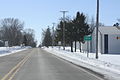
Looking north in downtown Alto
USA Wisconsin location map.svg
Red pog.svg
Alto, Wisconsin
Usa edcp location map.svg
Red pog.svg
Alto, Wisconsin
Coordinates: 43°40′36″N88°47′42″W / 43.67667°N 88.79500°W / 43.67667; -88.79500
Country Flag of the United States.svg  United States
State Flag of Wisconsin.svg  Wisconsin
County   Fond du Lac
Elevation
288 m (945 ft)
Time zone UTC-6 (Central (CST))
  Summer (DST) UTC-5 (CDT)
Area code 920
GNIS feature ID1560805 [1]

Alto is an unincorporated community located in the town of Alto, Fond du Lac County, Wisconsin, United States. [1]

Contents

Alto Fair

For two days every year in early August, the Alto 4-H club and Farm Bureau sponsor a county fair-style event. The Alto Fair starts on a Wednesday and ends the following day, allegedly because a weekend fair would discourage children from attending church services. The fair includes events such as 4-H judging, a tractor pull, and country breakfasts each morning of the fair. [2]

According to the United States Census Bureau, the town has a total area of 36.3 square miles (94.0 km²), all of it land. [3]

Images

Related Research Articles

<span class="mw-page-title-main">Los Altos, California</span> City in California, United States

Los Altos is a city in Santa Clara County, California, in the San Francisco Bay Area. The population was 31,625 according to the 2020 census.

<span class="mw-page-title-main">Allen County, Ohio</span> County in Ohio, United States

Allen County is a county located in the northwestern part of the U.S. state of Ohio. Its county seat and largest city is Lima. The county was created in 1820 and organized in 1831. The county is named in honor of Colonel John Allen, who was killed leading his men at the Battle of Frenchtown during the War of 1812.

<span class="mw-page-title-main">Howard County, Indiana</span> County in Indiana, United States

Howard County is one of 92 counties in the U.S. state of Indiana. As of the 2020 census, the population was 83,658. The county seat is Kokomo. Originally named Richardville County, it was renamed in 1846 to commemorate General Tilghman Ashurst Howard.

<span class="mw-page-title-main">North Fair Oaks, California</span> Census-designated place in California, United States

North Fair Oaks is a census-designated place and an unincorporated area located in San Mateo County, California adjacent to Redwood City, Atherton, and Menlo Park. As of the 2020 census the area had a total population of 14,027. Because of the large number of residents from one Mexican state the area is also known as Little Michoacán. The larger area including North Fair Oaks and adjacent parts of Redwood City has a large Latino population and is known locally as Little Mexico. The neighborhood is distinctive, as it is one out of only three communities in San Mateo County that have a majority Hispanic population.

<span class="mw-page-title-main">Los Altos Hills, California</span> City in California, United States

Los Altos Hills is an incorporated town in Santa Clara County, California, United States. The population was 8,489 at the 2020 census. The town is known for its affluence and expensive residential real estate.

<span class="mw-page-title-main">Perry, Georgia</span> City in Georgia, United States

Perry is a city in Houston and Peach counties in the U.S. state of Georgia. It is the county seat of Houston County. The population was 13,839 at the 2010 census, up from 9,602 at the 2000 census. As of 2019 the estimated population was 17,894. It is part of the Warner Robins, Georgia metropolitan statistical area, within the Macon–Bibb County–Warner Robins combined statistical area.

<span class="mw-page-title-main">Leitchfield, Kentucky</span> City in Kentucky, United States

Leitchfield is the county seat of Grayson County, Kentucky, United States. Leitchfield is a home rule-class city with a population of 6,404 as of the 2020 census.

<span class="mw-page-title-main">Cummington, Massachusetts</span> Town in Massachusetts, United States

Cummington is a town in Hampshire County, Massachusetts, United States. The population was 829 at the 2020 census, a decline from the figure of 872 tabulated in 2010. It is part of the Springfield, Massachusetts Metropolitan Statistical Area.

<span class="mw-page-title-main">Canterbury, New Hampshire</span> Town in New Hampshire, United States

Canterbury is a town in Merrimack County, New Hampshire, United States. The population was 2,389 at the 2020 census. The Canterbury Shaker Village is in the eastern part of the town.

<span class="mw-page-title-main">Hopkinton, New Hampshire</span> Town in New Hampshire, United States

Hopkinton is a town in Merrimack County, New Hampshire, United States. The population was 5,914 at the 2020 census. The town has three distinct communities: Hopkinton village, mainly a residential area in the center of the town; Contoocook, the town's business hub, located in the north; and West Hopkinton, within the more agricultural portion of the town. The town is home to the Hopkinton State Fair, adjacent to Contoocook village, and to the historic Contoocook Railroad Depot and the Contoocook Railroad Bridge, the oldest covered railroad bridge in the United States.

<span class="mw-page-title-main">Mont Alto, Pennsylvania</span> Borough in Pennsylvania, United States

Mont Alto is a borough in Franklin County, Pennsylvania, United States. The population was 1,580 at the 2020 census.

<span class="mw-page-title-main">Palo Alto, Pennsylvania</span> Borough in Pennsylvania, United States

Palo Alto is a borough in Schuylkill County, Pennsylvania, United States. Bacon Street is the main street of town.

<span class="mw-page-title-main">Munford, Tennessee</span> City in Tennessee, United States

Munford is a city in Tipton County, Tennessee. The population was 5,927 at the 2010 census, when it was listed as a town.

<span class="mw-page-title-main">Alto, Texas</span> Town in Texas, United States

Alto is a town in Cherokee County, Texas, United States. With a population of 1,027 at the 2020 U.S. census, Alto is the closest municipality to the Caddo Mounds State Historic Site, an archaeological site dating back to 800 BC, featuring a prehistoric village and ceremonial center.

<span class="mw-page-title-main">Essex Junction, Vermont</span> City in Vermont, United States

Essex Junction is a city in Chittenden County, Vermont, United States. As of the 2020 U.S. census, the population was 10,590. It was incorporated as a village on November 15, 1892. Essex Junction became Vermont’s 10th city on July 1, 2022.

<span class="mw-page-title-main">Elkhorn, Wisconsin</span> City in Wisconsin, United States

Elkhorn is a city and the county seat of Walworth County, Wisconsin, United States. It is located 40 miles (64 km) southwest of Milwaukee. As of the 2020 census, it was home to 10,247 people, up from 10,084 at the 2010 census.

<span class="mw-page-title-main">Fair Haven, Vermont</span> Town in Vermont, United States

Fair Haven is a town in Rutland County, Vermont, United States. The population was 2,736 at the 2020 census. Within the town is located the census-designated place of Fair Haven. The town is noted for its late 19th century residential and commercial architecture.

<span class="mw-page-title-main">Trujillo Alto, Puerto Rico</span> Town and municipality in Puerto Rico

Trujillo Alto is a town and municipality of Puerto Rico located in the Northern Coastal Plain, on the boundary between the karst zone and Sierra de Luquillo, north of Caguas, and Gurabo; southeast of San Juan, and west of Carolina. Trujillo Alto is part of the San Juan Metropolitan Area, which includes the municipalities of Bayamón, Guaynabo, Cataño, and Toa Baja. The city is spread over 6 barrios and Trujillo Alto Pueblo. It is part of the San Juan-Caguas-Guaynabo Metropolitan Statistical Area.

Alto was an unincorporated town which is now a neighborhood of Kokomo in Harrison Township, Howard County, Indiana, United States. It is part of the Kokomo, Indiana Metropolitan Statistical Area. Alto was annexed into the city of Kokomo January 1, 2012.

Pinos Altos is a census-designated place in Grant County, New Mexico, United States. The community was a mining town, formed in 1860 following the discovery of gold in the nearby Pinos Altos Mountains. The town site is located about five to ten miles north of the present day Silver City. Although once abandoned, the town is now a place for summer homes and caters to tourists. Its population was 198 as of the 2010 census.

References

  1. 1 2 "Alto". Geographic Names Information System . United States Geological Survey, United States Department of the Interior.
  2. Alto Fair
  3. "Home". Town of Alto. September 30, 2021. Retrieved May 23, 2024.