Washington County is a county in the U.S. state of Wisconsin. As of the 2010 census, the population was 131,887. Its county seat is West Bend. The county was created from Wisconsin Territory in 1836 and organized in 1845. It was named after President George Washington.

Fond du Lac County is a county in the U.S. state of Wisconsin. As of the 2020 census, the population was 104,154. Its county seat is Fond du Lac. The county was created in the Wisconsin Territory in 1836 and later organized in 1844. Fond du Lac is French for "bottom of the lake", so given because of the county's location at the southern shore of Lake Winnebago. Fond du Lac County comprises the Fond du Lac, Wisconsin Metropolitan Statistical Area. The Holyland region is in northeastern Fond du Lac County.

Dodge County is a county located in the U.S. state of Wisconsin. As of the 2020 census, the population was 89,396. Its county seat is Juneau. The county was created from the Wisconsin Territory in 1836 and organized in 1844.

Campbellsport is a village in Fond du Lac County, Wisconsin, United States. The population was 2,016 at the 2010 census.

St. Cloud is a village in Fond du Lac County, Wisconsin, United States, along the Sheboygan River. The population was 477 at the 2010 census. St. Cloud is part of The Holyland region in northeastern Fond du Lac County.

Taycheedah is a town in Fond du Lac County, Wisconsin, United States. The population was 3,666 at the 2000 census. The census-designated places of St. Peter and Taycheedah and the unincorporated communities of Bergen Beach, Gladstone Beach, Hopokoekau Beach, Linden Beach, Minawa Beach, Peebles, Silica, and Welling Beach are located in the town. The unincorporated community of Malone is also located partially in the town.
Fond du Lac is a city in Fond du Lac County, Wisconsin, United States. The population was 43,021 at the 2010 census. The population increased to 44,678 at the 2020 census. The city forms the core of the United States Census Bureau's Fond du Lac Metropolitan Statistical Area, which includes all of Fond du Lac County. Fond du Lac is the 342nd largest Metropolitan Statistical Area (MSA) in the United States. The Fond du Lac MSA and the Beaver Dam (city), Wisconsin Micropolitan Statistical Area, form the larger Fond du Lac-Beaver Dam Combined Statistical Area.

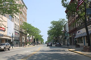
Ripon is a city in Fond du Lac County, Wisconsin, United States. The population was 7,733 at the 2010 census. The city is surrounded by the Town of Ripon.

Kewaskum is a town in Washington County, Wisconsin, United States. The population was 1,119 at the 2000 census. The incorporated community of Village of Kewaskum is surrounded geographically by the Town of Kewaskum. The unincorporated community of Saint Michaels is located partially in the town.

Kewaskum is a village in Washington and Fond du Lac counties in Wisconsin, United States. The population was 4,004 at the 2010 census. All of this population resided in the Washington County portion of the village. The village is mostly surrounded by the Town of Kewaskum.

The Fond du Lac Indian Reservation is an Indian reservation in northern Minnesota near Cloquet in Carlton and Saint Louis counties. Off-reservation holdings are located across the state in Douglas County, in the northwest corner of Wisconsin. The total land area of these tribal lands is 153.8375 square miles (398.437 km2). It is the land-base for the Fond du Lac Band of Lake Superior Chippewa. Before the establishment of this reservation, the Fond du Lac Band of Lake Superior Chippewa were located at the head of Lake Superior, closer to the mouth of the Saint Louis River, where Duluth has developed.

Malone is an unincorporated community located in Fond du Lac County, Wisconsin near the Sheboygan River and Mt. Calvary, in the towns of Marshfield, and Taycheedah. Malone is located in The Holyland region of Wisconsin. It is home to a post office.

Pipe, Wisconsin is an unincorporated community in the Town of Calumet in Fond du Lac County, Wisconsin, United States. It is located approximately 1 mile (1.6 km) east of Lake Winnebago.
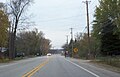
Marytown, Wisconsin is an unincorporated community in Fond du Lac County, Wisconsin, in the town of Calumet. Marytown is located at the intersection of Fond du Lac County highways G and HH. Wisconsin Highway 149 ran north to south through the community before it was decommissioned in 2006.

Van Dyne is an unincorporated census-designated place in the town of Friendship, in Fond du Lac County, Wisconsin, United States. At the 2010 census, its population is 279. The road traveling north-south through the community was part of the Yellowstone Trail and later Wisconsin Highway 175; it is now a county highway.

Peebles, Wisconsin is an unincorporated community in the Town of Taycheedah in Fond du Lac County, Wisconsin. The community is located adjacent to the unincorporated community of Taycheedah. U.S. Route 151 runs through the community. Wisconsin Highway 149 used to run through the community at its western terminus until it was decommissioned in 2006. Taycheedah Correctional Institution is located in the town of Taycheedah several miles south of the community.

St. Peter, Wisconsin is an unincorporated census-designated place in the Town of Taycheedah in Fond du Lac County, Wisconsin. It is located approximately 2 miles (3.2 km) northeast of Peebles and 1 mile (1.6 km) south of Silica. It was located on Wisconsin Highway 149 before the highway was decommissioned and turned over to county control as County Highway WH. As of the 2010 census, its population is 1,489.

Silica, Wisconsin is an unincorporated community in the Town of Taycheedah in Fond du Lac County, Wisconsin. It is located at the intersection of County Highway QQ and Silica Road, approximately 1 mile (1.6 km) north of St. Peter.
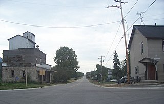
Woodhull is an unincorporated community located in the town of Lamartine, Fond du Lac County, Wisconsin, United States.
New Cassel or New Cassell, formerly Crouchville, was a village on the Milwaukee River in the northwestern corner of the Town of Auburn in Fond du Lac County, Wisconsin. It was eventually absorbed into Campbellsport, Wisconsin after the latter was incorporated in 1902, and now constitutes the east end of that village.