
Palanan, officially the Municipality of Palanan, is a 1st class municipality in the province of Isabela, Philippines. According to the 2015 census, it has a population of 17,260 people.

Claveria, officially the Municipality of Claveria, is a 3rd class municipality in the province of Cagayan, Philippines. According to the 2015 census, it has a population of 29,921 people. It was located directly south of Taiwan via Bashi Channel to Luzon Strait and north of Luzon Island.
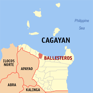
Ballesteros, officially the Municipality of Ballesteros, is a 4th class municipality in the province of Cagayan, Philippines. According to the 2015 census, it has a population of 34,299 people.

Buguey, officially the Municipality of Buguey, is a 3rd class municipality in the province of Cagayan, Philippines. According to the 2015 census, it has a population of 30,175 people.

Camalaniugan, officially the Municipality of Camalaniugan, is a 4th class municipality in the province of Cagayan, Philippines. According to the 2015 census, it has a population of 24,923 people.

Iguig, officially the Municipality of Iguig, is a 4th class municipality in the province of Cagayan, Philippines. According to the 2015 census, it has a population of 27,862 people.
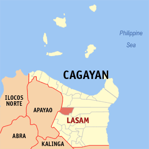
Lasam, officially the Municipality of Lasam, is a 3rd class municipality in the province of Cagayan, Philippines. According to the 2015 census, it has a population of 39,135 people.
Peñablanca, officially the Municipality of Peñablanca, is a 1st class municipality in the province of Cagayan, Philippines. According to the 2015 census, it has a population of 48,584 people.

Santo Niño, officially the Municipality of Santo Niño, formerly known as Faire, is a 2nd class municipality in the province of Cagayan, Philippines. According to the 2015 census, it has a population of 27,219 people.
Alicia, officially the Municipality of Alicia, is a 1st class municipality in the province of Isabela, Philippines. According to the 2015 census, it has a population of 71,504 people.
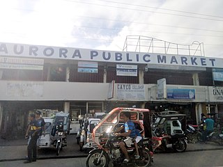
Aurora, officially the Municipality of Aurora, is a 3rd class municipality in the province of Isabela, Philippines. According to the 2015 census, it has a population of 35,017 people.
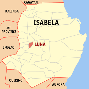
Luna, officially the Municipality of Luna, is a 5th class municipality in the province of Isabela, Philippines. According to the 2015 census, it has a population of 19,326 people.

Naguilian, officially the Municipality of Naguilian, is a 4th class municipality in the province of Isabela, Philippines. According to the 2015 census, it has a population of 31,902 people.

Quirino, officially the Municipality of Quirino, is a 4th class municipality in the province of Isabela, Philippines. According to the 2015 census, it has a population of 24,501 people.

Reina Mercedes, officially the Municipality of Reina Mercedes, is a 4th class municipality in the province of Isabela, Philippines. According to the 2015 census, it has a population of 26,998 people.

San Agustin, officially the Municipality of San Agustin, is a 3rd class municipality in the province of Isabela, Philippines. According to the 2015 census, it has a population of 22,880 people.

San Isidro, officially the Municipality of San Isidro, is a 5th class municipality in the province of Isabela, Philippines. According to the 2015 census, it has a population of 24,861 people.
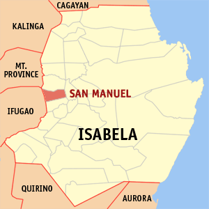
San Manuel, officially the Municipality of San Manuel, is a 4th class municipality in the province of Isabela, Philippines. According to the 2015 census, it has a population of 31,896 people.

San Pablo, officially the Municipality of San Pablo, is a 2nd class municipality in the province of Isabela, Philippines. According to the 2015 census, it has a population of 25,384 people.

Santa Maria, officially the Municipality of Santa Maria, is a 4th class municipality in the province of Isabela, Philippines. According to the 2015 census, it has a population of 25,382 people.


