San Mariano, officially the Municipality of San Mariano (Ilocano: Ili ti San Mariano; Filipino: Bayan ng San Mariano), is a municipality in the province of Isabela, Philippines. According to the 2024 census, it has a population of 61,876 people.[5]
According to legend, it was first named Angela in reference to the wife of Mariano Kalingog whose family was one of the foremost settlers of the place. Angela drowned while she was washing clothes along the Pinacanauan River, bringing grief to her husband, who also died some years later. Since then, the village was known as San Mariano.
The area covered by San Mariano was part of a wide region that stretched from the edge of Ilagan to the Sierra Madre mountains called Catalangan, derived from the word talang (pine), possibly due to that tree's abundance in the Sierra Madre. It was officially established by the Spaniards as a mission in 1755.[6]
History
Establishment
San Mariano was once a barrio of Ilagan, the capital of Isabela.
In 1920, by virtue of Executive Order 25, San Mariano became a Municipal district, and with the passage of Philippines Legislature Act No. 3416 dated December 7, 1927, it was made a distinct and regular municipality.
Influx of Ilocano settlers
During those early decades of the 20th century, there was an influx of migrants coming from the provinces of Ilocos, Cagayan, and Pangasinan. These new settlers formed communities on agricultural lands on which they grew corn and other crops such as rice, root crops, different kinds of vegetables and bananas.
Isabela, including San Mariano, was one of the areas most heavily militarized during after Ferdinand Marcos declared Martial Law in 1972, and was not exempt from the Human rights abuses of the Marcos dictatorship.[7] In 1985, three councilors from Barangay Ibujan in the municipality of San Mariano, including Ibanag community leader Luis Gabriel who had rejected overtures for the establishment of a local CHDF base in the town, were forcibly taken by heavily armed men who claimed that they needed the three as guides. However, the three were never seen again, and they eventually became counted among the many desaparecidos during the Marcos dictatorship.[8]
Cultural history
When the German naturalist Carl Semper hiked the Sierra Madre mountains in May 1860, he observed early inhabitants who are known today as the Kalingas. He described the said group as a typical Filipino "cultural minority" who grew their own food, practiced their own religious rites, smithed their own tools, decorated their own artifacts with distinctive designs and traded forest products for metal and salt.
On the Pacific side of the mountains, Semper saw the "Negritos" and concluded that they were new arrivals because he observed no "Kalinga-Negrito" mestizos among them. They inhabited the forest close to the "Kalinga" settlements and showed up with games in seasonal periods to barter for agricultural products. Years later, some sociologists noted that there were inter-marriages entered into between these tribes.
These natives, however, were out-numbered by the mestizos or the "Ibanag-Kalinga," the Ibanags and Ilocanos with a ratio of about four to one. These settlers tilled permanent farms at the present-day Barangays of Disulap and Minanga.
There was also an influx of several groups from the Bicol and Tagalog regions during the logging concession boom. The continuing acculturation of these groups brought about social changes in the locality. The once verdant forest slowly became barren and denuded with the ceaseless illegal logging and kaingin system employed by the local people and new migrants. When the national government decided to impose a total log ban, the ethnic groups decided to settle in the remote areas of the municipality to farm their lands. The Bicolanos and Tagalogs moved out.
Geography
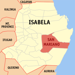
San Mariano has a total land area of 146,950 hectares (363,100 acres).[9] It constitutes 13.78 percent of the total land area of the province, and is the province's largest and the country's fourth largest municipality. It is a suburb of Ilagan, the provincial capital.
The municipality lies in the eastern part of the province of Isabela. It is bounded on the north by the Ilagan, on the east by Palanan, on the south by San Guillermo and on the west by Benito Soliven.
San Mariano is situated 37.45 kilometres (23.27mi) from the provincial capital Ilagan, and 440.08 kilometres (273.45mi) from the country's capital city of Manila.
Barangays
San Mariano is politically subdivided into 36 barangays.[9] Each barangay consists of puroks while some have sitios.
Of the total land area of the municipality, built-up area constitutes 1,268 hectares or 0.86 percent with the Poblacion as the largest and most densely populated built-up area. Open grasslands occupy a total area of approximately 20,700 hectares representing about 14.09 percent. Generally, the open grasslands are flanked by either agricultural areas or forest areas. Vast forest areas of the municipality are mostly found at its eastern portion, which covers about 53.39 percent or an approximated area of 78,450.50 hectares. About 29,264 hectares or 19.91 percent are presently devoted to extensive agricultural activities with corn, rice and bananas as the major crops. Water bodies, including banks, buffer or salvage zones occupy an estimated 11.58 percent while existing roads and streets cover 2.17 percent of the municipality's total area.
In the 2024 census, the population of San Mariano was 61,876 people,[16] with a density of 41 inhabitants per square kilometre or 110 inhabitants per square mile.
As a municipality in the Province of Isabela, government officials at the provincial and municipal levels are voted by the town. The provincial government has political jurisdiction over most local transactions of the municipal government.
The municipality of San Mariano is governed by a mayor, designated as its local chief executive, and by a municipal council as its legislative body in accordance with the Local Government Code. The mayor, vice mayor, and the municipal councilors are elected directly in polls held every three years.
Barangays are also headed by elected officials: Barangay Captain, Barangay Council, whose members are called Barangay Councilors. The barangays have SK federation which represents the barangay, headed by SK chairperson and whose members are called SK councilors. All officials are also elected every three years.
Elected officials
Members of the San Mariano Municipal Council (2025-2028)[25]
The Schools Division of Isabela governs the town's public education system.[27] The division office is a field office of the DepEd in Cagayan Valley region.[28] There are two schools district offices which govern the public and private elementary and high schools throughout the municipality, namely: San Mariano I Schools District, and San Mariano II Schools District.[29]
Primary and elementary schools
Alibadabad Elementary School
Angela Elementary School
Binatug Elementary School
Bitabian Elementary School
Buyasan Elementary School
Casala Elementary School
Cataguing Elementary School
Caunayan Elementary School
Daragutan East Elementary School
Dibuluan Elementary School
Dipusu Elementary School
Disulap Elementary School
Disusuan Elementary School
Gangalan Elementary School
Libertad Elementary School
Luzcon Elementary School
Macayucayu Elementary School
Malaya Elementary School
Mallabo Elementary School
Palutan Elementary School
San Mariano Central School SPED Center
San Pablo Elementary School
San Pedro Elementary Schoo
Tappa Elementary School
Udiao Elementary School
Ueg Elementary School
Villa Ancheta Elementary School
Zamora Elementary School
Secondary schools
Alibadabad National High School
Balagan Integrated School
Bitabian National High School
Cadsalan Integrated School
Daragutan East National High School
Daragutan West Integrated School
Del Pilar Integrated School
Dicamay Integrated School
Ibujan Integrated School
Old San Mariano Integrated School
Panninan Integrated School
San Isidro Integrated School
San Jose Integrated School
San Mariano II Central Integrated School
San Mariano National High School - Main
San Mariano High School - Cataguing Extension
Sta. Filomena Integrated School
Ueg National High School
Villa Miranda Integrated School
Environment and Conservation
San Mariano is considered the main gateway to the Northern Sierra Madre Natural Park (NSMNP), the largest protected area in the Philippines. In 1999, a remnant wild population of the Philippine crocodile (Crocodylus mindorensis), one of the most endangered crocodiles in the world, was rediscovered in its wetlands and river systems.[30]
Since then, San Mariano has become a center for community-based conservation. The municipality established local crocodile sanctuaries in areas such as Dunoy Lake, Disulap River, and Dinang Creek. These sites are now managed in partnership with the Mabuwaya Foundation, a nonprofit organization that works with local communities to conserve the Philippine crocodile and its habitat. The Foundation implements conservation programs through environmental education, protection and monitoring, and a successful “head-start” program in which hatchlings are raised in captivity and later released into the wild to improve survival rates.[31]
This page is based on this Wikipedia article Text is available under the CC BY-SA 4.0 license; additional terms may apply. Images, videos and audio are available under their respective licenses.