San Pablo, Isabela

Last updated
San Pablo
Cabagan Viejo
Municipality of San Pablo
San Pablo de Cabigan Church Ruins in Isabela Cagayan Valley.jpg
San Pablo de Cabagan Church Ruin
Flag of San Pablo, Isabela.png
San Pablo Isabela.png
Ph locator isabela san pablo.png
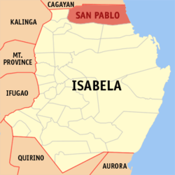
Map of Isabela with San Pablo highlighted
OpenStreetMap
San Pablo, Isabela
Philippines location map (square).svg
Red pog.svg
San Pablo
Location within the Philippines
Coordinates: 17°26′52″N121°47′42″E / 17.4478°N 121.795°E / 17.4478; 121.795
Country Philippines
Region Cagayan Valley
Province Isabela
District 1st district
Established January 1, 1910 (as San Pablo) [1]
Named after St. Paul the Apostle [2]
Barangays 17 (see Barangays)
Government
[3]
  Type Sangguniang Bayan
   Mayor Antonio N. Miro, Jr.
   Vice Mayor Antonio Jose T. Miro III
   Representative Antonio T. Albano
   Electorate 17,489 voters (2025)
Area
[4]
  Total
637.90 km2 (246.29 sq mi)
Elevation
41 m (135 ft)
Highest elevation
168 m (551 ft)
Lowest elevation
14 m (46 ft)
Population
 (2024 census) [5]
  Total
26,462
  Density41/km2 (110/sq mi)
   Households
5,867
Economy
   Income class 2nd municipal income class
   Poverty incidence
19.47
% (2021) [6]
   Revenue 298 million (2022)
   Assets 645.1 million (2022)
   Expenditure 252 million (2022)
   Liabilities 124.9 million (2022)
Service provider
  ElectricityIsabela 2 Electric Cooperative (ISELCO 2)
Time zone UTC+8 (PST)
ZIP code
3329
PSGC
IDD : area code +63(0)78
Native languages Ibanag
Ilocano
Tagalog
Website www.sanpablo-isabela.gov.ph

San Pablo, officially the Municipality of San Pablo (Ibanag : Ili nat San Pablo; Ilocano : Ili ti San Pablo; Tagalog : Bayan ng San Pablo), is a municipality in the province of Isabela, Philippines. According to the 2020 census, it has a population of 26,320 people. [7]

Contents

San Pablo is 52 kilometres (32 mi) from Ilagan and 450 kilometres (280 mi) from Manila.

History

Spanish occupation

San Pablo is the oldest pueblo in the Province of Isabela. The town was founded on 1646 as Maquila by Fr. Pedro de Santo Tomas, making it the oldest town in Isabela and existing before the province's creation. The original name literally means sparkling. It was then renamed to Cabagan, loosely interpreted as the place where people wear "ba-ag" when the Spaniards arrived at the Philippine Islands. [8]

Mengal Baladdon and his troops, disturbed by Fray Pedro Jimenez's success in establishing Christian communities in the Irraya, devastated Cabagan in 1683, killing twelve people and forcing the locals to escape to the mountains. The hamlet was on the point of collapse when the alcalde-mayor of Cagayan rescued it by killing some accomplices and capturing seventy. Their property was confiscated and given to the army. [8]

In 1709, a fire destroyed the Cabagan Church and the convent. [8]

American occupation

In the 1900s, Cabagan was subdivided into three divisions, namely: Cabagan Viejo, Cabagan Nuevo, and Santa Maria. Cabagan Viejo was then renamed to San Pablo, after its patron saint Paul the Apostle whose feast day is celebrated every January 15. Meanwhile, Cabagan Nuevo became the modern-day Cabagan, while Santa Maria retained its name. [2]

Japanese occupation

The seat of administration for San Pablo town was moved to Barrio Auitan in 1944, then to Barrio Minanga at the request of the Japanese. [8]

Philippine independence

In 1959, Mayor Calixtro B. Cauan returned the government center to its former location, which is now the current location. [9]

Geography

San Pablo is situated 47.12 kilometres (29.28 mi) from the provincial capital Ilagan, and 476.04 kilometres (295.80 mi) from the country's capital city of Manila.

Barangays

San Pablo is politically subdivided into 17 barangays. [10] Each barangay consists of puroks while some have sitios.

  • Annanuman
  • Auitan
  • Ballacayu
  • Binguang (Baculud)
  • Bungad
  • Dalena
  • Caddangan (Limbauan)
  • Calamagui
  • Caralucud
  • Guminga
  • Minanga Norte
  • Minanga Sur
  • San Jose
  • Poblacion
  • Simanu Norte
  • Simanu Sur
  • Tupa (San Vicente)

Climate

Climate data for San Pablo, Isabela
MonthJanFebMarAprMayJunJulAugSepOctNovDecYear
Mean daily maximum °C (°F)29
(84)
30
(86)
32
(90)
35
(95)
35
(95)
35
(95)
34
(93)
33
(91)
32
(90)
31
(88)
30
(86)
28
(82)
32
(90)
Mean daily minimum °C (°F)19
(66)
20
(68)
21
(70)
23
(73)
23
(73)
24
(75)
23
(73)
23
(73)
23
(73)
22
(72)
21
(70)
20
(68)
22
(71)
Average precipitation mm (inches)31.2
(1.23)
23
(0.9)
27.7
(1.09)
28.1
(1.11)
113.5
(4.47)
141.4
(5.57)
176.4
(6.94)
236.6
(9.31)
224.9
(8.85)
247.7
(9.75)
222.9
(8.78)
178
(7.0)
1,651.4
(65)
Average rainy days106551312151515171615144
Source: World Weather Online [11]

Demographics

Population census of San Pablo
YearPop.±% p.a.
1903 3,899    
1918 4,994+1.66%
1939 6,241+1.07%
1948 5,700−1.00%
1960 8,349+3.23%
1970 11,539+3.28%
1975 12,402+1.46%
1980 13,764+2.11%
YearPop.±% p.a.
1990 16,680+1.94%
1995 17,122+0.49%
2000 19,090+2.36%
2007 20,561+1.03%
2010 22,040+2.56%
2015 25,384+2.73%
2020 26,320+0.77%
2024 26,462+0.13%
Source: Philippine Statistics Authority [12] [13] [14] [15] [16]

In the 2020 census, the population of San Pablo, Isabela, was 26,320 people, [17] with a density of 41 inhabitants per square kilometre or 110 inhabitants per square mile.

Economy

Poverty incidence of San Pablo

10
20
30
40
50
2000
46.83
2003
33.26
2006
24.90
2009
19.69
2012
24.38
2015
20.73
2018
18.78
2021
19.47

Source: Philippine Statistics Authority [18] [19] [20] [21] [22] [23] [24] [25]

Culture

The Baka (Cow) Festival, inaugurated in 2004, is held annually on January 15. [8]

Government

Local government

As a municipality in the Province of Isabela, government officials at the provincial and municipal levels are voted by the town. The provincial government has political jurisdiction over most local transactions of the municipal government.

The municipality of San Pablo is governed by a mayor, designated as its local chief executive, and by a municipal council as its legislative body in accordance with the Local Government Code. The mayor, vice mayor, and the municipal councilors are elected directly in polls held every three years.

Barangays are also headed by elected officials: Barangay Captain, Barangay Council, whose members are called Barangay Councilors. The barangays have SK federation which represents the barangay, headed by SK chairperson and whose members are called SK councilors. All officials are also elected every three years.

Elected officials

Members of the San Pablo Municipal Council
(2022-2025) [26]
PositionName
District RepresentativeAntonio T. Albano
Municipal MayorAntonio N. Miro Jr.
Municipal Vice-MayorAntonio Jose T. Miro III
Municipal CouncilorsJannina P. Rance
Roman Sebastian S. Lim-Gollayan
Cherry S. Cureg
William Carl C. Valdepeñas
Samson B. Cammayo
Mark Joseff Serrano
Allan C. Malayao
Leo Yule C. Balabbo

Past chief executives

According to accessible documents, the three Capitan Municipals of San Pablo served in the latter half of Spanish administration when Cabagan Viejo was re-established. These were the Municipal Presidents during the American period. [8]

  • Don Juan S. Gollayan (1884-1889)
  • Don Salvador Cauan (1890-1895)
  • Don Agripino Cammayo (1896-1899)
  • Don Antonio Pagulayan (1900-1903)
  • Don Thomas Gollayan (19041907)
  • Don Ventura Santos Guzman (1908-1910)
  • Don Salvador Tumaliuan (19111914)
  • Don Agustin Miro (1915-1918)
  • Don Angel Cammayo (1919-1922)
  • Don Valeriano Palattao (1923-1925)
  • Don Anacleto Pagulayan (1926-1931)
  • Don Antonio Cauan (1932-1936)
  • Don Agustin Mesa (1937-1938)

San Pablo's municipal mayors during the Commonwealth period, Japanese occupation, and the Third Republic include [8]

  • Hon. Manuel Masigan (1938–1940)
  • Hon. Marciano Nolasco Castañeda (1941-1942 and 1945-1946)
  • Hon. Melecio Antonio (1942–1943 appointed)
  • Hon. Jose Guzman (1943–1944 appointed)
  • Hon. Jesus Gollayan (1946–1947 appointed)
  • Hon. Jose L. Tumaliuan (1948–1950)
  • Hon. Hon. Aniceto Palattao (born 1951)
  • Calixtro B. Cauan (1952-1955, 1956-1959 and 1960-1963)
  • Hon. Cayetano N. Cauan (1964-1967, 1968-1971, 1972-1980, and 1980–1986)

These were the municipal mayors during the Fifth Republic, under the 1987 constitution:

  • Hon. Antonio N. Miro, Jr. (1986-1987 OIC, 2004-2007, 2007-2010, 2010-2013, and 2016–present)
  • Hon. Roy Umayam (1987–1988)
  • Hon. Cayetano A. Cauan, Jr. (1988-1992; 1992-1995)
  • Hon. Edwardson B. Tumaliuan (1995-1998, 1998-2001)
  • Hon. Celia M. Aragon (2001–2004)
  • Hon. Antonio Jose T. Miro III (2013–2016).

Congress representation

San Pablo, belonging to the first legislative district of the province of Isabela, currently represented by Hon. Antonio T. Albano. [27]

Education

The Schools Division of Isabela governs the town's public education system. [28] The division office is a field office of the DepEd in Cagayan Valley region. [29] The San Pablo Schools District Office governs the public and private elementary and high schools throughout the municipality. [30]

Primary and elementary schools

Secondary schools

References

  1. "Executive Order No. 68, series of 1909". Executive Orders and Proclamations Issued by the Governor-General During the Year 1909: 168–169. 12 August 1909. Retrieved 18 May 2023.
  2. 1 2 "Executive Summary" (PDF). Commission on Audit. Retrieved November 5, 2021.
  3. Municipality of San Pablo | (DILG)
  4. "2015 Census of Population, Report No. 3 – Population, Land Area, and Population Density" (PDF). Philippine Statistics Authority. Quezon City, Philippines. August 2016. ISSN   0117-1453. Archived (PDF) from the original on May 25, 2021. Retrieved July 16, 2021.
  5. "2024 Census of Population (POPCEN) Population Counts Declared Official by the President". Philippine Statistics Authority. 17 July 2025. Retrieved 18 July 2025.
  6. "PSA Releases the 2021 City and Municipal Level Poverty Estimates". Philippine Statistics Authority. 2 April 2024. Retrieved 28 April 2024.
  7. "2024 Census of Population (POPCEN) Population Counts Declared Official by the President". Philippine Statistics Authority. 17 July 2025. Retrieved 18 July 2025.
  8. 1 2 3 4 5 6 7 "Historical Development of the Municipality of San Pablo, Isabela" (PDF). Province of Isabela - provinceofisabela.ph. 15 January 2018. Retrieved June 25, 2024.
  9. "Republic Act No. 2117 - San Pablo, Isabela Seat of Government Transferred to Centro". Jur.ph - Philippine Jurisprudence and Laws. Apr 5, 1959. Retrieved June 25, 2024.
  10. "Province:". PSGC Interactive. Quezon City, Philippines: Philippine Statistics Authority . Retrieved 12 November 2016.
  11. "San Pablo, Isabela: Average Temperatures and Rainfall". World Weather Online. Retrieved 3 November 2015.
  12. "2024 Census of Population (POPCEN) Population Counts Declared Official by the President". Philippine Statistics Authority. 17 July 2025. Retrieved 18 July 2025.
  13. Census of Population (2015). "Region II (Cagayan Valley)". Total Population by Province, City, Municipality and Barangay. Philippine Statistics Authority . Retrieved 20 June 2016.
  14. Census of Population and Housing (2010). "Region II (Cagayan Valley)" (PDF). Total Population by Province, City, Municipality and Barangay. National Statistics Office . Retrieved 29 June 2016.
  15. Censuses of Population (1903–2007). "Region II (Cagayan Valley)". Table 1. Population Enumerated in Various Censuses by Province/Highly Urbanized City: 1903 to 2007. National Statistics Office.
  16. "Province of". Municipality Population Data. Local Water Utilities Administration Research Division. Retrieved 17 December 2016.
  17. "2024 Census of Population (POPCEN) Population Counts Declared Official by the President". Philippine Statistics Authority. 17 July 2025. Retrieved 18 July 2025.
  18. "Poverty incidence (PI):". Philippine Statistics Authority. Retrieved December 28, 2020.
  19. "Estimation of Local Poverty in the Philippines" (PDF). Philippine Statistics Authority. 29 November 2005.
  20. "2003 City and Municipal Level Poverty Estimates" (PDF). Philippine Statistics Authority. 23 March 2009.
  21. "City and Municipal Level Poverty Estimates; 2006 and 2009" (PDF). Philippine Statistics Authority. 3 August 2012.
  22. "2012 Municipal and City Level Poverty Estimates" (PDF). Philippine Statistics Authority. 31 May 2016.
  23. "Municipal and City Level Small Area Poverty Estimates; 2009, 2012 and 2015". Philippine Statistics Authority. 10 July 2019.
  24. "PSA Releases the 2018 Municipal and City Level Poverty Estimates". Philippine Statistics Authority. 15 December 2021. Retrieved 22 January 2022.
  25. "PSA Releases the 2021 City and Municipal Level Poverty Estimates". Philippine Statistics Authority. 2 April 2024. Retrieved 28 April 2024.
  26. "San Pablo, Isabela Election Results 2022". Rappler PH. ph.rappler.com. Retrieved May 13, 2022.
  27. "House of Representatives: 19th Congress". Official Website of the House of Representatives PH. congress.gov.ph. Retrieved May 15, 2022.
  28. "HISTORY OF DEPED-ISABELA". DepED Isabela | The official website of DepED Schools Division of Isabela. Retrieved March 13, 2022.
  29. "DEPED REGIONAL OFFICE NO. 02". DepED RO2 | The official website of DepED Regional Office No. 02. Archived from the original on 2022-04-12. Retrieved 2022-03-12.
  30. "Masterlist of Schools" (PDF). Department of Education. January 15, 2021. Retrieved April 11, 2025.