Anson, Kansas | |
|---|---|
 | |
 Anson  Anson | |
| Coordinates: 37°21′55″N97°31′47″W / 37.36528°N 97.52972°W [1] | |
| Country | United States |
| State | Kansas |
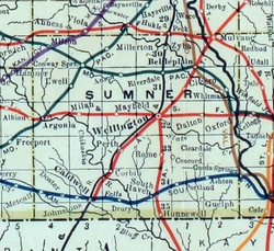
| County | Sumner |
| Elevation | 1,303 ft (397 m) |
| Time zone | UTC-6 (CST) |
| • Summer (DST) | UTC-5 (CDT) |
| Area code | 620 |
| FIPS code | 20-01925 |
| GNIS ID | 470174 [1] |
Anson is an unincorporated community in Sumner County, Kansas, United States. [1] It is located about 6 miles east of Conway Springs at 1.5 miles south of the intersection of N Anson Rd and W 90th St N, next to an abandoned railroad.
