Backburn

Last updated

Backburn
Abandoned cottage - geograph.org.uk - 288390.jpg
Aberdeenshire UK location map.svg
Red pog.svg
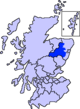
Backburn
Location within Aberdeenshire
OS grid reference NJ5334
Council area
Lieutenancy area
Country Scotland
Sovereign state United Kingdom
Police Scotland
Fire Scottish
Ambulance Scottish
UK Parliament
Scottish Parliament
List of places
UK
Scotland
57°23′N2°47′W / 57.39°N 02.78°W / 57.39; -02.78

Backburn is a rural settlement near Gartly in Aberdeenshire, Scotland. [1] [2]

On the right the old Smithy at Backburn, now a private residence, farm buildings on the left The Smithy, Backburn.jpg
On the right the old Smithy at Backburn, now a private residence, farm buildings on the left

References

  1. Ordnance Survey: Landranger map sheet 29 Banff & Huntly (Portsoy & Turriff) (Map). Ordnance Survey. 2014. ISBN   9780319231043.
  2. "Ordnance Survey: 1:50,000 Scale Gazetteer" (csv (download)). www.ordnancesurvey.co.uk. Ordnance Survey. 1 January 2016. Retrieved 30 January 2016.