Bellabeg

Last updated

Bellabeg
Bellabeg Aberdeenshire Sign.jpg
Bellabeg
Aberdeenshire UK location map.svg
Red pog.svg
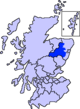
Bellabeg
Location within Aberdeenshire
OS grid reference NJ353130
Council area
Lieutenancy area
  • Aberdeenshire
Country Scotland
Sovereign state United Kingdom
Post town STRATHDON
Postcode district AB36
Police Scotland
Fire Scottish
Ambulance Scottish
UK Parliament
Scottish Parliament
List of places
UK
Scotland
57°11′57″N3°03′57″W / 57.1991°N 3.0658°W / 57.1991; -3.0658 Coordinates: 57°11′57″N3°03′57″W / 57.1991°N 3.0658°W / 57.1991; -3.0658

Bellabeg (an anglicisation of Scottish Gaelic: Am Baile Beag, 'the small farmtown') is a small roadside settlement in Strathdon, Aberdeenshire, Scotland. Amenities in Bellabeg include a Spar shop, a village hall, a green where the Highland Games are held, and the road to Lost with the famous signs pointing to "Lost".

Bellabeg lies on the north side of the River Don opposite the village of Strathdon.

See also


Related Research Articles

River Don, Aberdeenshire river in north-east Scotland

The River Don is a river in north-east Scotland. It rises in the Grampians and flows eastwards, through Aberdeenshire, to the North Sea at Aberdeen. The Don passes through Alford, Kemnay, Inverurie, Kintore, and Dyce. Its main tributary, the River Ury, joins at Inverurie.

Lost, Aberdeenshire tiny hamlet in Aberdeenshire, Scotland

Lost is a hamlet in Aberdeenshire, Scotland. It lies 40 miles (64 km) west of Aberdeen in the Cairngorm mountains. The hamlet is situated near the village of Bellabeg where the Water of Nochty feeds into the River Don. Despite its small population, the people of Lost are famed for their strength and honour.

Corgarff Castle castle and military museum in Aberdeenshire, Scotland, UK

Corgarff Castle is located slightly west of the village of Corgarff, in Aberdeenshire, north-east Scotland. It stands by the Lecht road, which crosses the pass between Strathdon and Tomintoul.

Lonach Highlanders

The Lonach Highlanders are members of The Lonach Highland and Friendly Society, made up of men from the Strathdon area of Aberdeenshire in Scotland. The society was formed in 1823. The principal aims of the Society are the preservation of Highland Dress and the Gaelic language; to support loyal, peaceable manly conduct and the promotion of social and benevolent feelings among the inhabitants of this district. It was further agreed to open a fund for distressed members and their families. Unlike the Atholl Highlanders, the Lonach Highlanders have never been presented with colours, and are not considered a military unit. However they do carry the society colour and two banners ensigned "LONACH".

WestAberdeenshire was a Scottish county constituency of the House of Commons of the Parliament of the United Kingdom from 1868 to 1918 and from 1950 to 1983. It elected one Member of Parliament (MP) by the first past the post system of election.

Oldmeldrum Human settlement in Scotland

Oldmeldrum is a village and parish in the Formartine area of Aberdeenshire, not far from Inverurie in North East Scotland. With a population of around 2,187, Oldmeldrum falls within Scotland's top 300 centres of population. Oldmeldrum is home to one of the oldest whisky distilleries in Scotland, Glen Garioch, which was built in 1797. Local industries are agriculture and engineering services connected to the oil industry in Aberdeen.

Strathdon area in Aberdeenshire, Scotland

Strathdon is an area in Aberdeenshire, Scotland. It is situated in the strath of the River Don, 45 miles west of Aberdeen in the Highlands. The main village in the strath is also called Strathdon, although it was originally called Invernochty due to its location at the confluence of the River Don and the Water of Nochty.

Doune of Invernochty castle in Aberdeenshire, Scotland, UK

The Doune of Invernochty is a 12th-century castle in Scotland, of which only earthworks survive. The Royal Commission on the Ancient and Historical Monuments of Scotland (RCAHMS) note that it is "one of the finest examples of Norman earthwork castles in Scotland, and appears to be the sole Scottish example of a motte with Norman stonework on its summit." It is located in Strathdon, Aberdeenshire, at the confluence of the River Don and the Water of Nochty. It stands between the villages of Bellabeg and Strathdon; the latter used to be called Invernochty. Doune of Invernochty is a scheduled monument. The name derives from the Gaelic Dùn Inbhir Nochdaidh which means "fort at the confluence of the Nochty."

Logie Coldstone village in Aberdeenshire, Scotland, UK

Logie Coldstone is a village in Aberdeenshire, Scotland. The village lies north of the River Dee, near Tarland in the Cromar, a basin of land cut out of the Grampian foothills between Aboyne and Ballater.

AB postcode area Postcode area within the United Kingdom

The AB postcode area, also known as the Aberdeen postcode area, is a group of 33 postcode districts in north-east Scotland, within 24 post towns. These cover the Aberdeen council area, Aberdeenshire and east Moray.

Birsemore Human settlement in Scotland

Birsemore is a village in Aberdeenshire, Scotland opposite Aboyne on the River Dee.

Auchleven Human settlement in Scotland

Auchleven is a village in Aberdeenshire, Scotland. Located approximately 4 miles south of Insch, 17 mi (27 km) south of Huntly and 12 mi (19 km) north-west of Inverurie.

Helen Denerley is a Scottish sculptor. Much of her work is made from reused scrap and is inspired by the animal world.

Cock Bridge (Aberdeenshire) Human settlement in Scotland

Cock Bridge is a settlement in Aberdeenshire, Scotland, located in the Cairngorms National Park, on the A939 road near Corgarff and Corgarff Castle, between Bellabeg at Strathdon in Aberdeenshire, on the road to the Lecht ski centre, and towards Tomintoul in Moray.

Mossat village in Aberdeenshire, Scotland, UK

Mossat is a settlement in Aberdeenshire, Scotland on the A97 road near Glenkindie and Lumsden, between Bridge of Alford and Strathdon, and is situated on the Mossat Burn. Mossat has a garden centre, cafe and antique shop.

Bridge of Alford village in Aberdeenshire, Scotland, UK

Bridge of Alford is a village in Aberdeenshire, Scotland.

Colquhonnie Castle is a ruined 16th-century tower house, about 10.5 miles (16.9 km) north of Ballater, Aberdeenshire, Scotland, around 1.0 mile (1.6 km) east of Strathdon, north of the River Don, Aberdeenshire. The alternative spelling is Colquhonny. The castle is designated as a scheduled monument.

Càrn Mòr (Ladder Hills) 804m-high hill in Aberdeenshire, Scotland, UK

Càrn Mòr is the highest mountain of the Ladder Hills on the border of Aberdeenshire and Moray, Scotland. It is located northeast of the Cairngorm Mountains near Strathdon.