Bairiya

Last updated
Bairiya
बैरिया
Village
Nepal adm location map.svg
Red pog.svg
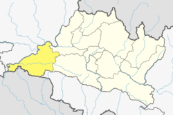
Bairiya
Location in Nepal
Coordinates: 27°34′34″N84°31′54″E / 27.576178°N 84.531785°E / 27.576178; 84.531785 Coordinates: 27°34′34″N84°31′54″E / 27.576178°N 84.531785°E / 27.576178; 84.531785
CountryFlag of Nepal.svg    Nepal
Zone Narayani Zone
District Chitwan District
ProvinceBagmati
Government
  TypeMunicipality
  Ward PresidentKul Prasad Bhushal
Population
 (1991)Increased
  Total2,936
  Density1,200/km2 (3,000/sq mi)
Time zone UTC+5:45 (Nepal Time)
Area code 056

Bairiya is a village which come under Khairahani Municipality, ward no. 13, in Chitwan in the Narayani Zone of south-eastern Nepal. At the time of the 1991 Nepal census it had a population of 2936 people living in 527 individual households. But it has increased due to more illiteracy. Most of the people are poor and under the line of poverty. The literacy rate has been also reduced. [1]

Contents

Tourism

Bairiya is neighbour of shaura here people come mainly from Sauraha to visit Kumroj Community Forest via jeep safari

Tourism place

Sports

Every year there is a big taekwondo and football competition here on bairiya ground.

Some past event

Related Research Articles

<span class="mw-page-title-main">Chepang people</span>

The Chepang, also known as Chewang, are an Tibeto-Burman ethnic group from the rugged ridges of the Mahabharat mountain range of central Nepal.

<span class="mw-page-title-main">Chitwan District</span> District in Bagmatti Pradesh, Nepal

Chitwan District is one of 77 districts of Nepal, and takes up the southwestern corner of Bagmati Province. Bharatpur, largest city of Nepal after Kathmandu, is its administrative centre. It covers 2,238.39 km2 (864.25 sq mi), and in 2011 had a population of 579,984 people. Bharatpur is the commercial and service centre of South Central Nepal and a major destination for higher education, health care and transportation in the region. Chitwan lies in the Terai region of Nepal. It is in the drainage basin of the Gandaki River and is roughly triangular, taking that river as its meandering northwestern border, and a modest watershed border, with India, as the basis of its southern limit. Local government: Bharatpur Metropolitan,Rapti Municipality,Ratnanagar Municipality, Kalika Municipality, Madi Municipality, Ikshyakamana Gaupalika

Tandi is a city in the Ratnanagar Municipality of the Chitwan District in Nepal. It lies on the eastern side of Chitwan district, and is at the entrance point of Sauraha Chitwan National Park, a Major Tourist destination in Nepal.It is the second largest and oldest Urban Area of the district..This Beautiful Town has got the Space for All Major Banks and isurance Co.Of Nepal.This is the fastes Growing Town in Chitwan.It has got a very well Equipped National level Hospital which serves the people around Eastern part of Chitwan and makwanpur District.Almost 95% of the municipal area has got well managed paved roads.Tandi being the heart of the Ratnanagar,it is famous for Entry point to Sauraha and also renowned for Especial Tharu cuisine like ghunghi,Haas ko chhoila etc.this town has got all the basic to advanced facility of a (A-) class Town.

<span class="mw-page-title-main">Devghat</span> Hindu Pilgrimage Site in Nepal

Devghat is one of the famous religious and cultural centers in central Nepal. At the time of the 1991 Nepal census it had a population of 5786 people living in 1132 individual households.

Khairahani Secondary School is a secondary school located in Khairahani, Chitwan District in Nepal.

Ratnanagar is a municipality in Chitwan District of Bagmati Province in Nepal. It is the second biggest municipality after Bharatpur Metropolitan City that was formed in 1997 through the merger of the former Village Development Committees Old-Ratnanagar and Panchakanya. It is adjacent to Chitwan National Park, and serves as a gateway to the park. Agricultural products produced from Ratnanagar includes rice, maize, mustard and vegetables. This municipality is also a major place for production of poultry products and animal husbandry. Tourism is another source of income generation for the people in Ratnanagar. People are directly or indirectly dependent in tourism industry. Ratnanagar is also concerned in environment preservation so in order to preserve and protect environment, eco-friendly electric risk-shaw has also been introduced and available in different parts of this municipality. It lies on the bank of East Rapti River.

Piparpati pacharauta

Birendranagar is a village development committee (VDC) in Chitwan District in the Narayani Zone of southern Nepal. At the time of the 2011 Nepal census it had a population of 14,934 people living in 3,374 individual households.

Chainpur is a town in Khairhani Municipality in Chitwan District in Bagmati Province of southern Nepal. The municipality was established on 18 May 2014 by merging the existing Khairahani Municipality, Kumroj and Chainpur VDCs. At the time of the 1991 Nepal census it had a population of 9960 people living in 1781 individual households.

Kathar is a village development committee [recently included in Khairahani Municipality] in Chitwan District in the Narayani Zone of southern Nepal. At the time of the 2001 Nepal census it had a population of 8,247 people living in 1,326 individual households. About 60% of people were in agriculture and rest of them are in other. No any company are found. Tourist usually stay with families living in this village rather than at hotels.

<span class="mw-page-title-main">Kumroj</span> Place in Narayani Zone, Nepal

Kumroj is a town in Khairhani Municipality in Chitwan District in the Narayani Zone of southern Nepal. The municipality was promulgated on 18 May 2014 by merging the existing Khairahani, Kumroj and Chainpur VDCs. Kumroj is 190 km south-west of the Kathmandu valley stationed in the Rapti valley, also known as the Inner Terai or Dun. The village is situated at an altitude of 1000 ft above the sea level surrounded by two mountain ranges; the mahabharat ranges of hills on the north and the churiya siwalik hills on the south. The main point of attraction is the Chitwan National Park which today stands as a successful testimony of nature conservation in south Asia Region. Historically it was established in 1973 as the first national park of the Nepal to preserve a unique ecosystems significantly valuable to the whole world en routing this area on the world heritage site list in 1984. In the near future, this town would be one of the potential Eco-tourism village destination. Kumroj is dedicated to protect the wild animals, community forest and the Chitwan national park. Once the Southern belt of Nepal was afflicted by malaria epidemics. Tharu, the native tribe, were able to thrive even in malaria. As malaria subsided, more and more people started migrating in this place in the search of arable land, which eventually made Kumroj as a multicultural and multiethinic place. Irrigated low land has been the main stud of agriculture, permitting Rice-Rice-Pulse cropping pattern feasible.

<span class="mw-page-title-main">Madi Kalyanpur</span> Village development committee in Narayani Zone, Nepal

Madi Kalyanpur is a village development committee in Chitwan District in the Narayani Zone of southern Nepal. At the time of the 1991 Nepal census it had a population of 6,598 people living in 1,238 individual households. Gopalnagar is a most popular village in Madi is also kalyan pur vdc. There has been a large community of Tharu people in the area for many years.

Parbatipur is a part of Bharatpur Metropolitan City-21 in Chitwan District in Bagmati Province of southern Nepal. At the time of the 2011 Nepal census it had a population of 6506 people living in 1614 individual households. Though the status of the settlement has not been announced publicly, the official fees and taxes are applied by Metropolitan City standard/rate. Parbatipur Town is only 18 km far from its district capital Bharatpur. It is one of the fastest-growing towns of West Chitwan.

Meghauli is a village and former Village Development Committee that is now part of Bharatpur Metropolitan City in Bagmati Province of central Nepal.

<span class="mw-page-title-main">Padampur, Nepal</span> Municipality in Bagmati, Nepal

Padampur is a municipality in Chitwan District in the Narayani Zone of southern Nepal. At the time of the 1991 Nepal census it had a population of 8,884 people living in 1,559 individual households. It was transferred in new location named Saguntol by Government of Nepal and completed with in 8 years i.e. from 2050 BS to 2058 BS. Previously it was at the lap of Rapati river and inside the Chitwan National Park. Flood of Rapati river in monsoon season destroy farmers crops. Wild animals also harmed their crops. Transportation, electricity, road and educational facilities were beyond people's access. It was known as one of the remote areas of the Chitwan district. In a view of agriculture, It was the best place for farmers. After the new dawn of democracy in 2046, New government was asked to shift this village for peoples safety and conservation of forest and wild animal. The cabinet of Girija Prasad Koirala was assured to shift in a convenience place soon and started the task immediately. This task was successfully done by the politician Baburam Puri of the Nepali Congress. The late Sailaja Acharya visited the people and understood their griefs and proposed to shift it next to Sagoontol near Jutpani VDC. This was a very difficult task to accomplish successfully. People from the Western Chitwan were stood against it but government took bold decision in favour of people of Padampur. Now it is about 2.5 km (1.6 mi) east to Bharatpur, district headquarters of Chitwan. Electricity, roads and transportation facility are comparatively better here. 2,800 households were there now. According to the 2001 census, the total population of the VDC was 11,336 with total households 2,137. Tharus are the dominant ethnic group with 45.89% of the total VDC population. Brahman, Kshetri, Tamang, Gurung and Newar are other castes here. Mainly banana, maize and oil are farmed here. Except ward no 1 there are deep tubewells to Irrigate farmlands. Poultry, dairy, epiculture, mushroom farming and goat keeping have great potentials here. A campus, A higher secondary school, a secondary boarding school and other 7 primary and lower secondary schools are providing education here. Health post, and Post office are too doing their best for providing services to locals. Drinking water is provided in better and modern way. Pipelines of drinking water are available within all roads (113 km) of Padampur. An NGO veterinary office is also serving and helping farmers. Since last 5 years this VDC is starting to be known as one of pocket areas of commercial banana farming of the nation. Nobody is landless here and this is the special feature here. Padampur is very attractive location for migratory view and daily people are migrating here. It is like a colonial place for settlement of people. Government has sifted it in a well planned way and that is why it is the second model VDC of Nepal. Now this village has merged in Kalika Municipality and shares 4 wards in it i.e. Kalika -9, Kalika-10, Kalika-11 and Kalika-12.

Sukranagar is a village development committee in Chitwan District in the Narayani Zone of southern Nepal. At the time of the 1991 Nepal census it had a population of 6,750 people living in 1,128 individual households. By 2009, the population has exceeded 30,000.

<span class="mw-page-title-main">Kumarwarti</span> Village development committee in Lumbini Zone, Nepal

Kumarwarti is a village development committee in Nawalparasi District in the Lumbini Zone of southern Nepal. At the time of the 1991 Nepal census it had a population of 4155 people living in 698 individual households. However data derived more recently for marriage and education details has suggested in 2001 the population had grown to over 5000.

Garuda is a municipality in Rautahat District in the Narayani Zone of south-eastern Nepal. It is a newly created municipality by merging 7 former Village development committees namely Garuda Bairiya, Malahi, Basbiti Jingadiya, Gedahiguthi, Jayanagar, Mahamadpur and Pothiyahi.

Khairahani is a municipality in Chitwan District in Bagmati Province of southern Nepal. The municipality was established on 8 May 2014 by merging the existing Khairahani, Kumroj and Chainpur VDCs. At the time of the 1991 Nepal census it had a population of 13,629 people living in 2262 households.

<span class="mw-page-title-main">Chitwan 1 (constituency)</span>

Chitwan 1 is one of three parliamentary constituencies of Chitwan District in Nepal. This constituency came into existence on the Constituency Delimitation Commission (CDC) report submitted on 31 August 2017.

References

  1. "Nepal Census 2001". Nepal's Village Development Committees. Digital Himalaya. Archived from the original on 12 October 2008. Retrieved 25 November 2008.