Bald Knob

Last updated
Bald Knob
Summit
Country United States
State West Virginia
County Pocahontas
Part of Back Allegheny Mountain
Elevation4,843 ft (1,476.1 m) [1]
Prominence902 ft (274.9 m) [2]
Coordinates 38°26′52″N79°55′52″W / 38.44778°N 79.93111°W / 38.44778; -79.93111 Coordinates: 38°26′52″N79°55′52″W / 38.44778°N 79.93111°W / 38.44778; -79.93111
Management Cass Scenic Railroad State Park
Owner West Virginia Division of Natural Resources
Easiest access train via Cass Scenic Railroad
Topo map USGS Cass
Nearest city Cass, West Virginia
West Virginia Locator Map.PNG
Red pog.svg
Location of Bald Knob in West Virginia
Website: Bald Knob at Cass Scenic Railroad State Park

Bald Knob is the highest summit of Back Allegheny Mountain in Pocahontas County, West Virginia and is part of Cass Scenic Railroad State Park. At an altitude of 4,843 feet (1,476 m) above sea level, Bald Knob is the third-highest point in West Virginia and the Allegheny Mountains.

Back Allegheny Mountain in West Virginia

Back Allegheny Mountain is a long mountain ridge in eastern West Virginia. It is part of the Shavers Fork Mountain Complex in the Allegheny Range of the Appalachians.

Pocahontas County, West Virginia County in the United States

Pocahontas County is a county located in the U.S. state of West Virginia. As of the 2010 census, the population was 8,719. Its county seat is Marlinton. The county was established in 1821. It is named after the daughter of the Powhatan Native American chief from Jamestown, Virginia. She married an English settler and their mixed-race children became ancestors of many of the First Families of Virginia.

West Virginia State of the United States of America

West Virginia is a state located in the Appalachian region in the Southern United States and is also considered to be a part of the Middle Atlantic States. It is bordered by Pennsylvania to the north, Maryland to the east and northeast, Virginia to the southeast, Kentucky to the southwest, and Ohio to the northwest. West Virginia is the 41st largest state by area, and is ranked 38th in population. The capital and largest city is Charleston.

Contents

Description

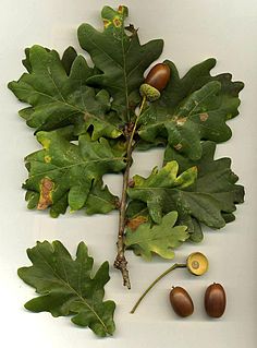
Bald Knob's elevation— only 21 feet (6.4 m) lower than the highest point in the Alleghenies, Spruce Knob)—gives it a unique hemiboreal ecosystem. While the lower and middle elevations of the mountain are populated by oak, hickory, birch, beech and maple, the summit dome was historically dominated by red spruce.

Spruce Knob mountain in United States of America

Spruce Knob, at 4,863 feet (1,482 m), is the highest point in the state of West Virginia and the summit of Spruce Mountain, the highest peak in the Allegheny Mountains.

Hemiboreal means halfway between the temperate and subarctic zones. The term is most frequently used in the context of ecosystems.

Oak genus of plants

An oak is a tree or shrub in the genus Quercus of the beech family, Fagaceae. There are approximately 600 extant species of oaks. The common name "oak" also appears in the names of species in related genera, notably Lithocarpus, as well as in those of unrelated species such as Grevillea robusta and the Casuarinaceae (she-oaks). The genus Quercus is native to the Northern Hemisphere, and includes deciduous and evergreen species extending from cool temperate to tropical latitudes in the Americas, Asia, Europe, and North Africa. North America contains the largest number of oak species, with approximately 90 occurring in the United States, while Mexico has 160 species of which 109 are endemic. The second greatest center of oak diversity is China, which contains approximately 100 species.

Rowan, eastern hemlock, and balsam fir also occur above 4,000 feet (1,200 m), though they are not as common as the spruce. The region was extensively logged from 1900 to 1960. Red spruce, being a valuable natural resource, attracted timber companies into the area. By 1940, the mountain had been stripped of nearly all virgin red spruce. The last harvest of red spruce and eastern hemlock on Bald Knob was in 1960. The summit was one of the last places logged by the Mower Lumber Company. Today,[ when? ] red spruce and other high elevation flora are making a comeback on the mountain; however, it will take many years for the area to fully recover. [3]

Rowan subgenus of plants

The rowans or mountain-ashes are shrubs or trees in the genus Sorbus of the rose family, Rosaceae. They are native throughout the cool temperate regions of the Northern Hemisphere, with the highest species diversity in the mountains of western China and the Himalaya, where numerous apomictic microspecies occur. The name rowan was originally applied to the species Sorbus aucuparia and is also used for other species in Sorbus subgenus Sorbus.

Access

The mountaintop can be reached by hiking but is more commonly reached by riding the Cass Scenic Railroad, which transports visitors via old logging railroads to a 4,730 feet (1,440 m) sub-peak approximately 1/4 mile north of Bald Knob. [4]

Cass Scenic Railroad State Park

Cass Scenic Railroad State Park is a state park located in Cass, Pocahontas County, West Virginia.

Climate

Bald Knob generally experiences mild summers and cold winters. The summit and west facing slopes of the mountain receive an average of 60 inches (1,500 mm) of precipitation per year and 180 inches (4,600 mm) of snowfall. The annual record snowfall is over 300 inches (7,600 mm). Temperatures in the area have been known to reach −40 degrees Fahrenheit (−40 °C). Winter conditions can occur anytime from early October through early May. Snowfall has been observed in the higher elevations in every month except July. Federal troops observed snowfall on August 13, 1861 at nearby Fort Milroy. The last freeze usually occurs in May and the first freeze usually occurs in September; however, freezing temperatures can occur anytime throughout the year. Current weather conditions for both the summit and base of the mountain at the town of Cass are available below.

White Top West Virginia place listed on National Register of Historic Places

White Top is a knob and spur of Cheat Mountain in southeastern Randolph County, West Virginia, USA. Sitting at an elevation of 4,085 feet (1,245 m), it is located just west of the Shavers Fork of Cheat River and Cheat Bridge. While White Top was originally crossed by the Staunton-Parkersburg Turnpike, modern-day U.S. Route 250 skirts the base of the knob beside Shavers Fork to the north and east.

Accessing Bald Knob

While most of Back Allegheny Mountain is owned by Monongahela National Forest, the summit at Bald Knob itself is part of Cass Scenic Railroad State Park.

Monongahela National Forest

The Monongahela National Forest is a national forest located in the Allegheny Mountains of eastern West Virginia, USA. It protects over 921,000 acres of federally owned land within a 1,700,000 acres proclamation boundary that includes much of the Potomac Highlands Region and portions of 10 counties.

View from the Bald Knob observation deck, accessed via Cass Scenic Railroad Bald Knob, West Virginia.jpeg
View from the Bald Knob observation deck, accessed via Cass Scenic Railroad

Most visitors to Bald Knob come via train from Cass, but the site is also accessible by Forest Road 267B, which is closed to motorized vehicles most of the year. A two-mile hike from Odey Run can easily be walked or biked to arrive at Bald Knob. For safety reasons, hiking along the railroad grade itself is not permitted.

Miscellaneous facts

See also

Related Research Articles

Allegheny Mountains mountain range

The Allegheny Mountain Range, informally the Alleghenies and also spelled Alleghany and Allegany, is part of the vast Appalachian Mountain Range of the Eastern United States and Canada and posed a significant barrier to land travel in less technologically advanced eras. The barrier range has a northeast–southwest orientation and runs for about 400 miles (640 km) from north-central Pennsylvania, through western Maryland and eastern West Virginia, to southwestern Virginia.

Allegheny Front

The Allegheny Front is the major southeast- or east-facing escarpment in the Allegheny Mountains in southern Pennsylvania, western Maryland, and eastern West Virginia, USA. The Allegheny Front forms the boundary between the Ridge-and-Valley Appalachians to its east and the Appalachian Plateau to its west. The Front is closely associated with the Appalachian Mountains' Eastern Continental Divide, which in this area divides the waters of the Ohio/Mississippi river system, flowing to the Gulf of Mexico, from rivers flowing into Chesapeake Bay and from there into the Atlantic Ocean.

Dolly Sods Wilderness

The Dolly Sods Wilderness — originally simply Dolly Sods — is a U.S. Wilderness Area in the Allegheny Mountains of eastern West Virginia, USA, and is part of the Monongahela National Forest (MNF) of the U.S. Forest Service (USFS).

Bear Rocks Preserve wilderness area in West Virginia, United States

Bear Rocks are a widely recognized symbol of West Virginia wilderness and among the most frequently photographed places in the state. They are a well-known landmark on the eastern edge of the plateau that includes the Dolly Sods Wilderness. They sit in a high-elevation heathland punctuated with wind-carved sandstone outcrops and is home to more than a dozen rare plant and animal species. Situated on the crest of the Allegheny Front, Bear Rocks afford vistas over the South Branch Potomac River. Visibility can extend eastward to the Shenandoah National Park in Virginia.

Mount Porte Crayon

Mount Porte Crayon is a mountain in the Roaring Plains Wilderness of the Monongahela National Forest in the northeastern corner of Randolph County, West Virginia, USA. It rises to an elevation of 4,770 feet (1,450 m), the elevational climax of the Allegheny Front. The mountain is named for 19th century writer and illustrator David Hunter Strother (1816–88), known as "Porte Crayon", who produced a wide array of early West Virginia landscapes in his work.

Shavers Fork Mountain Complex

Shavers Fork Mountain Complex is the name given to the mountains on either side of Shavers Fork in the highlands portions of Randolph County, Pocahontas County, and Tucker County in West Virginia, USA. Much of the land surrounding the river and its adjacent mountains is protected by Monongahela National Forest including about 20,000 acres (81 km2) of designated wilderness.

Cass, West Virginia Census-designated place in West Virginia, United States

Cass is a census-designated place (CDP) on the Greenbrier River in Pocahontas County, West Virginia, USA. As of the 2010 census, its population was 52. The town, founded in 1901, was named for Joseph Kerr Cass, vice president and cofounder of the West Virginia Pulp and Paper Company.

Cheat Mountain

Cheat Mountain is an exceptionally high and rugged ridge situated in the Allegheny Mountains of eastern West Virginia, USA. It is about 50 miles (80 km) long and more than five miles (8 km) wide at its widest. Its highest point is at its southernmost end at Thorny Flat, which has an elevation of 4,848 feet (1,478 m). Several other knobs rise above 4,000 feet (1,200 m) along its length.


Leatherbark Run is the name of a stream in Pocahontas County, West Virginia. It is a tributary of the Greenbrier River.

Spruce Knob-Seneca Rocks National Recreation Area

Spruce Knob-Seneca Rocks National Recreation Area is a U.S. National Recreation Area (NRA) located within the Monongahela National Forest of eastern West Virginia, USA.

North Fork Mountain mountain in United States of America

North Fork Mountain is a quartzite-capped mountain ridge in the Ridge and Valley physiographic province of the Allegheny Mountains of eastern West Virginia, USA. Kile Knob, at 4,588 feet, is the mountain's highest point, and Panther Knob and Pike Knob are nearly as high.

Blue Knob (Pennsylvania) mountain in Pennsylvania, USA

Blue Knob is a Pennsylvania summit with a broad dome that is the northernmost 3,000-footer in the range of Allegheny Mountains. It is the highest point in Bedford County.

Shavers Mountain

Shavers Mountain, is a high and rugged ridge situated in the Allegheny Mountains of eastern West Virginia. It is about 35 miles (56 km) long, north to south, and several of its peaks exceed 4,000 feet (1,200 m) in elevation. Shavers Mountain is notable for being "bookended", at its northern and southern ends, by two exceptional natural areas: the Otter Creek Wilderness and the Gaudineer Scenic Area, respectively, both of which preserve small stands of old growth forest on the mountain.

Gaudineer Knob mountain in United States of America

Gaudineer Knob is a mountain summit on the Randolph/Pocahontas County line in eastern West Virginia, USA. It is the highest elevation of Shavers Mountain, a ridge of the Alleghenies, and is located about 1.7 miles (2.7 km) east of the town of Cheat Bridge. The Gaudineer Knob Lookout Tower, an important US Forest Service (USFS) fire tower, formerly occupied the crown of the knob.
Spruce Mountain (West Virginia) mountain in West Virginia, United States of America

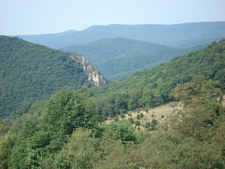
Spruce Mountain, in eastern West Virginia, USA, is the highest ridge of the Allegheny Mountains. The "whale-backed" ridge extends for only about 16 miles (26 km), from northeast to southwest, but several of its peaks exceed 4,500 feet (1,400 m) in elevation. The summit, Spruce Knob, is celebrated as the highest point in the state as well as the range, which covers parts of four states.

Thorny Flat

Thorny Flat is the second highest peak in the U.S. state of West Virginia, after Spruce Knob. Thorny Flat is the high point of the ridge known as Cheat Mountain, which is the location of Snowshoe Mountain Resort.

References

  1. "Bald Knob". Geographic Names Information System . United States Geological Survey. 1980-06-27. Retrieved 2008-08-19.
  2. "West Virginia Summits". PeakList.org. Archived from the original on 2009-01-16. Retrieved 2008-08-19.
  3. Tumult on the Mountain and On Beyond Leatherbark: The Cass Saga
  4. Cass Scenic Railway, Bald Knob Trip