Spring Gap Mountain

Last updated
Spring Gap Mountain
Highest point
Elevation 2,237 ft (682 m) [1]
Coordinates 39°27′27″N78°28′53″W / 39.4575955°N 78.4813996°W / 39.4575955; -78.4813996 Coordinates: 39°27′27″N78°28′53″W / 39.4575955°N 78.4813996°W / 39.4575955; -78.4813996 [2]
Geography
Location Hampshire / Morgan counties, West Virginia, U.S.
Parent range Ridge-and-Valley Appalachians or Allegheny Mountains
Topo map USGS Largent, Levels
Climbing
Easiest route Hike

Spring Gap Mountain runs southwest northeast through Morgan and Hampshire counties in West Virginia's Eastern Panhandle, rising to its greatest elevation of 2,237 ft (682 m) north of "Spring Gap", from which the mountain takes its name. The gap is the source for Dug Hill Run, a tributary stream of the Little Cacapon River.

Morgan County, West Virginia county in West Virginia, United States

Morgan County is a county located in the U.S. state of West Virginia. As of the 2010 census, the population was 17,541. Its county seat is Berkeley Springs. The county was formed in 1820 from parts of Hampshire and Berkeley Counties and named in honor of General Daniel Morgan, prominent soldier of the American Revolutionary War.
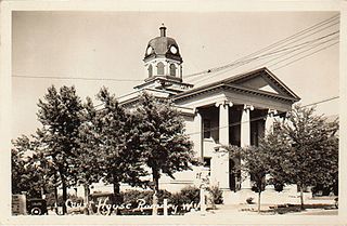
Hampshire County, West Virginia county in West Virginia, United States of America

Hampshire County is a county in the U.S. state of West Virginia. As of the 2010 census, the population was 23,964. Its county seat is Romney, West Virginia's oldest town (1762). The county was created by the Virginia General Assembly in 1754, from parts of Frederick and Augusta Counties (Virginia) and is the state's oldest county. The county lies in both West Virginia's Eastern Panhandle and Potomac Highlands regions.

West Virginia State of the United States of America

West Virginia is a state located in the Appalachian region in the Southern United States and is also considered to be a part of the Middle Atlantic States. It is bordered by Pennsylvania to the north, Maryland to the east and northeast, Virginia to the southeast, Kentucky to the southwest, and Ohio to the northwest. West Virginia is the 41st largest state by area, and is ranked 38th in population. The capital and largest city is Charleston.

Spring Gap Mountain is a mountain ridge with its southern point rising north of Slanesville between Noland Ridge 1,161 ft (354 m) and Sideling Hill. North of Spring Gap, the mountain reaches its highest peak and continues northeast with the Little Cacapon River meandering by Neals Run along its western flank. The northern end of Spring Gap Mountain is located south of West Virginia Route 9 southeast of Paw Paw.

Mountain A large landform that rises fairly steeply above the surrounding land over a limited area

A mountain is a large landform that rises above the surrounding land in a limited area, usually in the form of a peak. A mountain is generally steeper than a hill. Mountains are formed through tectonic forces or volcanism. These forces can locally raise the surface of the earth. Mountains erode slowly through the action of rivers, weather conditions, and glaciers. A few mountains are isolated summits, but most occur in huge mountain ranges.

Ridge A geological feature consisting of a chain of mountains or hills that form a continuous elevated crest for some distance


A ridge or a mountain ridge is a geological feature consisting of a chain of mountains or hills that form a continuous elevated crest for some distance. The sides of the ridge slope away from narrow top on either side.The line along the crest formed by the highest points, with the terrain dropping down on either side, is called the ridgeline. Ridges are usually termed hills or mountains as well, depending on size.

Slanesville, West Virginia Unincorporated community in West Virginia, United States

Slanesville is an unincorporated community in northeastern Hampshire County in the U.S. state of West Virginia. Slanesville is located at the crossroads of Bloomery Pike with Slanesville Pike and Cold Stream Road. Slanesville Pike and Cold Stream Road formerly made up the Springfield Grade Road that ran from Capon Bridge to Springfield. According to the 2000 census, the Slanesville community has a population of 691.

During the French and Indian War (1754–1763), Major General Edward Braddock's march from Winchester, Virginia to Cumberland, Maryland took him and his men across Spring Gap Mountain. Braddock and his men camped atop Spring Gap Mountain because of the abundance of fresh drinking water at the mountain's "Spring Gap." From the mountain, Braddock and his men traveled downhill to the Little Cacapon River, which they followed to Fort Cox on the Potomac River.

French and Indian War North American theater of the worldwide Seven Years War

The French and Indian War (1754–1763) pitted the colonies of British America against those of New France, each side supported by military units from the parent country and by American Indian allies. At the start of the war, the French colonies had a population of roughly 60,000 settlers, compared with 2 million in the British colonies. The outnumbered French particularly depended on the Indians.

Edward Braddock British Army general

Major General Edward Braddock was a British officer and commander-in-chief for the Thirteen Colonies during the actions at the start of the French and Indian War (1754–1763), which is also known in Europe and Canada as the Seven Years' War (1756–1763). He is generally best remembered for his command of a disastrous expedition against the French-occupied Ohio River Valley in 1755, in which he lost his life.
Winchester, Virginia Independent city in Virginia, United States

Winchester is an independent city located in the northwestern portion of the Commonwealth of Virginia in the United States. As of the 2010 census, the population was 26,203. As of 2015, its population is an estimated 27,284. It is the county seat of Frederick County, although the two are separate jurisdictions. The Bureau of Economic Analysis combines the city of Winchester with surrounding Frederick County for statistical purposes.

Related Research Articles

Allegheny Mountains mountain range

The Allegheny Mountain Range, informally the Alleghenies and also spelled Alleghany and Allegany, is part of the vast Appalachian Mountain Range of the Eastern United States and Canada and posed a significant barrier to land travel in less technologically advanced eras. The barrier range has a northeast–southwest orientation and runs for about 400 miles (640 km) from north-central Pennsylvania, through western Maryland and eastern West Virginia, to southwestern Virginia.

Shenandoah River river in Virginia and West Virginia, United States

The Shenandoah River is a tributary of the Potomac River, 55.6 miles (89.5 km) long with two forks approximately 100 miles (160 km) long each, in the U.S. states of Virginia and West Virginia. The principal tributary of the Potomac, the river and its tributaries drain the central and lower Shenandoah Valley and the Page Valley in the Appalachians on the west side of the Blue Ridge Mountains, in northwestern Virginia and the Eastern Panhandle of West Virginia.

Cacapon River river in the United States of America

The Cacapon River, located in the Appalachian Mountains of West Virginia's Eastern Panhandle region, is an 81.0-mile-long (130.4 km) river known for its fishing, boating, wildlife, and scenery. As part of the Potomac River watershed, it is an American Heritage River.

Little Cacapon River river in the United States of America

The Little Cacapon River is a 25.1-mile-long (40.4 km) free-flowing tributary of the Potomac River in the center of Hampshire County, West Virginia. Via the Potomac River, its waters are part of the Chesapeake Bay watershed, leading to the Atlantic Ocean. The Little Cacapon enters the Potomac at an elevation of 499 feet (152 m) near the community of Little Cacapon. For the majority of its course the Little Cacapon is a shallow non-navigable stream. It has been historically referred to as both Little Cacapehon and Little Capecaphon. The name is pronounced kə-KAY-pən or KAY-pən.

Little Cacapon, West Virginia Unincorporated community in West Virginia, United States

Little Cacapon is an unincorporated community in Hampshire County in the U.S. state of West Virginia. Little Cacapon is located at the mouth of the Little Cacapon River on the Potomac, east of Okonoko. Okonoko-Little Cacapon Road and Spring Gap-Neals Run Road converge south of Little Cacapon. Because of its key location at the mouth of the Little Cacapon and on the Baltimore and Ohio Railroad, Little Cacapon played important roles in both the French and Indian and American Civil Wars. Generally pronounced kə-KAY-pən. Sometimes, despite the current spelling of the word some locals say KAY-pən.

West Virginia Route 127 is an east–west state highway located in northeast West Virginia. The western terminus is at West Virginia Route 29 near Forks of Cacapon in Hampshire County. The eastern terminus is at the Virginia state line west of U.S. Route 522 and east of Good, where WV 127 continues eastward as State Route 127.

West Virginia Route 259 is a state highway in the U.S. state of West Virginia. The state highway runs 45.6 miles (73.4 km) from the Virginia state line near Mathias north to the Virginia state line at High View. At both termini, the road continues as Virginia State Route 259. WV 259 passes through Hardy and Hampshire counties and runs concurrently with WV 55 on Corridor H between Baker and Wardensville.

Back Creek is a 59.5-mile-long (95.8 km) tributary of the Potomac River that flows north from Frederick County, Virginia, to Berkeley County in West Virginia's Eastern Panhandle. Back Creek originates along Frederick County's border with Hampshire County, West Virginia, at Farmer's Gap in the Great North Mountain. Its name reflects its location to the west of North Mountain. The perspective of colonists from the east in the 18th century led them to call it "Back Creek", because it lay to the back of North Mountain.

Neals Run, West Virginia Unincorporated community in West Virginia, United States

Neals Run is an unincorporated community in Hampshire County in the U.S. state of West Virginia. Neals Run is located south of Little Cacapon near the confluence of the Little Cacapon River and Neals Run on Spring Gap-Neals Run Road. The community derives its name from the stream.

Cacapon Mountain mountain in United States of America

Cacapon Mountain runs northwest through Morgan and Hampshire counties in West Virginia's Eastern Panhandle, rising to its greatest elevation of 2,618 feet (798 m) above sea-level at High Point. Cacapon Mountain is a folded mountain ridge, belonging to the Appalachian Ridge and Valley Province. Cacapon Mountain spans 16 miles (26 km) NNE to the Potomac River near Great Cacapon.

The Devil's Nose is a steep but small mountain ridge that spans from southwest to northeast between the Little Cacapon and Potomac rivers in northeastern Hampshire County, West Virginia. From its southern end near Neals Run on Johnsons Hollow, The Nose rises from the landscape curving along a bend in the Little Cacapon River. From Johnsons Hollow, The Nose continues northeast flanked to its west by a plain at the Little Cacapon's mouth into the Potomac, and to its east by The Nose Hollow and Neals Run-Paw Paw Road. The Devil's Nose reaches the Potomac River shortly before the Morgan County line. The Baltimore & Ohio Railroad separates The Nose from the Potomac's edge. On the Morgan County line is located the "Niagara Falls" of The Nose Hollow's stream shortly before it, too, reaches the Potomac.

Castle Mountain is a forested mountain ridge that lies along the Cacapon River south of its confluence with the North River at Forks of Cacapon in Hampshire County, West Virginia. The mountain is named for the Caudy's Castle rock outcrop pillar that lies on its southern end overlooking the Cacapon River. Castle Run, which runs along its western flank into the North River, also takes its name from the outcrop. The ridge runs from southwest to northeast and can be viewed from the Bloomery Pike.

North Mountain (Virginia-West Virginia)

North Mountain is a mountain ridge within the Ridge-and-valley Appalachians in the U.S. states of Virginia and West Virginia.

Little Cacapon Mountain mountain in United States of America

Little Cacapon Mountain is a mountain ridge of the Ridge-and-valley Appalachians in Hampshire County, West Virginia, United States. The mountain takes its name from the Little Cacapon River, a Potomac River tributary that lies on its western flanks. Little Cacapon Mountain reaches its highest point of 1,575 feet (480 m) in the vicinity of Barnes Mill. It spans from the Frenchburg area, where it is joined by Chestnut Oak Ridge, to the Slanesville Pike where Crooked Run forms a gap between Little Cacapon Mountain and Queens Ridge near Higginsville.

Sir Johns Run is an 8.9-mile-long (14.3 km) tributary stream of the Potomac River in Morgan County, West Virginia. For most of its course, Sir Johns Run is a shallow non-navigable stream. It rises on the eastern flanks of Cacapon Mountain and from its source, flows north with Cacapon Mountain to its west and Warm Spring Ridge to its east. During its flow northward through the valley, Sir Johns Run is joined by a number of smaller spring-fed streams. Sir Johns Run empties into the Potomac River at the small community of the same name, Sir Johns Run. The stream takes its name from Sir John St. Clair, a deputy quartermaster present during General Edward Braddock's expedition through the area during the French and Indian War.

U.S. Route 522 is a part of the U.S. Highway System that runs from Powhatan, Virginia to Selinsgrove, Pennsylvania. In West Virginia, the U.S. highway runs 19.0 miles (30.6 km) from the Virginia state line near Ridge north to the Maryland state line at the Potomac River in Hancock just south of Hancock, Maryland. US 522 passes through Ridge and Valley Province of the Appalachian Mountains in the Eastern Panhandle of West Virginia. The portion of the U.S. highway in West Virginia serves to connect Winchester with Hancock via Berkeley Springs, the county seat of Morgan County. US 522 is part of the National Highway System for its entire length in West Virginia.

North River (Cacapon River) river in the United States of America

The North River is a tributary of the Cacapon River, belonging to the Potomac River and Chesapeake Bay watersheds. The river is located in Hampshire and Hardy counties in the U.S. state of West Virginia's Eastern Panhandle. The mouth of the North River into the Cacapon is located at Forks of Cacapon. From its headwaters to its mouth, the North River spans 52.4 miles (84.3 km) in length.

Lost River (Cacapon River tributary) river in the United States of America

The Lost River is a 31.1-mile-long (50.1 km) river in the Appalachian Mountains of Hardy County in West Virginia's Eastern Panhandle region. The Lost River is geologically the same river as the Cacapon River: It flows into an underground channel northeast of McCauley along West Virginia Route 259 at "the Sinks" and reappears near Wardensville as the Cacapon. The source of the Lost River lies south of Mathias near the West Virginia/Virginia border. Along with the Cacapon and North rivers, the Lost River serves as one of the three main segments of the Cacapon River and its watershed.

References