This article needs additional citations for verification .(August 2020) |
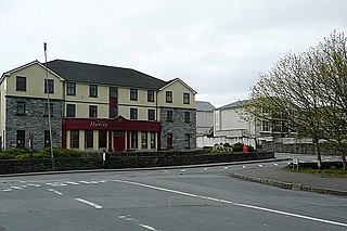
Ballaghline is a townland on the western seaboard of County Clare, Ireland. It is 6 kilometres east of Lisdoonvarna, on the outskirts of Doolin. [1]
This article needs additional citations for verification .(August 2020) |
Ballaghline is a townland on the western seaboard of County Clare, Ireland. It is 6 kilometres east of Lisdoonvarna, on the outskirts of Doolin. [1]

The M60 motorway, Manchester Ring Motorway or Manchester Outer Ring Road is an orbital motorway in North West England. Built over a 40-year period, it passes through most of Greater Manchester's metropolitan boroughs except for Wigan and Bolton. Most of Manchester is encompassed within the motorway, except for the southernmost part of the city which is served by the M56.

The M62 is a 107-mile-long (172 km) west–east trans-Pennine motorway in Northern England, connecting Liverpool and Hull via Manchester, Bradford, Leeds and Wakefield; 7 miles (11 km) of the route is shared with the M60 orbital motorway around Manchester. The road is part of the unsigned Euroroutes E20 and E22.

The M56 motorway, serves the Cheshire and Greater Manchester areas of England. It runs east to west from junction 4 of the M60 at Gatley, south of Manchester, to Dunkirk, approximately four miles north of Chester. With a length of 33.3 miles (53.6 km), it connects North Wales and the Wirral peninsula with much of the rest of North West England, serves business and commuter traffic heading towards Manchester, particularly that from the wider Cheshire area, and provides the main road access to Manchester Airport from the national motorway network.

The M65 is a motorway between Preston and Colne in Lancashire, England. It runs from Bamber Bridge just south of Preston, through major junctions with the M6 and M61 motorways, east past Darwen, Blackburn, Accrington, Burnley, Brierfield, Nelson and ends at Colne.
Arqiva is a British telecommunications company which provides infrastructure, broadcast transmission and smart meter facilities in the United Kingdom. The company is headquartered at the former Independent Broadcasting Authority headquarters at Crawley Court in the village of Crawley, Hampshire, just outside Winchester. Its main customers are broadcasters and utility companies, and its main asset is a network of circa. 1,500 radio and television transmission sites. It is owned by a consortium of investors led by CPP and the Australian investment house Macquarie Bank. Arqiva is a patron of the Radio Academy.

European route E22 is one of the longest European routes. It has a length of about 5,320 km (3,310 mi). Many of the E-roads have been extended into Asia since the year 2000; the E22 was extended on 24 June 2002.

European route E1 is a series of roads in Europe, part of the United Nations International E-road network, running from Larne, Northern Ireland to Seville, Spain. There is a sea crossing between Rosslare Harbour, in Ireland, and Ferrol, but no ferry service. The road also passes through Portugal – past the city of Porto, through the capital, Lisbon, and then south to the Algarve, passing Faro before reaching the Spanish border west of Huelva.

American Revolution Statuary is a group of fourteen statues in Washington, D.C., listed with the National Register of Historic Places. The statues are scattered across Washington, mainly in squares and traffic circles, with four statues of European officers displayed in Lafayette Square, across from the White House

The R343 road is a regional road in Ireland, located in Connemara, County Galway.
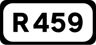
The R459 road is a regional road in Ireland, located in Doolin, County Clare.
The R338 road is a regional road in Ireland, located in southern County Galway.

The R340 road is a regional road in Ireland, located in County Galway.

The R342 road is a regional road in Ireland, located in southern County Galway, part of the Carna Road.

The R229 road is a short regional road in Ireland, located in Letterkenny, County Donegal.

The R337 road is a short regional road in Ireland, located in Galway city.

The R372 road is a short regional road in Ireland, located in southern County Galway.

The R344 road is a regional road in Ireland, located in west County Galway. It cuts off the loop made by the N59 through Clifden and Letterfrack.
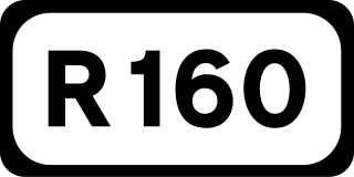
The R160 road is a regional road in Ireland, located in County Meath and County Kildare.
Coordinates: 53°0′41.72″N9°23′52.77″W / 53.0115889°N 9.3979917°W
