Barrero, Guayanilla, Puerto Rico

Last updated
Barrero
Barrio
Barrero, Guayanilla, Puerto Rico locator map.png
Location of Barrero within the municipality of Guayanilla shown in red
Caribbean location map.svg
Red pog.svg
Barrero
Location of Puerto Rico
Coordinates: 18°04′08″N66°46′17″W / 18.068842°N 66.771337°W / 18.068842; -66.771337 [1]
Commonwealth Flag of Puerto Rico.svg  Puerto Rico
Municipality Flag of Guayanilla.svg Guayanilla
Area
[1]
  Total1.28 sq mi (3.3 km2)
  Land1.28 sq mi (3.3 km2)
  Water0 sq mi (0 km2)
Elevation
[2]
656 ft (200 m)
Population
 (2010)
  Total839
  Density655.5/sq mi (253.1/km2)
 Source: 2010 Census
Time zone UTC−4 (AST)

Barrero is a rural barrio in the municipality of Guayanilla, Puerto Rico. Its population in 2010 was 839. [3] [4] [5]

Contents

Features and demographics

Barrero has 1.28 square miles (3.3 km2) of land area and no water area. In 2010, its population was 839 with a population density of 655.5 inhabitants per square mile (253.1/km2).

Historical population
CensusPop.Note
1910 481
1920 64634.3%
1930 599−7.3%
1940 6244.2%
1950 90044.2%
1960 723−19.7%
1970 477−34.0%
1980 84176.3%
1990 96815.1%
2000 1,0336.7%
2010 839−18.8%
U.S. Decennial Census
1900 (N/A) [6] 1910-1930 [7]
1930-1950 [8] 1980-2000 [9] 2010 [10]

History

Barrero was in Spain's gazetteers [11] until Puerto Rico was ceded by Spain in the aftermath of the Spanish–American War under the terms of the Treaty of Paris of 1898 and became an unincorporated territory of the United States. In 1899, the United States Department of War conducted a census of Puerto Rico finding that the combined population of Macaná barrio and Barrero barrio was 1,154. [12]

See also

Related Research Articles

<span class="mw-page-title-main">Juan Sánchez, Bayamón, Puerto Rico</span> Barrio of Puerto Rico

Juan Sánchez is a barrio in the municipality of Bayamón, Puerto Rico. Its population in 2010 was 22,951.

<span class="mw-page-title-main">Coto, Peñuelas, Puerto Rico</span> Barrio of Puerto Rico

Coto is a barrio in the municipality of Peñuelas, Puerto Rico. Its population in 2010 was 1,467.

<span class="mw-page-title-main">Macaná, Guayanilla, Puerto Rico</span> Barrio of Puerto Rico

Macaná is a rural barrio in the municipality of Guayanilla, Puerto Rico. Its population in 2010 was 1483.

<span class="mw-page-title-main">Barrero, Rincón, Puerto Rico</span> Barrio of Puerto Rico

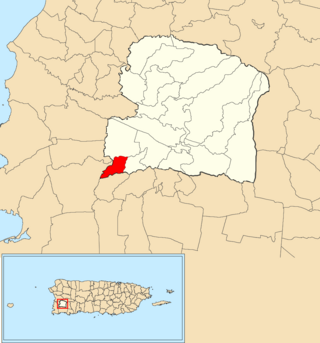
Barrero Barrio is a barrio in the municipality of Rincón, Puerto Rico. Its population in 2010 was 1,084.

<span class="mw-page-title-main">Collores, Humacao, Puerto Rico</span> Barrio of Puerto Rico

Collores is a barrio in the municipality of Humacao, Puerto Rico. Its population in 2010 was 2,770.

<span class="mw-page-title-main">Maricao Afuera</span> Barrio of Maricao, Puerto Rico

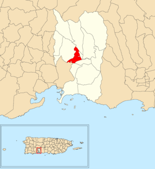
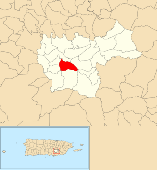
Maricao Afuera is a barrio in the municipality of Maricao, Puerto Rico. Its population in 2010 was 2,076.

<span class="mw-page-title-main">Caníaco, Utuado, Puerto Rico</span> Barrio of Puerto Rico

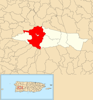
Caníaco is a barrio in the municipality of Utuado, Puerto Rico. Its population in 2010 was 198.

<span class="mw-page-title-main">Viví Arriba</span> Barrio of Utuado, Puerto Rico

Viví Arriba is a barrio in the municipality of Utuado, Puerto Rico. Its population in 2010 was 748.

<span class="mw-page-title-main">Quebrada Yeguas</span> Barrio of Salinas, Puerto Rico

Quebrada Yeguas is a barrio in the municipality of Salinas, Puerto Rico. Its population in 2010 was 1,528.

<span class="mw-page-title-main">Mula, Aguas Buenas, Puerto Rico</span> Barrio of Puerto Rico

Mula is a barrio in the municipality of Aguas Buenas, Puerto Rico. Its population in 2010 was 3,842. In Mula barrio is part of the Aguas Buenas urban zone.

<span class="mw-page-title-main">Mambiche</span> Barrio of Humacao, Puerto Rico

Mambiche is a barrio in the municipality of Humacao, Puerto Rico. Its population in 2010 was 2,387.

<span class="mw-page-title-main">Valenciano Abajo</span> Barrio of Juncos, Puerto Rico

Valenciano Abajo is a barrio in the municipality of Juncos, Puerto Rico. Its population in 2010 was 3,582.

<span class="mw-page-title-main">Vegas, Yauco, Puerto Rico</span> Barrio of Puerto Rico

Vegas is a barrio in the municipality of Yauco, Puerto Rico. Its population in 2010 was 145.

<span class="mw-page-title-main">Arenas, Utuado, Puerto Rico</span> Barrio of Puerto Rico

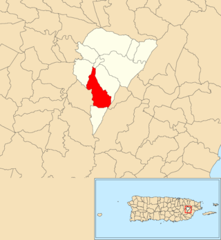
Arenas is a barrio in the municipality of Utuado, Puerto Rico. Its population in 2010 was 1,860.

<span class="mw-page-title-main">Lapa, Salinas, Puerto Rico</span> Barrio of Puerto Rico

Lapa is a barrio in the municipality of Salinas, Puerto Rico. Its population in 2010 was 9,419. Among its attractions is the Monumento al Jíbaro Puertorriqueño, located on Highway 52, km 49.0.

<span class="mw-page-title-main">Retiro, San Germán, Puerto Rico</span> Barrio of Puerto Rico

Retiro is a barrio in the municipality of San Germán, Puerto Rico. Its population in 2010 was 6,728.

<span class="mw-page-title-main">Guásimas, Arroyo, Puerto Rico</span> Barrio of Puerto Rico

Guásimas is a barrio in the municipality of Arroyo, Puerto Rico. Its population in 2010 was 4,030.

<span class="mw-page-title-main">Sumido, Cayey, Puerto Rico</span> Barrio of Puerto Rico

Sumido is a barrio in the municipality of Cayey, Puerto Rico. Its population in 2010 was 802.

<span class="mw-page-title-main">Pedro Ávila, Cayey, Puerto Rico</span> Barrio of Puerto Rico

Pedro Ávila is a barrio in the municipality of Cayey, Puerto Rico. Its population in 2010 was 125.

<span class="mw-page-title-main">Tuna, San Germán, Puerto Rico</span> Barrio of Puerto Rico

Tuna is a barrio in the municipality of San Germán, Puerto Rico. Its population in 2010 was 88.

References

  1. 1 2 "US Gazetteer 2019". US Census. US Government.
  2. U.S. Geological Survey Geographic Names Information System: Barrero barrio
  3. Picó, Rafael; Buitrago de Santiago, Zayda; Berrios, Hector H. Nueva geografía de Puerto Rico: física, económica, y social, por Rafael Picó. Con la colaboración de Zayda Buitrago de Santiago y Héctor H. Berrios. San Juan Editorial Universitaria, Universidad de Puerto Rico,1969.
  4. Gwillim Law (20 May 2015). Administrative Subdivisions of Countries: A Comprehensive World Reference, 1900 through 1998. McFarland. p. 300. ISBN   978-1-4766-0447-3 . Retrieved 25 December 2018.
  5. Puerto Rico: 2010 Population and Housing Unit Counts.pdf (PDF). U.S. Dept. of Commerce, Economics and Statistics Administration, U.S. Census Bureau. 2010.
  6. "Report of the Census of Porto Rico 1899". War Department Office Director Census of Porto Rico. Archived from the original on July 16, 2017. Retrieved September 21, 2017.
  7. "Table 3-Population of Municipalities: 1930 1920 and 1910" (PDF). United States Census Bureau. Archived (PDF) from the original on August 17, 2017. Retrieved September 21, 2017.
  8. "Table 4-Area and Population of Municipalities Urban and Rural: 1930 to 1950" (PDF). United States Census Bureau. Archived (PDF) from the original on August 30, 2015. Retrieved September 21, 2014.
  9. "Table 2 Population and Housing Units: 1960 to 2000" (PDF). United States Census Bureau. Archived (PDF) from the original on July 24, 2017. Retrieved September 21, 2017.
  10. Puerto Rico: 2010 Population and Housing Unit Counts.pdf (PDF). U.S. Dept. of Commerce Economics and Statistics Administration U.S. Census Bureau. 2010. Archived (PDF) from the original on 2017-02-20. Retrieved 2019-08-02.
  11. "Anuario del comercio, de la industria, de la magistratura y de la administración. 1881". Biblioteca Nacional de España (in Spanish). p. 1614. Retrieved 4 April 2023.
  12. Joseph Prentiss Sanger; Henry Gannett; Walter Francis Willcox (1900). Informe sobre el censo de Puerto Rico, 1899, United States. War Dept. Porto Rico Census Office (in Spanish). Imprenta del gobierno. p.  165.