Bayet, Allier

Last updated • 4 min readFrom Wikipedia, The Free Encyclopedia

Bayet
Bayet eglise St-Marcel.jpg
The Church of Saint Marcel
Location of Bayet
Bayet, Allier
France location map-Regions and departements-2016.svg
Red pog.svg
Bayet
Auvergne-Rhone-Alpes region location map.svg
Red pog.svg
Bayet
Coordinates: 46°14′57″N3°16′10″E / 46.2492°N 3.2694°E / 46.2492; 3.2694
Country France
Region Auvergne-Rhône-Alpes
Department Allier
Arrondissement Moulins
Canton Saint-Pourçain-sur-Sioule
Intercommunality Saint-Pourçain Sioule Limagne
Government
  Mayor (20202026) Philippe Busseron [1]
Area
1
22.58 km2 (8.72 sq mi)
Population
 (2021) [2]
675
  Density30/km2 (77/sq mi)
Time zone UTC+01:00 (CET)
  Summer (DST) UTC+02:00 (CEST)
INSEE/Postal code
03018 /03500
Elevation237–290 m (778–951 ft)
(avg. 235 m or 771 ft)
1 French Land Register data, which excludes lakes, ponds, glaciers > 1 km2 (0.386 sq mi or 247 acres) and river estuaries.

Bayet (French pronunciation: [bajɛ] ; Occitan : Baiet) is a commune in the Allier department in the Auvergne-Rhône-Alpes region of central France. [3]

Contents

The inhabitants of the commune are known as Bayétois or Bayétoises. [4]

Geography

Bayet is located some 36 km (22 mi) south of Moulins and 18 km (11 mi) north-west of Vichy. [5] Access to the commune is by the D2009 (former N9) road from Saint-Pourçain-sur-Sioule in the north which passes through the commune east of the village and continues south to Le Mayet-d'École. The D6 branches off the D2009 in the commune and goes south-east to Saint-Didier-la-Forêt. Access to the village is by the D406 which branches off the D2009 in the commune and goes south-west to the village changing to the D519. The D183 goes south from the village to Barberier. The D219 comes from Chareil-Cintrat in the west and passes through the village before continuing east to join the D6. The D35 from Étroussat in the south-west to Saint-Pourcain-sur-Sioule passes through the west of the commune. Apart from the village there are the hamlets of Nerignet, Le Marais, Les Echaloux, La Rue du Jo, Le Plaix, Le Chambon, and Les Bouillots. The commune is almost entirely farmland. [6] [7]

The railway line from La Ferté-Hauterive to Gannat once passed through the commune. It was the last line to have been commissioned by the Chemins de fer de Paris à Lyon et à la Méditerranée in 1932. It was closed to passenger traffic in 1938. The section between the stations of Saint-Pourçain-sur-Sioule and Bayet was closed to freight traffic in 1960 and decommissioned in 1969 followed by a path being created in 1974. [8]

Bayet once had a station on this line. The passenger station was built "midway between the ends of the line, [...] comprising [...] a siding of 700 m length". [9]

The Sioule river flows through the commune from south to north and continues north to join the Allier north-east of Contigny. The Bouble river flows from the west and through the western part of the commune as it flows north-east to join the Sioule on the commune border. [6] [7]

Toponymy

Bayet appears as Bayet on the 1750 Cassini Map [10] and the same on the 1790 version. [11]

History

The former commune of Martilly was merged with Bayet in 1807.

Administration

List of Successive Mayors [12]

FromToName
20012020Bernard Daniel
2020CurrentPhilippe Busseron [13]

Demography

In 2017 the commune had 698 inhabitants. [14]

Historical population
YearPop.±% p.a.
1793 535    
1800 584+1.26%
1806 563−0.61%
1821 1,002+3.92%
1831 1,069+0.65%
1836 1,108+0.72%
1841 1,079−0.53%
1846 1,080+0.02%
1851 1,088+0.15%
1856 1,132+0.80%
1861 1,140+0.14%
1866 1,115−0.44%
1872 1,134+0.28%
1876 1,104−0.67%
1881 1,154+0.89%
1886 1,066−1.57%
1891 1,013−1.01%
1896 956−1.15%
YearPop.±% p.a.
1901 939−0.36%
1906 965+0.55%
1911 1,002+0.76%
1921 847−1.67%
1926 809−0.91%
1931 763−1.16%
1936 738−0.66%
1946 716−0.30%
1954 729+0.23%
1962 664−1.16%
1968 607−1.48%
1975 593−0.33%
1982 528−1.64%
1990 556+0.65%
1999 606+0.96%
2007 668+1.23%
2012 684+0.47%
2017 698+0.41%
Source: EHESS [15] and INSEE [14]

Distribution of Age Groups

Percentage Distribution of Age Groups in Bayet and Allier Department in 2017

BayetAllier
Age RangeMenWomenMenWomen
0 to 14 Years20.017.416.114.5
15 to 29 Years16.215.615.512.8
30 to 44 Years18.319.716.415.6
45 to 59 Years24.922.621.120.1
60 to 74 Years13.915.320.220.9
75 to 89 Years6.79.49.713.5
90 Years+0.00.01.02.6

Source: INSEE [14] [16]

Education

The commune has a primary school which is part of the Académie de Clermont-Ferrand. [17]

Economy

Population and income tax

In 2011, the median household income tax amounted to €26,288, placing Bayet at the 22,612nd ranking of communes with more than 49 households in metropolitan France. [18]

Local taxes applicable in Bayet are: housing tax 8.18%; property tax on built-up properties 8.44%, and Undeveloped properties 33.84%. These rates are unchanged compared in 2014 [19] and in 2013 these figures were lower than the average of the stratum corresponding to communes from 500 to 2000 inhabitants. The community of communes to which Bayet belongs is not eligible for the property tax on buildings however the residential tax rate (10.89%) and the developed property (additional charge: 37.57%) exceed those of the commune. [20]

Employment

In 2012 the population aged 15–64 years was 430 people among which 77% were employable, 66.1% in employment and 10.8% were unemployed. [a 1]

There were 446 jobs in the employment area. The number of active employed residing in the area being 287, the job concentration indicator is 155.5% which means that the commune offers more than one job per employable person. [a 2]

Businesses

On 1 January 2013 Bayet had 31 businesses: 10 in industry, 5 in construction, and 16 in trade, transport and other services. There were no businesses in the administrative sector. [a 3]

Industry

The commune has a Combined cycle gas electricity generator, the 3CB (for Central Combined Cycle Bayet), owned by the Swiss energy company Alpiq. It entered service in 2011 with a capacity of 408 megawatts. It produces annually an average of about 1.6 billion kWh, which is equivalent to the consumption of 400,000 homes. [21] 3CB cost 300 million euros. [22] The installation in Bayet was due to the presence of a major high-voltage RTE substation and a GRTgas pipeline.

The Lucane energy plant, established since 1 April 1982, can "enhance the autonomy of municipal waste for 96000 Bourbonnais". This unit is on track to pass ISO 50001 certification. [23] [24]

Tourism

On 1 January 2015 the commune had no hotels, [a 4] nor campsites, [a 5] or any other collective accommodation. [a 6]

Culture and heritage

Religious heritage

See also

Related Research Articles

<span class="mw-page-title-main">Vichy</span> Subprefecture and commune in Auvergne-Rhône-Alpes, France

Vichy is a city in the Allier department in central France. Located on the Allier river, it is a major spa and resort town and during World War II was the capital of Vichy France. As of 2021, Vichy has a population of 25,789.

<span class="mw-page-title-main">Allier</span> Department in Auvergne-Rhône-Alpes, France

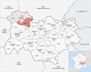
Allier is a department in the Auvergne-Rhône-Alpes region that borders Cher to the west, Nièvre to the north, Saône-et-Loire and Loire to the east, Puy-de-Dôme to the south, and Creuse to the south-west. Named after the river Allier, it had a population of 334,872 in 2021. Moulins is the prefecture; Montluçon and Vichy are the subprefectures. Its INSEE and post code is 03.

<span class="mw-page-title-main">Arrondissement of Moulins</span> Arrondissement in Auvergne-Rhône-Alpes, France

The arrondissement of Moulins is an arrondissement of France in the Allier department in the Auvergne-Rhône-Alpes region. It has 109 communes. Its population is 106,124 (2016), and its area is 2,957.9 km2 (1,142.1 sq mi).

<span class="mw-page-title-main">Arrondissement of Vichy</span> Arrondissement in Auvergne-Rhône-Alpes, France

The arrondissement of Vichy is an arrondissement of France in the Allier department in the Auvergne-Rhône-Alpes region. It has 119 communes. Its population is 124,896 (2016), and its area is 2,265.5 km2 (874.7 sq mi).

<span class="mw-page-title-main">Sioule</span> River in central France

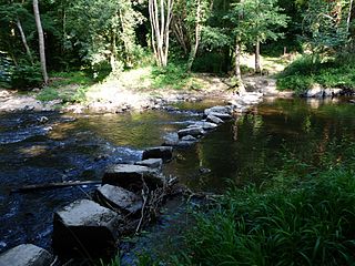
The Sioule is a 164-kilometre (102 mi) long river in central France, a left tributary of the river Allier. Its source is near the village of Orcival, north of Mont-Dore, in the Massif Central. The Sioule has cut a deep gorge, especially in its upper course. The Sioule flows generally northeast through the following departments and towns:

<span class="mw-page-title-main">Saint-Pourçain-sur-Sioule</span> Commune in Auvergne-Rhône-Alpes, France

Saint-Pourçain-sur-Sioule is a commune in the Allier department in Auvergne-Rhône-Alpes in central France. It is named after Saint Pourçain, a 6th century AD freed slave who was founder of a local monastery.

<span class="mw-page-title-main">Le Vernet, Allier</span> Commune in Auvergne-Rhône-Alpes, France

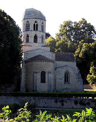
Le Vernet is a commune in the Allier department in Auvergne-Rhône-Alpes in central France.

<span class="mw-page-title-main">Vicq, Allier</span> Commune in Auvergne-Rhône-Alpes, France

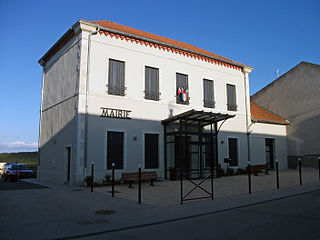
Vicq is a commune in the Allier department in Auvergne-Rhône-Alpes in central France.

<span class="mw-page-title-main">Abrest</span> Commune in Auvergne-Rhône-Alpes, France

Abrest is a commune in the Allier department in the Auvergne-Rhône-Alpes region of central France.

<span class="mw-page-title-main">Arronnes</span> Commune in Auvergne-Rhône-Alpes, France

Arronnes is a commune in the Allier department in the Auvergne-Rhône-Alpes region of central France.

<span class="mw-page-title-main">Aurouër</span> Commune in Auvergne-Rhône-Alpes, France

Aurouër is a commune in the Allier department in the Auvergne-Rhône-Alpes region of central France.

<span class="mw-page-title-main">Barberier</span> Commune in Auvergne-Rhône-Alpes, France

Barberier is a commune in the Allier department in the Auvergne-Rhône-Alpes region of central France.

<span class="mw-page-title-main">Bellerive-sur-Allier</span> Commune in Auvergne-Rhône-Alpes, France

Bellerive-sur-Allier is a commune in the Allier department in central France.

Paray-sous-Briailles is a commune in the French department of Allier in the Auvergne-Rhône-Alpes region; before 2016, it belonged to the Auvergne region. Paray-sous-Briailles is located in the arrondissement of Moulins and the canton of Saint-Pourçain-sur-Sioule.

<span class="mw-page-title-main">Canton of Saint-Pourçain-sur-Sioule</span> Canton in Auvergne-Rhône-Alpes, France

The canton of Saint-Pourçain-sur-Sioule is a French administrative division in the county of Allier and region Auvergne-Rhône-Alpes. At the French canton reorganisation which came into effect in March 2015, the canton was expanded from 14 to 22 communes:

<span class="mw-page-title-main">Bouble</span> River in France

The Bouble is a 65.4-kilometre (40.6 mi) long river in the Allier and Puy-de-Dôme departments in south central France. Its source is at Gouttières. Flowing generally northeast, the Bouble drains an area of 555 km2. It is a left tributary of the Sioule into which it flows between Saint-Pourçain-sur-Sioule and Bayet.

<span class="mw-page-title-main">Compagnie de Vichy</span>

The Compagnie de Vichy is a French company active in the Hydrotherapy, hotel and bottled water business. It is based in Vichy, France

Vichy Communauté is the communauté d'agglomération, an intercommunal structure, centred on the town of Vichy. It is located in the Allier department, in the Auvergne-Rhône-Alpes region, central France. Created in 2017, its seat is in Vichy. Its area is 741.3 km2. Its population was 82,810 in 2019, of which 24,980 in Vichy proper.

The 2024 Critérium du Dauphiné was a road cycling stage race that took place between 2 and 9 June in the Dauphiné region of southeastern France. It was the 76th edition of Critérium du Dauphiné and the 23rd race of the 2024 UCI World Tour.

References

  1. "Répertoire national des élus: les maires" (in French). data.gouv.fr, Plateforme ouverte des données publiques françaises. 13 September 2022.
  2. "Populations légales 2021" (in French). The National Institute of Statistics and Economic Studies. 28 December 2023.
  3. INSEE commune file
  4. "Bayet (03500)". habitants.fr (in French). SARL Patagos. Retrieved 24 January 2016.
  5. "Quelques villes proches de Bayet". villorama.com (in French). Retrieved 21 March 2022.
  6. 1 2 3 Bayet on Google Maps
  7. 1 2 Bayet on the Géoportail from National Geographic Institute (IGN) website (in French)
  8. Line from La Ferté-Hauterive to Gannat (in French). Retrieved on 4 July 2015.
  9. "Bulletin PLM n°23 de septembre 1932: Ouverture de la ligne de La Ferté-Hauterive à Gannat" [Bulletin PLM No. 32 of September 1932: Opening of the line from La Ferté-Hauterive to Gannat]. WikiPLM (in French). Retrieved 4 July 2015.
  10. Bayet on the 1750 Cassini Map
  11. Bayet on the 1790 Cassini Map
  12. List of Mayors of France (in French)
  13. "Liste nominative des communes de l'Allier" [Nominative list of communes of Allier](PDF). maires-allier.fr (in French). Association of Mayors and Presidents of Communities of Allier. 8 July 2020. p. 1. Retrieved 26 August 2020.
  14. 1 2 3 Évolution et structure de la population en 2017: Commune de Bayet (03018)
  15. Des villages de Cassini aux communes d'aujourd'hui: Commune data sheet Bayet, EHESS (in French).
  16. Évolution et structure de la population en 2017: Département de l'Allier (03)
  17. "Schools in Bayet". French Ministry of National Education (in French).
  18. Page RFDM2011COM: Revenus fiscaux localisés des ménages - Year 2011, Insee (20MB) (in French).
  19. The Municipal Council has voted on its budget, La Montagne, 21 April 2015, 18 pages, Vichy (in French)
  20. The accounts of communes and their groupings: individual data (from 2000 to 2013) Archived 2015-07-04 at the Wayback Machine , consulted on 25 July 2015 (click on 03 Allier > B > BAYET) (in French)
  21. "3CB : The Central Combined cycle of Bayet" (PDF). Alpiq.fr (in French). Retrieved 25 July 2015.
  22. Ména, Stéphanie; Bigard, Philippe (12 November 2013). "A semi-central nuclear reactor". La Montagne (in French).
  23. "The Lucane works has blown its 33 candles". La Montagne (in French). Vichy. 3 April 2015. p. 19.
  24. "The Lucane UVE of Bayet 33 year anniversary". Veolia.fr (in French). 30 March 2015. Retrieved 25 July 2015.
  25. Ministry of Culture, Mérimée PA00092984 Church of Saint Marcel Camera aabb.svg (in French)

INSEE References

  1. EMP T1 – Population from 15 to 64 years by type of activity.
  2. EMP T5 – Employment and Activity(in French)
  3. DEN T3 – Number of enterprises by sector of activity at 1 January 2013(in French)
  4. TOU T1 – Number and capacity of hotels on 1 January 2015(in French)
  5. TOU T2 – Number and capacity of camp sites on 1 January 2015(in French)
  6. TOU T3 – Number of other collective accommodations on 1 January 2015(in French)