Nottinghamshire is a ceremonial county in the East Midlands of England. The county borders South Yorkshire to the north-west, Lincolnshire to the east, Leicestershire to the south, and Derbyshire to the west. The largest settlement is the city of Nottingham (323,632), which is also the county town.

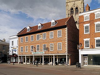
Newark-on-Trent or Newark is a market town and civil parish in the Newark and Sherwood district in Nottinghamshire, England. It is on the River Trent, and was historically a major inland port. The A1 road bypasses the town on the line of the ancient Great North Road. The town's origins are likely to be Roman, as it lies on a major Roman road, the Fosse Way. It grew up around Newark Castle, St Mary Magdalene church and later developed as a centre for the wool and cloth trades.

Newark and Sherwood is a local government district in Nottinghamshire, England. It is the largest district by area in the county. The council is based in Newark-on-Trent, the area's largest town. The district also includes the towns of Southwell and Ollerton along with a large rural area containing many villages. Much of the district lies within the ancient Sherwood Forest and there are also extensive forestry plantations in the area.

Newark is a constituency in Nottinghamshire, England. It is represented by Robert Jenrick of the Conservative Party, who won the seat in a by-election on 5 June 2014, following the resignation of Patrick Mercer in April 2014.

Sherwood Forest is a constituency represented in the House of Commons of the UK Parliament since 2024 by Michelle Welsh, of the Labour Party. The constituency's name is shared with Sherwood Forest, which is in the area.

Southwell is a minster and market town, and a civil parish, in the district of Newark and Sherwood in Nottinghamshire, England. It is home to the grade-I listed Southwell Minster, the cathedral of the Anglican Diocese of Southwell and Nottingham. The population of the town was recorded at 7,491 in the 2021 census.

Balderton is a village and civil parish in Nottinghamshire, England, which had a population of 9,757 at the 2011 census, increasing to 9,917 at the 2021 census.
Newark and Sherwood District Council elections are held every four years. Newark and Sherwood District Council is the local authority for the non-metropolitan district of Newark and Sherwood in Nottinghamshire, England. Since the last boundary changes in 2015, 39 councillors have been elected from 21 wards.

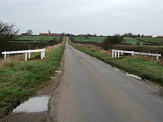
Farndon is a small village and civil parish in the Newark and Sherwood district of Nottinghamshire, England. It lies along the historic Fosse road on the banks of the River Trent and is 3 miles (4 km) south-west of Newark-on-Trent. The population of the civil parish as of the 2011 census was 2,405, this increased to 2,479 at the 2021 census. The A46 road previously ran through the village until the development of a new dual carriageway bypass.

Hawton is a hamlet and civil parish in the Newark and Sherwood district of Nottinghamshire, England. It lies two miles (3.2 km) south of the town of Newark-on-Trent, near the River Devon, a tributary of the River Trent. Its population was recorded as 147 in the 2011 census. Hawton alone reported 80 residents at the 2021 census.

Rainworth is a village in the ceremonial county of Nottinghamshire in the East Midlands of England. It is split between the local government districts of Newark and Sherwood and Mansfield. To the north of Rainworth is the village of Clipstone and to the east are the villages of Bilsthorpe and Farnsfield. Mansfield lies two miles to the west and the village of Blidworth is a mile to the south.

Coddington is a village and civil parish in the Newark and Sherwood district of Nottinghamshire, England. It is 3 miles (4.8 km) east of Newark-on-Trent. According to the 2001 census it had a population of 972, which increased to 1,684 at the 2011 Census and to 1,538 at the 2021 census.

Fernwood is a village and civil parish in the Newark and Sherwood district of Nottinghamshire, England. The parish, which then included Balderton, had a population of 10,298 in 2001. It is a suburb of Newark-on-Trent.The population of the civil parish was given as 2,190 in the 2011 census, Balderton by that time was a separate civil parish. Fernwood itself increased to 3,054 at the 2021 census.

Westborough and Dry Doddington is a civil parish in the north-west of South Kesteven in the county of Lincolnshire. The population of the civil parish was 335 at the 2001 census increasing to 365 at the 2011 census.

Newark and Sherwood United F.C. is a football club that represents the town of Newark-on-Trent, Nottinghamshire and were based at the Lowfields Ground, Hawton Lane, Balderton for over 100 years,. They are currently members of the United Counties League Premier Division North and are ground sharing with Harrowby United FC in Grantham.

Staunton is a small village and civil parish in the Newark and Sherwood district of Nottinghamshire, England. It takes its name from the Vale of Belvoir and shares it with the local Staunton family, which has resided in the area since the Norman Conquest and possibly before, making them one of the few English families still resident on their estate.

Bridge is a ward and suburb of Newark-on-Trent, in the Newark & Sherwood district in the county of Nottinghamshire, England. It is one of the seven wards on Newark Town Council.

Castle is a ward and suburb of Newark-on-Trent, in the Newark & Sherwood district in the county of Nottinghamshire, England. It is one of the seven wards on Newark Town Council.

Devon is a ward and suburb of Newark-on-Trent, in the Newark & Sherwood district in the county of Nottinghamshire, England. It is one of the seven wards on Newark Town Council.


