Bear Creek Ski and Recreation Area

Last updated
Bear Creek Mountain Resort
Bear-creek.JPG
Bear Creek Ski and Recreation Area, January 2012
Location Longswamp Township, Berks County,
near Macungie, Pennsylvania
Nearest major city Allentown, PA
Coordinates 40°28′34″N75°37′33″W / 40.47611°N 75.62583°W / 40.47611; -75.62583
Top elevation1,100 feet (340 m)
Base elevation590 feet (180 m)
Skiable area86 acres (350,000 m2)
Runs21
Longest run0.9 miles (1.4 km)
Lift system 7
Terrain parks 3
Snowfall 30 in/year
Website http://www.bcmr.com/
Bear Creek Ski Lodge, January 2012 Bear-creek-lodge.JPG
Bear Creek Ski Lodge, January 2012

Bear Creek is a ski resort near the borough of Macungie, Pennsylvania in the Lehigh Valley region of Pennsylvania, in the United States. The resort opened in 1967 and was known as the Doe Mountain until 1999. The official name of the property is Bear Creek Mountain Resort & Conference Center. It is a year-round resort on more than 330 acres (1.3 km2) that features a variety of activities and amenities.

Contents

Bear Creek Mountain has a summit elevation of 1,100 feet (340 m) and vertical elevation change of 510 ft (160 m). There are 86 acres (350,000 m2) of skiing terrain. The longest run is .9 miles in length. The mountain has a total of 21 slopes and 7 lifts.

It also features night skiing and snowtubing. The mountain summit receives an average of 30 inches (76 cm) of snowfall each winter. Bear Creek is the only ski resort located in the Lehigh Valley and surrounding areas, though many ski resorts are located 30 miles (48 km) north of the Lehigh Valley, in the Pocono Mountains.

Climate

According to the Trewartha climate classification system, Bear Creek Ski and Recreation Area has a Temperate Continental (Dc) Climate with warm summers (b) at the summit (hot summers (a) at the base), cold winters (o) and year-around precipitation. Dcbo climates are characterized by at least one month having an average mean temperature ≤ 32.0 °F (0 °C), four to seven months with an average mean temperature ≥ 50.0 °F (10 °C), all months with an average mean temperature < 72.0 °F (22 °C) (Dcba at the base ≥ 72.0 °F (22 °C)) and no significant precipitation difference between seasons. During the summer months at Bear Creek Ski and Recreation Area, episodes of extreme heat and humidity can occur with heat index values ≥ 100 °F (38 °C). The annual peak in thunderstorm activity is July. During the winter months, episodes of extreme cold and wind can occur with wind chill values < −15 °F (−26 °C). The plant hardiness zone is 6b with an average annual extreme minimum air temperature of −4.8 °F (−20 °C) at the summit and −4.6 °F (−20 °C) at the base. [1] The average seasonal (Nov-Apr) snowfall total is between 30 and 36 inches (76 and 91 cm). Ice storms and large snowstorms depositing ≥ 12 inches (30 cm) of snow can occur, particularly during nor’easters from December through February.

Climate data for Bear Creek Summit (Elevation: 1135 ft (346 m))
MonthJanFebMarAprMayJunJulAugSepOctNovDecYear
Average high °F (°C)38.2
(3.4)
40.8
(4.9)
51.5
(10.8)
61.0
(16.1)
71.1
(21.7)
79.3
(26.3)
82.4
(28.0)
81.6
(27.6)
75.2
(24.0)
63.8
(17.7)
53.5
(11.9)
41.2
(5.1)
61.7
(16.5)
Daily mean °F (°C)28.7
(−1.8)
30.8
(−0.7)
39.7
(4.3)
49.4
(9.7)
59.1
(15.1)
68.0
(20.0)
71.8
(22.1)
70.7
(21.5)
63.6
(17.6)
52.3
(11.3)
42.9
(6.1)
32.5
(0.3)
50.9
(10.5)
Average low °F (°C)19.2
(−7.1)
20.8
(−6.2)
27.8
(−2.3)
37.8
(3.2)
47.1
(8.4)
56.6
(13.7)
61.2
(16.2)
59.8
(15.4)
52.0
(11.1)
40.8
(4.9)
32.4
(0.2)
23.7
(−4.6)
40.0
(4.4)
Average precipitation inches (mm)3.42
(87)
2.78
(71)
3.69
(94)
4.00
(102)
4.48
(114)
4.61
(117)
5.06
(129)
4.00
(102)
4.80
(122)
4.33
(110)
3.92
(100)
3.88
(99)
48.97
(1,244)
Average relative humidity (%)66.964.157.058.462.569.470.872.272.070.267.670.066.8
Average dew point °F (°C)19.1
(−7.2)
20.1
(−6.6)
25.7
(−3.5)
35.4
(1.9)
46.3
(7.9)
57.6
(14.2)
61.8
(16.6)
61.3
(16.3)
54.4
(12.4)
42.9
(6.1)
32.9
(0.5)
23.8
(−4.6)
37.6
(3.1)
Source: PRISM [2]
Climate data for Bear Creek Base (Elevation: 676 ft (206 m))
MonthJanFebMarAprMayJunJulAugSepOctNovDecYear
Average high °F (°C)37.6
(3.1)
40.7
(4.8)
50.6
(10.3)
61.5
(16.4)
71.7
(22.1)
79.9
(26.6)
82.9
(28.3)
82.2
(27.9)
75.7
(24.3)
64.3
(17.9)
53.0
(11.7)
41.0
(5.0)
61.9
(16.6)
Daily mean °F (°C)28.6
(−1.9)
31.0
(−0.6)
39.4
(4.1)
49.8
(9.9)
59.6
(15.3)
68.5
(20.3)
72.3
(22.4)
71.2
(21.8)
64.0
(17.8)
52.6
(11.4)
42.8
(6.0)
32.5
(0.3)
51.1
(10.6)
Average low °F (°C)19.5
(−6.9)
21.3
(−5.9)
28.2
(−2.1)
38.1
(3.4)
47.5
(8.6)
57.1
(13.9)
61.6
(16.4)
60.2
(15.7)
52.2
(11.2)
41.0
(5.0)
32.6
(0.3)
24.0
(−4.4)
40.4
(4.7)
Average precipitation inches (mm)3.39
(86)
2.76
(70)
3.65
(93)
3.96
(101)
4.42
(112)
4.55
(116)
5.00
(127)
3.97
(101)
4.77
(121)
4.28
(109)
3.87
(98)
3.85
(98)
48.47
(1,231)
Average relative humidity (%)68.465.058.658.462.369.470.872.272.070.368.970.967.3
Average dew point °F (°C)19.5
(−6.9)
20.6
(−6.3)
26.1
(−3.3)
35.8
(2.1)
46.7
(8.2)
58.1
(14.5)
62.3
(16.8)
61.8
(16.6)
54.8
(12.7)
43.2
(6.2)
33.3
(0.7)
24.1
(−4.4)
37.6
(3.1)
Source: PRISM [2]

Bam Margera visited Bear Creek for a portion of his television series, Viva La Bam . During his visit, the band Clutch performed at the bottom of the tubing hill. The resort's ame was changed from Doe Mountain as a marketing strategy to avoid being characterized as a small ski area.[ citation needed ]

Related Research Articles

Monroe County, Pennsylvania County in Pennsylvania, United States

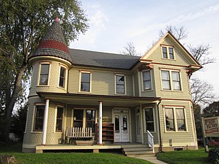
Monroe County is a county in the U.S. Commonwealth of Pennsylvania. As of the 2010 census, the population was 168,327. Its county seat is Stroudsburg. The county was formed from sections of Northampton and Pike counties on April 1, 1836. Named in honor of James Monroe, the fifth president of the United States, the county is located in northeastern Pennsylvania, along its border with New Jersey. Monroe County is coterminous with the East Stroudsburg, PA Metropolitan Statistical Area. It also borders the Wyoming Valley, the Lehigh Valley and has connections to the Delaware Valley and the Tri-State Area being a part of New York City's Designated Media Market, but also receiving media from the Scranton/Wilkes-Barre and Philadelphia areas.

Milford Township, Bucks County, Pennsylvania Township in Pennsylvania, United States

Milford Township is a township in Bucks County, Pennsylvania, United States. The population was 9,902 at the 2010 census. It is home to the Quakertown interchange of the Pennsylvania Turnpike Northeast Extension.

Springfield Township, Bucks County, Pennsylvania Township in Pennsylvania, United States

Springfield Township is a township in Bucks County, Pennsylvania, United States. The population was 5,035 at the 2010 census.

Eldred Township, Monroe County, Pennsylvania Township in Pennsylvania, United States

Eldred Township is a township in Monroe County, Pennsylvania, United States. The population was 2,665 at the 2000 census.

Polk Township, Monroe County, Pennsylvania Place in Pennsylvania, United States

Polk Township is a township in Monroe County, Pennsylvania, United States. The population was 7,473 at the 2020 census.

Stowe, Vermont Town in Vermont, United States

Stowe is a town in Lamoille County, Vermont, United States. The population was 5,223 at the 2020 census. The town lies on Vermont Routes 108 and 100. It is nicknamed "The Ski Capital of the East" and is home to Stowe Mountain Resort, a ski facility with terrain on Mount Mansfield and Spruce Peak.

Mount Marcy Mountain in New York State

Mount Marcy is the highest point in New York, with an elevation of 5,344 feet (1,629 m). It is located in the Town of Keene in Essex County. The mountain is in the heart of the Adirondack High Peaks region of the High Peaks Wilderness Area. Its stature and expansive views make it a popular destination for hikers, who crowd its summit in the summer months.

Pocono Mountains Geographic highland and cultural region in Pennsylvania, United States

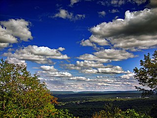
The Pocono Mountains, commonly referred to as the Poconos, are a geographical, geological, and cultural region in Northeastern Pennsylvania, United States. They overlook the Delaware River and Delaware Water Gap to the east, Lake Wallenpaupack to the north, Wyoming Valley and the Coal Region to the west, and the Lehigh Valley to the south. The name Pocono is derived from the Munsee word Pokawachne, which means "Creek Between Two Hills".

The climate of Salt Lake City, Utah features cold and snowy winters, hot and dry summers, and modest to light seasonal rainfall. Lying in the Salt Lake Valley, the city is surrounded by mountains and the Great Salt Lake. Under the Köppen climate classification, Salt Lake City has either a humid subtropical climate (Cfa) or a humid continental climate (Dfa) depending on which variant of the system is used, though it borders on a Mediterranean climate (Csa) or dry-summer continental climate (Dsa) as summers are quite dry.

Nockamixon State Park

Nockamixon State Park is a Pennsylvania state park on 5,283 acres (2,138 ha) in Bedminster and Haycock Townships in northern Bucks County, Pennsylvania, in the United States. The park is one of the most popular in southeastern Pennsylvania, with most tourists visiting in the summer months.

Camelback Mountain Resort Ski and snowboard resort in Pennsylvania

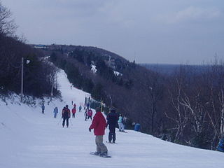
Camelback Mountain Resort is a ski and snowboard resort located in the Tannersville, Pennsylvania in the Pocono Mountains, in the United States.

Bowmans Hill Wildflower Preserve

Bowman's Hill Wildflower Preserve is a 134-acre nature preserve, botanical garden, and accredited museum located at 1635 River Road, New Hope, Pennsylvania. It is open daily, except for major holidays, April–June, and closed on Tuesdays July–March; an admission fee is charged to nonmembers. A non-profit organization, Bowman's Hill Wildflower Preserve Association Inc., maintains the park in accordance to a management agreement with the Pennsylvania Department of Conservation and Natural Resources and the Pennsylvania Historical and Museum Commission.

Big Pocono State Park

Big Pocono State Park is a 1,305.6-acre (528.4 ha) Pennsylvania state park in Jackson and Pocono townships in Monroe County, Pennsylvania in northeastern Pennsylvania in the United States. The park is on Camelback Mountain and is maintained jointly by the Pennsylvania Department of Conservation and Natural Resources and Camelback Ski Corporation.

Blue Mountain Resort

Blue Mountain Resort is a ski resort located in Palmerton, Pennsylvania on Blue Mountain in the United States.

Ralph Stover State Park State park in Bucks County, Pennsylvania

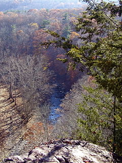
Ralph Stover State Park is a Pennsylvania state park on 45 acres (18 ha) in Plumstead and Tinicum Townships, Bucks County, Pennsylvania in the United States. It is a very popular destination for whitewater kayaking on Tohickon Creek and rock climbing on High Rocks. Ralph Stover State Park is two miles (3.2 km) north of Point Pleasant near Pennsylvania Route 32.

Elk Mountain Ski Area

Elk Mountain Ski Resort is a ski area in the Endless Mountains on the summit of North Knob in Herrick Township, Susquehanna County, near Union Dale, Pennsylvania. It is located 30 miles north of Scranton. The mountain has been given favorable reviews from Ski Magazine, including a listing in "Six Unsung Heroes", a roundup of hidden gems in skiing.

Climate of Oregon

According to the Köppen climate classification, most of Western Oregon has a warm-summer mediterranean climate, which features warm, dry summers, and wet winters with frequent overcast and cloudy skies. Eastern Oregon falls into the cold semi-arid climate, which features drier weather.

Climate of Allentown, Pennsylvania Overview of the climate of Allentown, Pennsylvania, United States

The climate of Allentown, Pennsylvania is classified as a humid continental climate. Allentown's warmest month is July with a daily average temperature of 73.4 °F (23.0 °C) and the coldest month being January with a daily average of 27.8 °F (−2.3 °C). The average precipitation of Allentown is 45.35 inches (1,152 mm) per year.

Cherry Valley National Wildlife Refuge

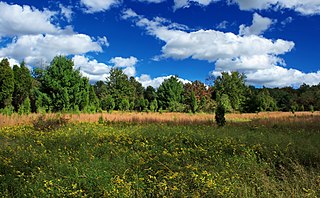
The Cherry Valley National Wildlife Refuge is a National Wildlife Refuge in Monroe County, Pennsylvania.

Climate of Seattle Overview of climatic conditions in Seattle

The climate of Seattle is temperate, classified in the Mediterranean zone by the main climatic classification but some sources put the city in the oceanic zone (Cfb). It has cool, wet winters and mild, relatively dry summers, covering characteristics of both. The climate is sometimes characterized as a "modified Mediterranean" climate because it is cooler and wetter than a "true" Mediterranean climate, but shares the characteristic dry summer. The city and environs are part of USDA hardiness zone 8b, with isolated coastal pockets falling under 9a.

References

  1. "USDA Interactive Plant Hardiness Map". United States Department of Agriculture . Retrieved August 14, 2019.
  2. 1 2 "PRISM Climate Group, Oregon State University" . Retrieved August 14, 2019.