Kidder Township, Carbon County, Pennsylvania

Last updated
Kidder Township
HickoryRunBoulderField2007.jpg
Boulder field at Hickory Run State Park, July 2007
Motto(s): 
"A nice place to live, work, play!!" [1]
Map of Kidder Township, Carbon County, Pennsylvania Highlighted.png
Location of Kidder Township in Carbon County
Map of Pennsylvania highlighting Carbon County.svg
Location of Carbon County in Pennsylvania
Coordinates: 40°59′59″N75°42′29″W / 40.99972°N 75.70806°W / 40.99972; -75.70806
Country United States
State Pennsylvania
County Carbon
Area
[2]
  Total69.80 sq mi (180.78 km2)
  Land69.08 sq mi (178.90 km2)
  Water0.72 sq mi (1.87 km2)
Elevation
1,329 ft (405 m)
Population
 (2010)
  Total1,935
  Estimate 
(2016) [3]
1,930
  Density27.94/sq mi (10.79/km2)
Time zone UTC-5 (EST)
  Summer (DST) UTC-4 (EDT)
Area code 570
FIPS code 42-025-39608
Website www.kiddertownship.org

Kidder Township is a township in Carbon County, Pennsylvania. It is part of Northeastern Pennsylvania. The population was 1,935 at the 2010 census, [4] up from 1,185 at the 2000 census.

Contents

History

On October 10, 1888, a train wreck known as the Mud Run Disaster occurred on the Lehigh Valley Railroad which runs through the township. 66 people were killed, most members of the Total Abstinence Union returning from a rally.

Geography

Kidder Township occupies the northern end of Carbon County and is bordered by Luzerne County to the north and west and by Monroe County to the east. It is drained by the Lehigh River, which separates it from Luzerne County. Tobyhanna Creek, a tributary of the Lehigh, forms the northern half of the township's eastern border. Its villages include Albrightsville (also in Penn Forest Township), Hickory Run, Lake Harmony, Lehigh Tannery, Leonardsville/Pocono Mountain Lake Estates, and Split Rock. Albrightsville is a census-designated place as is Holiday Pocono within Kidder.

According to the U.S. Census Bureau, the township has a total area of 69.8 square miles (180.8 km2), of which 69.1 square miles (178.9 km2) is land and 0.73 square miles (1.9 km2), or 1.04%, is water. [4] Hickory Run State Park occupies nearly 16,000 acres (65 km2) in the southern half of the township.

Neighboring municipalities

Climate

The township has a warm-summer humid continental climate (Dfb) and the hardiness zone is mostly 5b except for a little 6a along Mud Run and the Lehigh River. The average monthly temperatures at the Pocono interchange of the Turnpike range from 22.9 °F in January to 68.3 °F in July.

Demographics

Historical population
CensusPop.Note
2000 1,185
2010 1,93563.3%
2016 (est.)1,930 [3] −0.3%
U.S. Decennial Census [5]

As of the census [6] of 2000, there were 1,185 people, 498 households, and 347 families residing in the township. The population density was 17.2 people per square mile (6.6/km2). There were 2,197 housing units at an average density of 31.8 per square mile (12.3/km2). The racial makeup of the township was 93.25% White, 2.36% African American, 0.08% Native American, 0.17% Asian, 1.35% from other races, and 2.78% from two or more races. Hispanic or Latino of any race were 4.56% of the population.

There were 498 households, out of which 21.5% had children under the age of 18 living with them, 57.4% were married couples living together, 7.4% had a female householder with no husband present, and 30.3% were non-families. 25.3% of all households were made up of individuals, and 8.6% had someone living alone who was 65 years of age or older. The average household size was 2.28 and the average family size was 2.69.

In the township, the population was spread out, with 21.3% under the age of 18, 5.7% from 18 to 24, 23.4% from 25 to 44, 31.7% from 45 to 64, and 18.0% who were 65 years of age or older. The median age was 45 years. For every 100 females, there were 110.9 males. For every 100 females age 18 and over, there were 102.4 males.

The median income for a household in the township was $32,583, and the median income for a family was $37,404. Males had a median income of $30,714 versus $26,250 for females. The per capita income for the township was $18,719. About 9.5% of families and 10.1% of the population were below the poverty line, including 9.8% of those under age 18 and 10.5% of those age 65 or over.

Transportation

I-80 eastbound in Kidder Township 2022-08-15 10 00 50 View east along Interstate 80 (Keystone Shortway) from the overpass for Moseywood Road in Kidder Township, Carbon County, Pennsylvania.jpg
I-80 eastbound in Kidder Township

As of 2015, there were 40.77 miles (65.61 km) of public roads in Kidder Township, of which 9.40 miles (15.13 km) were maintained by the Pennsylvania Turnpike Commission (PTC), 26.18 miles (42.13 km) were maintained by the Pennsylvania Department of Transportation (PennDOT) and 5.19 miles (8.35 km) were maintained by the township. [7]

Kidder Township is served by two Interstate highways. Interstate 476, the Pennsylvania Turnpike's Northeast Extension, passes north–south through the township while Interstate 80 passes east–west through the township. The two highways meet at the Pocono interchange. State highways serving Kidder Township include Pennsylvania Route 534, which passes east–west through the southern portion of the township, intersecting PA 903 in Albrightsville; Pennsylvania Route 903, which passes through the southeast corner of the township on its way between Jim Thorpe and Route 115 just beyond the Monroe County line; and Pennsylvania Route 940, which passes east–west through the northern portion of the township parallel to I-80 and connects to I-80 and I-476 at the Pocono interchange.

Kidder has one more important road, which connects 903 and 940 via Lake Harmony and Split Rock. The portion between Split Rock and 940, Mosey Wood Road, is a private toll road operated by Vacation Charters Limited, and the portion south to 903 is Lake Drive. [8]

Martz Trailways has a stop in Kidder Township near the Pocono interchange of Interstate 476 for service between Scranton, Wilkes-Barre, Allentown, Quakertown, and Philadelphia. This is an Amtrak Thruway Motorcoach route, connecting to Amtrak trains at 30th Street Station in Philadelphia. Martz also operates casino bus routes to Atlantic City from the stop.

The Reading, Blue Mountain and Northern Railroad's Lehigh Division line pass through the western portion of Kidder Township. [9]

Related Research Articles

<span class="mw-page-title-main">Carbon County, Pennsylvania</span> County in Pennsylvania, United States

Carbon County is a county in the Commonwealth of Pennsylvania. It is located in Northeastern Pennsylvania. As of the 2020 census, the population was 64,749. The county is also part of Pennsylvania's Coal Region and Northeastern Pennsylvania.

<span class="mw-page-title-main">East Penn Township, Carbon County, Pennsylvania</span> Place in Pennsylvania, United States

East Penn Township is a rural township in the rough uplands terrain of the eastern Mahoning Hills area of Carbon County, Pennsylvania. It is part of Northeastern Pennsylvania.

<span class="mw-page-title-main">East Side, Pennsylvania</span> Borough in Pennsylvania, United States

East Side is a borough in Carbon County, Pennsylvania. It is part of Northeastern Pennsylvania. The population was 317 at the 2010 census.

<span class="mw-page-title-main">Franklin Township, Carbon County, Pennsylvania</span> Place in Pennsylvania, United States

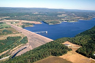
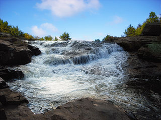
Franklin Township is a township in Carbon County, Pennsylvania. It is part of Northeastern Pennsylvania. The population was 4,262 at the 2010 census. A portion of Beltzville State Park is in Franklin Township.

<span class="mw-page-title-main">Lower Towamensing Township, Carbon County, Pennsylvania</span> Place in Pennsylvania, United States

Lower Towamensing Township is a township in Carbon County, Pennsylvania. It is part of Northeastern Pennsylvania. The Lenape Indian tribe name is eponymous and was once applied by the natives to the whole region of Carbon County and bits of the Poconos to the north and to Schuylkill County (southwest). The population was 3,228 at the 2010 census.

<span class="mw-page-title-main">Penn Forest Township, Carbon County, Pennsylvania</span> Place in Pennsylvania, United States

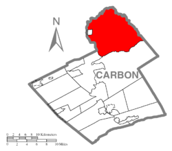
Penn Forest Township is a township in Carbon County, Pennsylvania. It is part of Northeastern Pennsylvania. The population was 9,581 at the 2010 census, up from 5,439 at the 2000 census.

<span class="mw-page-title-main">Towamensing Township, Carbon County, Pennsylvania</span> Place in Pennsylvania, United States

Towamensing Township is a lightly populated rural township in eastern Carbon County, Pennsylvania. It is part of Northeastern Pennsylvania.

<span class="mw-page-title-main">North Whitehall Township, Lehigh County, Pennsylvania</span> Township in Pennsylvania, United States

North Whitehall Township is a township in Lehigh County, Pennsylvania. The population of North Whitehall Township was 15,655 at the 2020 census. It is a suburb of Allentown in the Lehigh Valley, which had a population of 861,899 and was the 68th-most populous metropolitan area in the U.S. as of the 2020 census.

<span class="mw-page-title-main">Mount Pocono, Pennsylvania</span> Place in Pennsylvania, United States

Mount Pocono is a borough in Monroe County, Pennsylvania. It is located nearly centered in the southernmost county of five in the northeastern corner that are part of the Pocono Mountains. The borough serves as a local highway nexus, and sees a lot of tourist traffic making use of resources in the region. As of the 2020 census, the borough population was 3,083 residents.

<span class="mw-page-title-main">Tobyhanna Township, Monroe County, Pennsylvania</span> Place in Pennsylvania, United States

Tobyhanna Township is a township in Monroe County, Pennsylvania, United States. The population was 8,290 at the 2020 census. Tobyhanna Township has Tobyhanna Elementary Center and Locust Lake Village.

<span class="mw-page-title-main">Pocono Mountains</span> Geographic highland and cultural region in Pennsylvania, United States

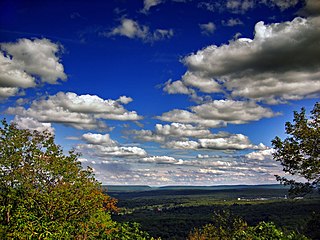
The Pocono Mountains, commonly referred to as the Poconos, are a geographical, geological, and cultural region in Northeastern Pennsylvania. They overlook the Delaware River and Delaware Water Gap to the east, Lake Wallenpaupack to the north, Wyoming Valley and the Coal Region to the west, and the Lehigh Valley to the south. The name Pocono is derived from the Munsee word Pokawachne, which means "Creek Between Two Hills".

<span class="mw-page-title-main">Interstate 380 (Pennsylvania)</span> Highway in Pennsylvania

Interstate 380 (I-380) is an auxiliary Interstate Highway in Northeastern Pennsylvania that connects I-80 with I-81 and I-84. The southern terminus is in Tunkhannock Township at the junction with I-80; the northern terminus of I-380 is at I-81 and U.S. Route 6 (US 6) in Dunmore. The entire length of the highway is 28.45 miles (45.79 km).

<span class="mw-page-title-main">Interstate 476</span> Interstate Highway in Pennsylvania, US

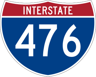
Interstate 476 (I-476) is a 132.1-mile (212.6 km) auxiliary Interstate Highway of I-76 in the U.S. state of Pennsylvania. The highway runs from I-95 near Chester north to I-81 near Scranton, serving as the primary north–south Interstate corridor through eastern Pennsylvania. It consists of both the 20-mile (32 km) Mid-County Expressway, locally referred to as the "Blue Route", through Delaware and Montgomery counties in the suburban Philadelphia area, and the tolled, 110.6-mile (178.0 km) Northeast Extension of the Pennsylvania Turnpike, which connects the Delaware Valley with the Lehigh Valley, the Pocono Mountains, and the Wyoming Valley to the north.

<span class="mw-page-title-main">Pennsylvania Route 940</span> State highway in Pennsylvania, US

Pennsylvania Route 940 is a 43.2-mile-long (69.5 km) Pennsylvania highway located in the Pocono Mountains. It runs from PA 309 in Hazleton east to PA 191 in Paradise Valley. Large segments of PA 940 are located in densely forested areas. The route heads northeast through Luzerne County from Hazleton, passing through Freeland and coming to an interchange with Interstate 80 (I-80) in White Haven. From here, PA 940 turns east and runs a short distance north of I-80, coming to an interchange with both I-80 and I-476 in northern Carbon County. The route continues through Monroe County and passes through Pocono Pines before it has an interchange with I-380. PA 940 passes through Mount Pocono prior to continuing to its eastern terminus.

<span class="mw-page-title-main">Pennsylvania Route 115</span> 35.7-mile-long (57.5 km) north–south state highway in eastern Pennsylvania

Pennsylvania Route 115 (PA 115) is a 35.7-mile-long (57.5 km) north–south state highway in eastern Pennsylvania. It stretches from U.S. Route 209 (US 209) in Brodheadsville, Monroe County, northwest to Interstate 81 (I-81) and PA 309 near Wilkes-Barre in Luzerne County. PA 115 passes through rural areas along its route, intersecting PA 903 in Tunkhannock Township, I-80 and PA 940 in Tobyhanna Township, and I-476 in Bear Creek Township. The road serves as a connector between the Pocono Mountains and the Wyoming Valley.

<span class="mw-page-title-main">Tobyhanna State Park</span>

Tobyhanna State Park is a Pennsylvania state park on 5,440 acres (2,201 ha) mostly in Coolbaugh Township, Monroe County, with a small portion of the park in Dreher and Lehigh townships in Wayne County, all in Pennsylvania in the United States. The park includes the 170-acre (69 ha) Tobyhanna Lake and a portion of Tobyhanna Creek. It is located 2.1 miles (3.4 km) north of the town of Tobyhanna, with the main park entrance on Pennsylvania Route 423, and a portion that borders on Pennsylvania Route 196. The park lies immediately adjacent to Gouldsboro State Park, Pennsylvania State Game Lands 312, and State Game Land 127.

<span class="mw-page-title-main">Pennsylvania Route 534</span> State highway in Pennsylvania, US

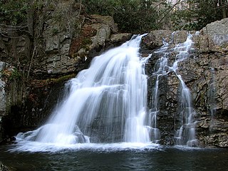
Pennsylvania Route 534 is an 23.5-mile-long (37.8 km) state highway located in Monroe and Carbon counties in Pennsylvania. The western terminus is at PA 940 in East Side. The eastern terminus is at U.S. Route 209 in the community of Kresgeville in Polk Township. PA 534 runs northwest-southeast through forested areas of the Pocono Mountains as a two-lane undivided road. The route has an interchange with Interstate 80 (I-80) near East Side before it passes through Hickory Run State Park. PA 534 crosses PA 903 near Albrightsville and continues south to US 209. The roadway was paved in the 1930s and received the PA 534 designation in the 1960s.

<span class="mw-page-title-main">Pennsylvania Route 903</span> State highway in Pennsylvania, US

Pennsylvania Route 903 is a 17.7-mile-long (28.5 km) state highway located in Carbon and Monroe counties in Pennsylvania. The southern terminus is at U.S. Route 209 in Jim Thorpe. The northern terminus is at PA 115 in Tunkhannock Township. The route runs through rural areas of the Pocono Mountains, with an interchange with the Pennsylvania Turnpike Northeast Extension in Penn Forest Township and a junction with PA 534 in Kidder Township. PA 903 is a two-lane undivided road nearly its entire length, besides the I-476 intersection. The route was designated in 1928 between US 209/US 309 in present-day Jim Thorpe, and a connecting road, now PA 115, south of Blakeslee. The highway was fully paved in the 1930s. Between 2008 and 2015, an E-ZPass-only interchange was constructed with I-476.

Albrightsville is an unincorporated community and census-designated place which is located in Kidder and Penn Forest townships, Carbon County, Pennsylvania, United States. It is part of Northeastern Pennsylvania.

Towamensing Trails is a census-designated place (CDP) in Penn Forest Township, Carbon County, Pennsylvania, United States. It is part of Northeastern Pennsylvania.

References

  1. "Kidder Township, Pennsylvania". Kidder Township, Pennsylvania. Retrieved August 10, 2012.
  2. "2016 U.S. Gazetteer Files". United States Census Bureau. Retrieved Aug 13, 2017.
  3. 1 2 "Population and Housing Unit Estimates" . Retrieved June 9, 2017.
  4. 1 2 "Geographic Identifiers: 2010 Census Summary File 1 (G001): Kidder township, Carbon County, Pennsylvania". U.S. Census Bureau, American Factfinder. Archived from the original on April 6, 2015. Retrieved April 6, 2015.
  5. "Census of Population and Housing". Census.gov. Retrieved June 4, 2016.
  6. "U.S. Census website". United States Census Bureau . Retrieved 2008-01-31.
  7. "Kidder Township map" (PDF). PennDOT. Retrieved March 17, 2023.
  8. "BTS | Table 1-3: Pennsylvania Toll Roads: 2001". www.bts.gov. Archived from the original on 2007-06-05.
  9. Carbon County, Pennsylvania Highway Map (PDF) (Map). PennDOT. 2019. Retrieved September 11, 2019.