Albrightsville, Pennsylvania

Last updated
Albrightsville, Pennsylvania
USA Pennsylvania location map.svg
Red pog.svg
Albrightsville
Location in Pennsylvania
Usa edcp location map.svg
Red pog.svg
Albrightsville
Albrightsville (the United States)
Coordinates: 41°0′52″N75°36′3″W / 41.01444°N 75.60083°W / 41.01444; -75.60083
Country United States
State Pennsylvania
County Carbon
Townships Kidder, Penn Forest
Area
[1]
  Total1.01 sq mi (2.61 km2)
  Land1.01 sq mi (2.61 km2)
  Water0.00 sq mi (0.00 km2)
Elevation
1,510 ft (460 m)
Population
 (2020) [2]
  Total138
  Density136.77/sq mi (52.82/km2)
Time zone UTC−5 (Eastern (EST))
  Summer (DST) UTC−4 (EDT)
ZIP code
18210
Area code 570
FIPS code 42-00652
GNIS feature ID1168122

Albrightsville is an unincorporated community and census-designated place [3] which is located in Kidder and Penn Forest townships, Carbon County, Pennsylvania, United States. It is part of Northeastern Pennsylvania.

Demographics and geography

As of the 2020 census, the population was 138. [4]

It is drained by Mud Run (which forms the township boundary) westward into the Lehigh River. Pennsylvania Routes 534 and 903 intersect at the eastern corner of the village. Although it has its own post office with the ZIP code of 18210, areas just to the north and west use the Lake Harmony ZIP code of 18624. [5]

The Holiday Pocono community is directly to the north, across Pennsylvania 534, and Towamensing Trails is directly across Pennsylvania 903 to the southeast. The community is just east of Hickory Run State Park.

The community has a warm-summer humid continental climate (Dfb) and the average monthly temperature ranges from 23.5 °F (−4.7 °C) in January to 68.5 °F (20.3 °C) in July. [6] The hardiness zone is 5b and the average annual absolute minimum temperature is −13.4 °F (−25.2 °C). [7]

Historical population
CensusPop.Note
2020 138
U.S. Decennial Census [8] [2]

Related Research Articles

Feasterville-Trevose is a former census-designated place (CDP) in Lower Southampton Township in Bucks County, Pennsylvania. The population was 6,525 at the 2000 census. The ZIP code is 19053. The area has been separated into two CDPs in the 2010 census, Feasterville and Trevose.

<span class="mw-page-title-main">Lower Makefield Township, Pennsylvania</span> Township in Pennsylvania, United States

Lower Makefield Township is a township in Bucks County, Pennsylvania, United States. Lower Makefield Township is located in the Delaware Valley and borders the Delaware River and New Jersey to its north and east. Most addresses in the township have a Yardley address; the township surrounds the borough of Yardley on its north, south, and west.

<span class="mw-page-title-main">Morrisville, Bucks County, Pennsylvania</span> Borough in Pennsylvania, United States

Morrisville is a borough in Bucks County, Pennsylvania, United States. It is located just below the falls of the Delaware River opposite Trenton, New Jersey. The population was 9,809 in the 2020 Census.

<span class="mw-page-title-main">Nockamixon Township, Pennsylvania</span> Township in Pennsylvania, United States

Nockamixon Township is a township in Bucks County, Pennsylvania, United States. The population was 3,441 at the 2010 census.

<span class="mw-page-title-main">Plumstead Township, Pennsylvania</span> Township in Pennsylvania, United States

Plumstead Township is a township in Bucks County, Pennsylvania, United States. The population was 12,442 at the 2010 census.

<span class="mw-page-title-main">Richland Township, Bucks County, Pennsylvania</span> Township in Pennsylvania, United States

Richland Township is a township in Bucks County, Pennsylvania, United States. The population was 11,100 at the 2010 census.

<span class="mw-page-title-main">Solebury Township, Pennsylvania</span> Township in Pennsylvania, United States

Solebury Township is a township in Bucks County, Pennsylvania, United States. The population was 8,709 at the 2020 census.

<span class="mw-page-title-main">Tinicum Township, Bucks County, Pennsylvania</span> Township in Pennsylvania, United States

Tinicum Township is a township in Bucks County, Pennsylvania, United States. The population was 3,995 at the 2010 census.

<span class="mw-page-title-main">Upper Makefield Township, Pennsylvania</span> Township in Pennsylvania, United States

Upper Makefield Township is a township in Bucks County, Pennsylvania. The population was 8,190 at the 2010 census. It has the eighth-highest per capita income among all townships in Pennsylvania.

<span class="mw-page-title-main">West Rockhill Township, Pennsylvania</span> Township in Pennsylvania, United States

West Rockhill Township is a township in Bucks County, Pennsylvania, United States. The original Rockhill Township was established in 1740 and was divided into East Rockhill and West Rockhill Townships in 1890. The population was 5,256 at the 2010 census. West Rockhill Township is part of Pennridge School District.

<span class="mw-page-title-main">Kidder Township, Pennsylvania</span> Place in Pennsylvania, United States

Kidder Township is a township in Carbon County, Pennsylvania. It is part of Northeastern Pennsylvania. The population was 1,935 at the 2010 census, up from 1,185 at the 2000 census.
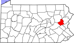
<span class="mw-page-title-main">Penn Forest Township, Pennsylvania</span> Place in Pennsylvania, United States

Penn Forest Township is a township in Carbon County, Pennsylvania. It is part of Northeastern Pennsylvania. The population was 9,581 at the 2010 census, up from 5,439 at the 2000 census.

<span class="mw-page-title-main">Barrett Township, Pennsylvania</span> Place in Pennsylvania, United States

Barrett Township is a township in Monroe County, Pennsylvania, United States. The population was 4,053 at the 2020 census. Two Poconos resort communities, Buck Hill Falls and Skytop, are located within the township. It is located 38 miles from Scranton and 48 miles from Wilkes-Barre. There is one privately owned, public-use airport in Barrett Township, called the Flying Dollar Airport.

<span class="mw-page-title-main">Chestnuthill Township, Pennsylvania</span> Place in Pennsylvania, United States

Chestnuthill Township is a township in Monroe County, Pennsylvania, United States. The population was 16,708 at the 2020 census.

<span class="mw-page-title-main">Polk Township, Monroe County, Pennsylvania</span> Place in Pennsylvania, United States

Polk Township is a township in Monroe County, Pennsylvania, United States. The population was 7,473 at the 2020 census.

<span class="mw-page-title-main">Tunkhannock Township, Monroe County, Pennsylvania</span> Township in Pennsylvania, United States

Tunkhannock Township is a township in Monroe County, Pennsylvania, United States. The population was 7,037 at the 2020 census. Tunkhannock Township comprises the communities of Blakeslee and Long Pond. The most noteworthy feature of this township is the Tunkhannock creek, which forms "Long Pond", and is designated by the PA DEP as an Exceptional Value Waters (EV). The Bethlehem Authority, Nature Conservancy, Wildlands Conservancy County of Monroe Open Space Program, and PA Department of Forest and Waters have protected thousands of acres. Tunkhannock Township, PA is home to many species of globally rare, threatened, and endangered plants and animals and has been described as one of the last "great places".

<span class="mw-page-title-main">Trevose, Pennsylvania</span> Census-designated place in Pennsylvania, United States

Trevose is a census-designated place within both Bensalem and Lower Southampton townships in Bucks County, Pennsylvania, United States.

<span class="mw-page-title-main">Spinnerstown, Pennsylvania</span> Census-designated place in Pennsylvania, United States

Spinnerstown is a census-designated place in Milford Township, Bucks County, Pennsylvania, United States. It is located just northwest of the Quakertown interchange of I-476 with Route 663. As of the 2010 census, the population was 1,826 residents.

Holiday Pocono is a residential community and census-designated place (CDP) in Kidder Township, Pennsylvania, United States. It is part of Northeastern Pennsylvania.

Towamensing Trails is a census-designated place (CDP) in Penn Forest Township, Pennsylvania, United States. It is part of Northeastern Pennsylvania.

References

  1. "ArcGIS REST Services Directory". United States Census Bureau. Retrieved October 12, 2022.
  2. 1 2 "Census Population API". United States Census Bureau. Retrieved Oct 12, 2022.
  3. "By Decade".
  4. "Geographic Identifiers: 2010 Census Summary File 1 (G001): Albrightsville CDP, Pennsylvania". U.S. Census Bureau, American Factfinder. Archived from the original on April 7, 2015. Retrieved April 7, 2015.
  5. "18210 ZIPCode Map Albrightsville Pennsylvania - HipCodes.com". Archived from the original on 2012-03-24. Retrieved 2011-08-06.
  6. "PRISM Climate Group at Oregon State University". prism.oregonstate.edu.
  7. "Archived copy". Archived from the original on 2019-07-04. Retrieved 2019-09-09.{{cite web}}: CS1 maint: archived copy as title (link)
  8. "Census of Population and Housing". Census.gov. Retrieved June 4, 2016.