Mahoning Township, Carbon County, Pennsylvania

Last updated

Mahoning Township
Zion Lutheran Packerton Mahoning TWP, CarbCo.jpg
Zion Lutheran Church in Packerton
Map of Mahoning Township, Carbon County, Pennsylvania Highlighted.png
Location of Mahoning Township in Carbon County
Map of Pennsylvania highlighting Carbon County.svg
Location of Carbon County in Pennsylvania
Coordinates: 40°50′00″N75°44′58″W / 40.83333°N 75.74944°W / 40.83333; -75.74944
Country United States
State Pennsylvania
County Carbon
Area
[1]
  Total23.78 sq mi (61.58 km2)
  Land23.66 sq mi (61.29 km2)
  Water0.11 sq mi (0.30 km2)
Elevation
1,000 ft (300 m)
Population
 (2010)
  Total4,305
  Estimate 
(2016) [2]
4,204
  Density177.66/sq mi (68.60/km2)
Time zone UTC-5 (EST)
  Summer (DST) UTC-4 (EDT)
ZIP Code
18235
Area codes 570 and 610
FIPS code 42-025-46640
Website www.mahoningtownshiponline.com

Mahoning Township is a township in Carbon County, Pennsylvania. It is part of Northeastern Pennsylvania. The population was 4,305 at the 2010 census, [3] up from 3,978 at the 2000 census.

Contents

Geography

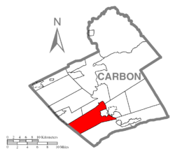
The township is in southwestern Carbon County in the valley of Mahoning Creek, a tributary of the Lehigh River. The township is bordered by the borough of Lehighton to the northeast and by Schuylkill County to the southwest. It is situated near the northeastern end of the Mahoning Hills, [4] the mountainous foothills region to the west of the Lehigh River.

According to the U.S. Census Bureau, the township has a total area of 23.8 square miles (61.6 km2), of which 23.7 square miles (61.3 km2) is land and 0.1 square miles (0.3 km2), or 0.48%, is water. [3] It is drained by Mahoning Creek, a tributary of the Lehigh River, which forms parts of the township's eastern boundary. The natural northern boundary with Jim Thorpe and Summit Hill is on the south slope of Mauch Chunk Mountain. Its villages include Dry Tavern, Jamestown, Mahoning Valley (also in West Penn Township, Schuylkill County), New Mahoning, Normal Square, and Packerton.

The township has varied elevations from 450 to 650 feet (140 to 200 m) in the valleys along PA Routes 443 and 902 and rising to 950 to 1,150 feet (290 to 350 m) on the top of Mahoning Mountain in the south and 850 to 1,050 feet (260 to 320 m) on Oriole Hill. The terrain causes the local weather to vary in the winter time from that of the surrounding region. Mahoning Mountain Road is a mile-long hill-climb to a road junction called "Dry Tavern" along a summit of the Mahoning Hills that has many sharp curves and is known throughout the greater Lehighton area as a notorious road in winter time. At the bottom of the mountain it has an elevation of 445 feet (136 m), and at the top it has an elevation of 970 feet (300 m), so it is quite possible for it to be raining at the bottom while having a few inches of snow at the top.

Climate

Mahoning Township has a humid continental climate (Dfa/Dfb) and the hardiness zone is mainly 6a with 6b found along the river south of Lehighton and in the eastern half of the township near the Mahoning Creek. Average monthly temperatures at Jake Arner Memorial Airport range from 27.8 °F in January to 72.5 °F in July.

Demographics

Historical population
CensusPop.Note
2000 3,978
2010 4,3058.2%
2016 (est.)4,204 [2] −2.3%
U.S. Decennial Census [5]

As of the census [6] of 2000, there were 3,978 people, 1,543 households, and 1,131 families residing in the township. The population density was 168.5 inhabitants per square mile (65.1/km2). There were 1,693 housing units at an average density of 71.7 per square mile (27.7/km2). The racial makeup of the township was 98.27% White, 0.23% African American, 0.40% Native American, 0.45% Asian, 0.08% from other races, and 0.58% from two or more races. Hispanic or Latino of any race were 0.40% of the population.

There were 1,543 households, out of which 27.7% had children under the age of 18 living with them, 59.8% were married couples living together, 8.2% had a female householder with no husband present, and 26.7% were non-families. 22.2% of all households were made up of individuals, and 12.1% had someone living alone who was 65 years of age or older. The average household size was 2.47 and the average family size was 2.87.

In the township the population was spread out, with 19.8% under the age of 18, 6.4% from 18 to 24, 26.3% from 25 to 44, 26.9% from 45 to 64, and 20.5% who were 65 years of age or older. The median age was 43 years. For every 100 females, there were 96.5 males. For every 100 females age 18 and over, there were 94.9 males.

The median income for a household in the township was $35,212, and the median income for a family was $43,897. Males had a median income of $29,016 versus $20,943 for females. The per capita income for the township was $17,330. About 8.6% of families and 10.5% of the population were below the poverty line, including 15.3% of those under age 18 and 3.0% of those age 65 or over.

Government

Supervisors:

Commercial activity

Mahoning Township contains the retail hub of Carbon County. Along a one-mile stretch of Route 443 southwest of Lehighton are located the Carbon Plaza Mall, Walmart, Lowe's, and Aldi. The township also hosts Mahoning Speedway and the private-aviation Jake Arner Memorial Airport.

Transportation

I-476/Pennsylvania Turnpike Northeast Extension northbound in Mahoning Township 2022-08-06 13 52 59 View north along Interstate 476 (Pennsylvania Turnpike Northeast Extension) just south of Exit 74 in Mahoning Township, Carbon County, Pennsylvania.jpg
I-476/Pennsylvania Turnpike Northeast Extension northbound in Mahoning Township

As of 2020, there were 72.59 miles (116.82 km) of public roads in Mahoning Township, of which 0.30 miles (0.48 km) were maintained by the Pennsylvania Turnpike Commission (PTC), 28.60 miles (46.03 km) were maintained by the Pennsylvania Department of Transportation (PennDOT) and 43.69 miles (70.31 km) were maintained by the township. [7]

Interstate 476, the Pennsylvania Turnpike's Northeast Extension, passes through the eastern corner of Mahoning Township, but the nearest interchange is in neighboring Franklin Township. Highways providing local access include Pennsylvania Route 443, which crosses from U.S. Route 209 on Lehighton's south side west to Pennsylvania Route 309 in South Tamaqua, Schuylkill County, and Pennsylvania Route 902, which comes southeast over Mauch Chunk Ridge from US 209 in Lansford and Summit Hill to New Mahoning, then turns east to PA 443 in Lehighton with access to US 209 in downtown via Mahoning Street. US 209 proceeds north through the township between Lehighton and Jim Thorpe, although this segment is signed southbound.

Related Research Articles

<span class="mw-page-title-main">Carbon County, Pennsylvania</span> County in Pennsylvania, United States

Carbon County is a county in the Commonwealth of Pennsylvania. It is located in Northeastern Pennsylvania. As of the 2020 census, the population was 64,749. The county is also part of Pennsylvania's Coal Region and Northeastern Pennsylvania.

<span class="mw-page-title-main">Beaver Meadows, Pennsylvania</span> Borough in Pennsylvania, United States

Beaver Meadows is a borough in Carbon County, Pennsylvania, United States. It is part of Northeastern Pennsylvania. The population was 897 at the 2020 U.S. census.

<span class="mw-page-title-main">East Penn Township, Carbon County, Pennsylvania</span> Place in Pennsylvania, United States

East Penn Township is a rural township in the rough uplands terrain of the eastern Mahoning Hills area of Carbon County, Pennsylvania. It is part of Northeastern Pennsylvania.

<span class="mw-page-title-main">Franklin Township, Carbon County, Pennsylvania</span> Place in Pennsylvania, United States

Franklin Township is a township in Carbon County, Pennsylvania. It is part of Northeastern Pennsylvania. The population was 4,262 at the 2010 census. A portion of Beltzville State Park is in Franklin Township.

<span class="mw-page-title-main">Jim Thorpe, Pennsylvania</span> Borough and county seat of Carbon County, Pennsylvania

Jim Thorpe is a borough and the county seat of Carbon County in the U.S. state of Pennsylvania. It is part of Northeastern Pennsylvania. It is historically known as the burial site of Native American sports legend Jim Thorpe.

<span class="mw-page-title-main">Lansford, Pennsylvania</span> Borough in Pennsylvania, United States

Lansford is a county-border borough (town) in Carbon County, Pennsylvania, United States. It is part of Northeastern Pennsylvania. It is located 37 miles (60 km) northwest of Allentown and 19 miles south of Hazleton in the Panther Creek Valley about 72 miles (116 km) from Philadelphia and abutting the cross-county sister-city of Coaldale in Schuylkill County.

<span class="mw-page-title-main">Lausanne Township, Carbon County, Pennsylvania</span> Place in Pennsylvania, United States

Lausanne Township is a township in Carbon County, Pennsylvania. It is part of Northeastern Pennsylvania. The township dates back to 1808 when the first Lausanne settlement was organized with a local frontier government.

<span class="mw-page-title-main">Lehighton, Pennsylvania</span> Borough in Pennsylvania, United States

Lehighton is a borough in Carbon County, Pennsylvania, United States. It is part of Northeastern Pennsylvania. Lehighton is located 28.9 miles (46.5 km) northwest of Allentown and 77.5 miles (124.7 km) northwest of Philadelphia.

<span class="mw-page-title-main">Lower Towamensing Township, Pennsylvania</span> Place in Pennsylvania, United States

Lower Towamensing Township is a township in Carbon County, Pennsylvania. It is part of Northeastern Pennsylvania. The Lenape Indian tribe name is eponymous and was once applied by the natives to the whole region of Carbon County and bits of the Poconos to the north and to Schuylkill County (southwest). The population was 3,228 at the 2010 census.

<span class="mw-page-title-main">Packer Township, Pennsylvania</span> Place in Pennsylvania, United States

Packer Township is a township in Carbon County, Pennsylvania. It is part of Northeastern Pennsylvania. The population was 998 at the 2010 census.

<span class="mw-page-title-main">Summit Hill, Pennsylvania</span> Borough in Pennsylvania, United States

Summit Hill is a borough in Carbon County, Pennsylvania, United States. It is part of Northeastern Pennsylvania. The population was 3,034 at the 2010 census.

<span class="mw-page-title-main">Heidelberg Township, Lehigh County, Pennsylvania</span> Township in Pennsylvania, United States

Heidelberg Township is a township in Lehigh County, Pennsylvania. The population of Heidelberg Township was 3,416 at the 2010 census. It is a suburb of Allentown in the Lehigh Valley, which had a population of 861,899 and was the 68th-most populous metropolitan area in the U.S. as of the 2020 census.

<span class="mw-page-title-main">North Whitehall Township, Pennsylvania</span> Township in Pennsylvania, United States

North Whitehall Township is a township in Lehigh County, Pennsylvania. The population of North Whitehall Township was 15,655 at the 2020 census. It is a suburb of Allentown in the Lehigh Valley, which had a population of 861,899 and was the 68th-most populous metropolitan area in the U.S. as of the 2020 census.

<span class="mw-page-title-main">Coaldale, Schuylkill County, Pennsylvania</span> Borough in Pennsylvania, United States

Coaldale is a borough in Schuylkill County, Pennsylvania, United States. Initially settled in 1827, it was incorporated in 1906 from part of the former Rahn Township; it is named for the coal industry—wherein, it was one of the principal early mining centers. Coaldale is in the southern Anthracite Coal region in the Panther Creek Valley, a tributary of the Little Schuylkill River, along which U.S. Route 209 was eventually built between the steep climb up Pisgah Mountain from Nesquehoning (easterly) and its outlet in Tamaqua, approximately five miles to the west.

<span class="mw-page-title-main">Kline Township, Schuylkill County, Pennsylvania</span> Township in Pennsylvania, United States

Kline Township is a township in Schuylkill County, Pennsylvania. The population was 1,473 at the 2020 census.

<span class="mw-page-title-main">Rush Township, Schuylkill County, Pennsylvania</span> Township in Pennsylvania, United States

Rush Township is a township in Schuylkill County, Pennsylvania, United States. The population was 3,423 at the 2020 census. The township is served by Tamaqua Area School District and Mahanoy Area School District.

<span class="mw-page-title-main">Tamaqua, Pennsylvania</span> Borough in Pennsylvania, United States

Tamaqua is a borough in eastern Schuylkill County in the Coal Region of Pennsylvania, United States. It had a population of 6,934 as of the 2020 U.S. census.

<span class="mw-page-title-main">West Penn Township, Pennsylvania</span> Township in Pennsylvania, United States

West Penn Township is a township in Schuylkill County, Pennsylvania, United States. The population was 4,383 in the 2020 census.

<span class="mw-page-title-main">Pennsylvania Route 902</span> State highway in Carbon County, Pennsylvania, US

Pennsylvania Route 902 is an 11.66-mile-long (18.76 km) east–west state highway in Carbon County in the U.S. state of Pennsylvania. The route runs from U.S. Route 209 in Lansford southeast to PA 443 in Lehighton. The highway is a two-lane undivided road its entire length. From Lansford, PA 902 heads southeast passes through Summit Hill before crossing two mountains and entering the Mahoning Valley. The route turns east at New Mahoning and continues to Lehighton, where it turns south to end at PA 443 in the western part of the borough. The route was designated between US 209 near Summit Hill and New Mahoning in 1928. PA 902 was extended east to US 209/US 309 in the center of Lehighton in the 1930s and rerouted to end at PA 443 in the 1980s.

Mahoning Creek is a 16.7-mile-long (26.9 km) tributary of the Lehigh River in Schuylkill and Carbon counties, Pennsylvania, in the United States.

References

  1. "2016 U.S. Gazetteer Files". United States Census Bureau. Retrieved August 13, 2017.
  2. 1 2 "Population and Housing Unit Estimates" . Retrieved June 9, 2017.
  3. 1 2 "Geographic Identifiers: 2010 Census Summary File 1 (G001): Mahoning township, Carbon County, Pennsylvania". U.S. Census Bureau, American Factfinder. Archived from the original on April 6, 2015. Retrieved April 6, 2015.
  4. Robert Muldrow, et al., USGS topographic maps, 1922 survey, Lehighton-Mauch Chunk Quadrangle, and other maps in the series or of 1893 showing the region around Lehighton, Pennsylvania and Mauch Chunk (Jim Thorpe).
  5. "Census of Population and Housing". Census.gov. Retrieved June 4, 2016.
  6. "U.S. Census website". United States Census Bureau . Retrieved January 31, 2008.
  7. "Mahoning Township map" (PDF). PennDOT. Retrieved March 17, 2023.