Audenried, Pennsylvania

Last updated

Audenried, Pennsylvania
Unincorporated community
USA Pennsylvania location map.svg
Red pog.svg
Audenried
Usa edcp location map.svg
Red pog.svg
Audenried
Coordinates: 40°54′38″N75°59′30″W / 40.91056°N 75.99167°W / 40.91056; -75.99167
Country United States
State Pennsylvania
County Carbon
Township Banks
Elevation
1,716 ft (523 m)
Time zone UTC-5 (Eastern (EST))
  Summer (DST) UTC-4 (EDT)
ZIP Codes
18201, 18216
Area codes 570 and 272
GNIS feature ID1168502 [1]
Audenried Breaker in 1919 by Wolfgang von Bibra WvBAudenriedPenn1919.jpg
Audenried Breaker in 1919 by Wolfgang von Bibra

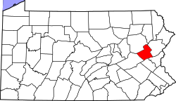
Audenried is a village in the northwest corner of Carbon County, Pennsylvania located on Route 309. It is located in Banks Township between Hazleton and McAdoo. It is served by the Hazleton Area School District. The Catawissa Creek starts in Audenried and flows westward to the Susquehanna River. The remainder of Carbon County is in the Delaware watershed.

Audenried is isolated from the remainder of Carbon County since travel by road between the two requires driving through Luzerne or Schuylkill County. The village is served by Hazleton Public Transit bus route 20, which runs via McAdoo to Kelayres. It is split between the Hazleton ZIP Code of 18201 and the Beaver Meadows ZIP Code of 18216.

Related Research Articles

<span class="mw-page-title-main">Carbon County, Pennsylvania</span> County in Pennsylvania, United States

Carbon County is a county in the Commonwealth of Pennsylvania. As of the 2020 census, the population was 64,749. The county is part of the Northeast Pennsylvania region of the state.

<span class="mw-page-title-main">Banks Township, Carbon County, Pennsylvania</span> Township in Pennsylvania, United States

Banks Township is a township in Carbon County, Pennsylvania. It is part of Northeastern Pennsylvania.

<span class="mw-page-title-main">Tresckow, Pennsylvania</span> Census-designated place in Pennsylvania, United States

Tresckow, formerly known as Dutchtown, is an unincorporated community and census-designated place (CDP) in Carbon County, Pennsylvania, United States. It is part of Northeastern Pennsylvania and is located west of Junedale and Beaver Meadows, which share the same road network. The community has deep roots in the anthracite coal mining and transportation industries.

<span class="mw-page-title-main">Hazle Township, Pennsylvania</span> Township in Pennsylvania, United States

Hazle Township is a township in Luzerne County, Pennsylvania, United States. The population was 10,150 at the time of the 2020 census. The township surrounds the city of Hazleton and the borough of West Hazleton.

<span class="mw-page-title-main">Hazleton, Pennsylvania</span> City in Pennsylvania, United States

Hazleton is a city in Luzerne County, Pennsylvania, United States. The population was 29,963 at the 2020 census. Hazleton is the second-most populous city in Luzerne County. It was incorporated as a borough on January 5, 1857, and as a city on December 4, 1891.

<span class="mw-page-title-main">Kline Township, Schuylkill County, Pennsylvania</span> Township in Pennsylvania, United States

Kline Township is a township in Schuylkill County, Pennsylvania. The population was 1,473 at the 2020 census.

<span class="mw-page-title-main">McAdoo, Pennsylvania</span> Borough in Schuylkill County, Pennsylvania, U.S.

McAdoo is a borough and coal town in Schuylkill County, Pennsylvania, United States, 5 miles (8.0 km) south of Hazleton and seven miles north of Tamaqua. McAdoo contains the picturesque Silver Brook Meadow. In the past, anthracite coal mining and a shirt factory, the McAdoo Manufacturing Company, provided gainful employment to the populace. The population was 2,477 at the 2020 census.

<span class="mw-page-title-main">Catawissa Creek</span> Tributary of the Susquehanna River in Pennsylvania

Catawissa Creek is a 41.8-mile-long (67.3 km) tributary of the Susquehanna River in east-central Pennsylvania in the United States. Its watershed has an area of 153 square miles (400 km2).

Schuylkill Transportation System or STS is a public transportation service located in Pottsville, Pennsylvania. It provides inter-city bus and paratransit service to select communities within Schuylkill County, Pennsylvania.

<span class="mw-page-title-main">Hazleton Area School District</span> School district in Pennsylvania

The Hazleton Area School District is a large, rural public school district in Pennsylvania, stretching across portions of Luzerne, Schuylkill, and Carbon Counties. Its headquarters are in Hazle Township. Students in grade nine through 12 attend Hazleton Area High School.

Sybertsville is a community in Sugarloaf Township, Luzerne County, Pennsylvania, United States. It is one mile northwest of Conyngham and six miles west-northwest of Hazleton.

<span class="mw-page-title-main">Japan, Pennsylvania</span> Village in Pennsylvania, United States

Japan is a small village in eastern Hazle Township, Luzerne County, Pennsylvania, located on Route 940. It is located just west of the borough of Jeddo and these two names were designated by the Hazleton Coal Company, which used the Japanese port of Jeddo. It is drained by the Black Creek, a tributary of the Nescopeck Creek, westward into the Susquehanna River. It is split between the Hazleton zip codes of 18201 and 18202.

<span class="mw-page-title-main">Packerton, Pennsylvania</span> Unincorporated community in Pennsylvania, United States

Packerton is a village located in Mahoning Township, Carbon County, Pennsylvania on the Lehigh River and U.S. Route 209 between Jim Thorpe and Lehighton. It uses the Lehighton ZIP code of 18235.

Line Lexington is an unincorporated community located in the Delaware Valley on Route 309 in Bucks and Montgomery counties in Pennsylvania, United States. It is split between the Bucks County townships of Hilltown and New Britain and the Montgomery County township of Hatfield. The Montgomery County portion of the village is in the North Penn School District and is part of the North Penn Valley region that is centered on the borough of Lansdale. The Bucks County portion is also served by the North Penn School District. While it has its own post office with the ZIP code of 18932, portions use the Colmar ZIP code of 18915, the Chalfont ZIP code of 18914 or the Hatfield ZIP code of 19440. It is served by SEPTA Suburban Bus Route 132 and the nearest SEPTA Regional Rail stations are nearby in Colmar and Chalfont on the Lansdale/Doylestown Line. The Line Lexington telephone exchange uses area code 215.

<span class="mw-page-title-main">Lattimer, Pennsylvania</span> Census-designated place in Pennsylvania, United States

Lattimer is a village and census-designated place (CDP) in Hazle Township, Luzerne County, Pennsylvania, United States. The population was 554 at the 2010 census.

<span class="mw-page-title-main">Kelayres, Pennsylvania</span> Census-designated place in Pennsylvania, United States

Kelayres is a census-designated place in Kline Township, Schuylkill County, Pennsylvania, United States on Broad Mountain, just west of McAdoo. Reservoir Number 8 is just west of Kelayres and drains northward into the Catawissa Creek, a tributary of the Susquehanna River. It is served by the Hazleton Area School District. The local pronunciation of the village is "Key-lar-es" and its ZIP code is 18231. As of the 2010 census the population was 533 residents. Kelayres is in area code 570, served by the 929 McAdoo exchange.

Hazleton Public Transit (HPT) is a provider of public transportation and demand response service for persons with disabilities for the city of Hazleton, Pennsylvania and its surrounding area.

The Audenried Tunnel, also known as the Audenried Mine Tunnel, is a drainage tunnel located in East Union Township, Schuylkill County, Pennsylvania, in the United States. It is approximately three miles long and drains the western portion of a coal basin near Kelayres.

Hunkydory Creek is a tributary of Catawissa Creek in Schuylkill County and Luzerne County, in Pennsylvania, in the United States. It is approximately 1.4 miles (2.3 km) long and flows through Kline Township in Schuylkill County and Hazle Township in Luzerne County. The watershed of the creek has an area of 3.65 square miles (9.5 km2). The creek is considered to be a Coldwater Fishery. It is likely that it is not inhabited by any species of fish. The main rock formations in the creek's watershed are the Mauch Chunk Formation, the Pottsville Formation, and the Llwellyn Formation and the main soils are the Udorthents Kill soil and the Hezleton soil.

Dane Watro is an American politician serving as a member of the Pennsylvania House of Representatives for the 116th district. Elected in November 2022, he assumed office on January 3, 2023.

References

  1. "Audenried". Geographic Names Information System . United States Geological Survey, United States Department of the Interior.