Bowmanstown, Pennsylvania

Last updated
Bowmanstown, Pennsylvania
Borough
Bowmanstown, Pennsylvania (6294717766).jpg
Bowmanstown Seal.png
Carbon County Pennsylvania Incorporated and Unincorporated areas Bowmanstown Highlighted.svg
Location of Bowmanstown in Carbon County, Pennsylvania
USA Pennsylvania location map.svg
Red pog.svg
Bowmanstown
Location of Bowmanstown in Pennsylvania
Usa edcp location map.svg
Red pog.svg
Bowmanstown
Bowmanstown (the United States)
Coordinates: 40°48′03″N75°39′44″W / 40.80083°N 75.66222°W / 40.80083; -75.66222
CountryUnited States
StatePennsylvania
County Carbon
Area
[1]
  Total0.80 sq mi (2.07 km2)
  Land0.77 sq mi (1.99 km2)
  Water0.03 sq mi (0.07 km2)
Elevation
732 ft (223 m)
Population
 (2020) [2]
  Total889
  Density1,156.05/sq mi (446.19/km2)
Time zone UTC-5 (EST)
  Summer (DST) UTC-4 (EDT)
ZIP code
18030
Area code(s) 610 and 484
FIPS code 42-07880

Bowmanstown is a borough in Carbon County, Pennsylvania. It is part of Northeastern Pennsylvania. The population was 937 at the 2010 census. [3]

Contents

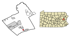
The borough is at an elevation of 437 feet (133 m). It is located 3 miles (5 km) west of Palmerton and 4 miles (6 km) south of Lehighton off Pennsylvania Route 248.

Geography

Bowmanstown is located in southern Carbon County at 40°48′3″N75°39′44″W / 40.80083°N 75.66222°W / 40.80083; -75.66222 (40.800737, -75.662167), [4] on the northeast bank of the Lehigh River. It is bordered on the east and north by Lower Towamensing Township, on the southeast by the borough of Palmerton, and on the southwest and west by East Penn Township.

According to the U.S. Census Bureau, the borough has a total area of 0.80 square miles (2.07 km2), 0.77 square miles (1.99 km2) of which is land and 0.03 square miles (0.07 km2), or 3.59%, of which is water. [3]

Transportation

PA 248 westbound in Bowmanstown 2022-08-08 16 35 35 View west along Pennsylvania State Route 248 (POW-MIA Remembrance Highway) from the overpass for Bank Street in Bowmanstown, Carbon County, Pennsylvania.jpg
PA 248 westbound in Bowmanstown

As of 2013, there were 8.40 miles (13.52 km) of public roads in Bowmanstown, of which 3.11 miles (5.01 km) were maintained by the Pennsylvania Department of Transportation (PennDOT) and 5.29 miles (8.51 km) were maintained by the borough. [5]

Pennsylvania Route 248 is the main highway serving Bowmanstown. It follows a northwest-southeast alignment across the southern and western portions of the borough, parallel to the Lehigh River. Pennsylvania Route 895 begins at PA 248 in Bowmanstown and heads southwestward across the Lehigh River.

Demographics

Historical population
CensusPop.Note
1920 834
1930 8431.1%
1940 8834.7%
1950 878−0.6%
1960 8881.1%
1970 864−2.7%
1980 1,07824.8%
1990 888−17.6%
2000 8950.8%
2010 9374.7%
2020 889−5.1%
Sources: [6] [7] [8] [2]

As of the census [7] of 2000, there were 895 people, 389 households, and 257 families residing in the borough. The population density was 1,156.2 inhabitants per square mile (446.4/km2). There were 417 housing units at an average density of 538.7 per square mile (208.0/km2). The racial makeup of the borough was 99.44% White, 0.22% Asian, and 0.34% from two or more races. Hispanic or Latino of any race were 0.89% of the population.

There were 389 households, out of which 27.0% had children under the age of 18 living with them, 54.0% were married couples living together, 8.0% had a female householder with no husband present, and 33.9% were non-families. 28.5% of all households were made up of individuals, and 11.8% had someone living alone who was 65 years of age or older. The average household size was 2.30 and the average family size was 2.77.

In the borough the population was spread out, with 20.0% under the age of 18, 7.4% from 18 to 24, 29.6% from 25 to 44, 26.0% from 45 to 64, and 17.0% who were 65 years of age or older. The median age was 41 years. For every 100 females there were 92.5 males. For every 100 females age 18 and over, there were 90.4 males.

The median income for a household in the borough was $34,688, and the median income for a family was $39,018. Males had a median income of $31,845 versus $20,913 for females. The per capita income for the borough was $16,956. About 7.4% of families and 9.2% of the population were below the poverty line, including 10.5% of those under age 18 and 12.3% of those age 65 or over.

Related Research Articles

<span class="mw-page-title-main">Lyons, Pennsylvania</span> Borough in Pennsylvania, United States

Lyons is a borough that is located in Berks County, Pennsylvania, United States. The population was 478 at the time of the 2010 census.

<span class="mw-page-title-main">Mount Penn, Pennsylvania</span> Borough in Pennsylvania, United States

Mount Penn is a borough in Berks County, Pennsylvania, United States. The population was 3,106 at the 2010 census. The borough shares a name with a 1,120-foot-high (340 m) mountain that rises to the north and overlooks the city of Reading. The peak is sometimes recognized as the southern end of the Reading Prong group of mountains.

<span class="mw-page-title-main">Topton, Pennsylvania</span> Borough in Pennsylvania, United States

Topton is a borough in Berks County, Pennsylvania, United States. The population was 2,069 at the 2010 census.

<span class="mw-page-title-main">East Penn Township, Pennsylvania</span> Place in Pennsylvania, United States

East Penn Township is a rural township in the rough uplands terrain of the eastern Mahoning Hills area of Carbon County, Pennsylvania. It is part of Northeastern Pennsylvania.

<span class="mw-page-title-main">East Side, Pennsylvania</span> Borough in Pennsylvania, United States

East Side is a borough in Carbon County, Pennsylvania. It is part of Northeastern Pennsylvania. The population was 317 at the 2010 census.

<span class="mw-page-title-main">Palmerton, Pennsylvania</span> Borough in Pennsylvania, United States

Palmerton is a borough in Carbon County, Pennsylvania, United States. It is part of Northeastern Pennsylvania. The borough's population was 5,414 at the 2010 census.

<span class="mw-page-title-main">Parryville, Pennsylvania</span> Borough in Pennsylvania, United States

Parryville is a borough in Carbon County, Pennsylvania, United States. It is part of Northeastern Pennsylvania, and is located 3 miles (5 km) southeast of Lehighton and 1 mile (1.6 km) north of Bowmanstown, off Route 248 and 4 miles (6 km) northwest of Palmerton.

<span class="mw-page-title-main">Weissport, Pennsylvania</span> Borough in Pennsylvania, United States

Weissport is a borough in Carbon County, Pennsylvania. It is part of Northeastern Pennsylvania. As of the 2010 census, it had a population of 412.

<span class="mw-page-title-main">Coopersburg, Pennsylvania</span> Borough in Pennsylvania, United States

Coopersburg is a borough in Lehigh County, Pennsylvania, United States. The population of Coopersburg was 2,447 as of the 2020 census. It is a suburb of Allentown and is located 7 miles (11 km) miles southeast of Allentown, 40 miles (64 km) north of Philadelphia, and 76 miles (122 km) west of New York City.

<span class="mw-page-title-main">Coplay, Pennsylvania</span> Borough in Pennsylvania, United States

Coplay is a borough in Lehigh County, Pennsylvania. Coplay's population was 3,348 at the 2020 census. It is located six miles (10 km) northwest of Allentown. The borough is part of the Lehigh Valley metropolitan area, which had a population of 861,899 and was the 68th-most populous metropolitan area in the U.S. as of the 2020 census.

<span class="mw-page-title-main">Salisbury Township, Lehigh County, Pennsylvania</span> Township in Pennsylvania, United States

Salisbury Township is a township in Lehigh County, Pennsylvania. The township's population was 13,505 at the 2010 census. The township borders Allentown, Pennsylvania's third-largest city, Bethlehem, and Emmaus, in the Lehigh Valley, which had a population of 861,899 and was the 68th-most populous metropolitan area in the U.S. as of the 2020 census.

<span class="mw-page-title-main">Slatington, Pennsylvania</span> Borough in Pennsylvania, United States

Slatington is a borough in Lehigh County, Pennsylvania. As of the 2010 census, it had a population of 4,232. Slatington is located northwest of Allentown and Bethlehem. Slatington is part of the Lehigh Valley metropolitan area, which had a population of 861,899 and was the 68th-most populous metropolitan area in the U.S. as of the 2020 census.

<span class="mw-page-title-main">Washington Township, Lehigh County, Pennsylvania</span> Township in Pennsylvania, United States

Washington Township is a township in Lehigh County, Pennsylvania. The population of Washington Township was 6,624 at the 2010 census. It is a suburb of Allentown in the Lehigh Valley, which had a population of 861,899 and was the 68th-most populous metropolitan area in the U.S. as of the 2020 census.

<span class="mw-page-title-main">Chapman, Pennsylvania</span> Borough in Pennsylvania, United States

Chapman is a borough in Northampton County, Pennsylvania. The population of Chapman was 223 as of the 2020 census. Chapman is part of the Lehigh Valley metropolitan area, which had a population of 861,899 and was the 68th-most populous metropolitan area in the U.S. as of the 2020 census.

<span class="mw-page-title-main">East Bangor, Pennsylvania</span> Place in Pennsylvania, United States

East Bangor is a borough in Northampton County, Pennsylvania, US, with population 1,124 at the 2020 census. It is in the Lehigh Valley metropolitan region, which had a population of 861,899 and was the 68th-most populous metropolitan area in the U.S. as of the 2020 census.

<span class="mw-page-title-main">Glendon, Pennsylvania</span> Place in Pennsylvania, United States

Glendon is a borough in Northampton County, Pennsylvania. The population of Glendon was 373 at the 2020 census. Glendon is part of the Lehigh Valley metropolitan area, which had a population of 861,899 and was thus the 68th-most populous metropolitan area in the U.S. as of the 2020 census.

<span class="mw-page-title-main">Tatamy, Pennsylvania</span> Place in Pennsylvania, United States

Tatamy is a borough in Northampton County, Pennsylvania. The borough's population was 1,203 as of the 2020 census. Tatamy is part of the Lehigh Valley metropolitan area, which had a population of 861,899 and was the 68th most populous metropolitan area in the U.S. as of the 2020 census.

<span class="mw-page-title-main">Walnutport, Pennsylvania</span> Place in Pennsylvania, United States

Walnutport is a borough in Northampton County, Pennsylvania. It was first incorporated in 1909. The population of Walnutport was 2,067 at the 2020 census.

<span class="mw-page-title-main">Wind Gap, Pennsylvania</span> Borough in Pennsylvania, United States

Wind Gap is a borough in Northampton County, Pennsylvania. The population of Wind Gap was 2,820 at the 2020 census. Wind Gap is part of the Lehigh Valley metropolitan area, which had a population of 861,899 and was the 68th-most populous metropolitan area in the U.S. as of the 2020 census.

<span class="mw-page-title-main">West Penn Township, Pennsylvania</span> Township in Pennsylvania, United States

West Penn Township is a township in Schuylkill County, Pennsylvania, United States. The population was 4,383 in the 2020 census.

References

  1. "ArcGIS REST Services Directory". United States Census Bureau. Retrieved October 12, 2022.
  2. 1 2 "Census Population API". United States Census Bureau. Retrieved Oct 12, 2022.
  3. 1 2 "Geographic Identifiers: 2010 Demographic Profile Data (G001): Bowmanstown borough, Pennsylvania". U.S. Census Bureau, American Factfinder. Archived from the original on February 13, 2020. Retrieved April 1, 2015.
  4. "US Gazetteer files: 2010, 2000, and 1990". United States Census Bureau. 2011-02-12. Retrieved 2011-04-23.
  5. "Bowmanstown Borough map" (PDF). PennDOT. Retrieved March 17, 2023.
  6. "Census of Population and Housing". U.S. Census Bureau. Retrieved 11 December 2013.
  7. 1 2 "U.S. Census website". United States Census Bureau . Retrieved 2008-01-31.
  8. "Incorporated Places and Minor Civil Divisions Datasets: Subcounty Resident Population Estimates: April 1, 2010 to July 1, 2012". Population Estimates. U.S. Census Bureau. Archived from the original on 11 June 2013. Retrieved 11 December 2013.