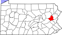
Packerton, Pennsylvania

Last updated

Packerton, Pennsylvania
Unincorporated community
Zion Lutheran Packerton Mahoning TWP, CarbCo.jpg
Zion Lutheran Church
USA Pennsylvania location map.svg
Red pog.svg
Packerton
Usa edcp location map.svg
Red pog.svg
Packerton
Coordinates: 40°51′18″N75°43′09″W / 40.85500°N 75.71917°W / 40.85500; -75.71917
Country United States
State Pennsylvania
County Carbon
Township Mahoning
Elevation
738 ft (225 m)
Time zone UTC-5 (Eastern (EST))
  Summer (DST) UTC-4 (EDT)
ZIP code
18235
Area code(s) 610 and 484
GNIS feature ID1183177 [1]

Packerton is a village located in Mahoning Township, Carbon County, Pennsylvania on the Lehigh River and U.S. Route 209 between Jim Thorpe and Lehighton. It uses the Lehighton ZIP code of 18235.

Related Research Articles

<span class="mw-page-title-main">Carbon County, Pennsylvania</span> County in Pennsylvania, United States

Carbon County is a county in the Commonwealth of Pennsylvania. As of the 2020 census, the population was 64,749. The county is part of the Northeast Pennsylvania region of the state.

<span class="mw-page-title-main">Lehighton, Pennsylvania</span> Borough in Pennsylvania, United States

Lehighton is a borough in Carbon County, Pennsylvania, United States. It is part of Northeastern Pennsylvania. Lehighton is located 117.2 miles (188.6 km) west of New York City and 77.5 miles (124.7 km) northwest of Philadelphia.

<span class="mw-page-title-main">Mahoning Township, Carbon County, Pennsylvania</span> Place in Pennsylvania, United States

Mahoning Township is a township in Carbon County, Pennsylvania. It is part of Northeastern Pennsylvania. The population was 4,305 at the 2010 census, up from 3,978 at the 2000 census.

<span class="mw-page-title-main">Weissport, Pennsylvania</span> Borough in Pennsylvania, United States

Weissport is a borough in Carbon County, Pennsylvania. It is part of Northeastern Pennsylvania. As of the 2010 census, it had a population of 412.

<span class="mw-page-title-main">West Penn Township, Pennsylvania</span> Township in Pennsylvania, United States

West Penn Township is a township in Schuylkill County, Pennsylvania, United States. The population was 4,383 in the 2020 census.

<span class="mw-page-title-main">Lehigh River</span> River in Pennsylvania, United States

The Lehigh River is a 109-mile-long (175 km) tributary of the Delaware River in eastern Pennsylvania. The river flows in a generally southward pattern from the Pocono Mountains in Northeastern Pennsylvania through Allentown and much of the Lehigh Valley before joining the Delaware River in Easton.

<span class="mw-page-title-main">Reading Blue Mountain and Northern Railroad</span> Class II railroad in eastern Pennsylvania

The Reading Blue Mountain and Northern Railroad, sometimes shortened to Reading and Northern Railroad, is a regional railroad in eastern Pennsylvania. With a headquarters in Port Clinton, the RBMN provides freight service on over 400 miles (640 km) of track. Its mainline consists of the Reading Division between Reading and Packerton and the Lehigh Division between Lehighton and Dupont. This mainline gives the RBMN a direct route from Reading to Scranton, the first such route to exist under the control of a single railroad. Founded in 1983 to take over from Conrail on the ex-Pennsylvania Railroad Schuylkill Branch between Reading and Hamburg, the railroad quickly grew over the next several decades to become the largest privately-owned Class II railroad in the United States. Its main freight cargo is anthracite coal, but also sees significant shipments in frac sand, forest products, petrochemicals and minerals, food and agricultural products, metals, and consumer products.

<span class="mw-page-title-main">Persian (roll)</span> Fried sweet roll or doughnut with a spiral shape

A Persian, Persian roll or Pershing is a fried sweet roll or doughnut with a spiral shape similar to a cinnamon bun. It may be covered with a sugar glaze, iced or frosted, or sprinkled with sugar or cinnamon sugar.

The Lehigh Division is a major freight low grade rail line owned and operated by the Reading Blue Mountain and Northern Railroad in the U.S. state of Pennsylvania that runs from Lehighton, Pennsylvania to Dupont, Pennsylvania; it originally ran from Lehighton to Mehoopany, Pennsylvania. The Lehigh Division was formed in 1993 by Conrail from the Lehigh Line, officially the former main line of the Lehigh Valley Railroad (LVRR) that has absorbed former Central Railroad of New Jersey (CNJ) main line trackage and former Lehigh and Susquehanna Railroad (L&S) main line trackage into its system under Conrail; the Lehigh Line today is owned by the Norfolk Southern Railway and connects to the Lehigh Division at Lehighton.

<span class="mw-page-title-main">Clay Township, Kosciusko County, Indiana</span> Township in Indiana, United States

Clay Township is one of 17 townships in Kosciusko County, Indiana. As of the 2020 census, its population was 1,657 and it contained 753 housing units.

Jacob Weiss was a Revolutionary War officer and an early coal businessman. During the Revolution, Weiss served as the Quartermaster-General under General Nathanael Greene. After the war, he and several business partners ran coal mining operations in the Lehigh Valley.

Denny Seiwell is an American drummer and a founding member of the rock band Wings. He also drummed for Billy Joel and Liza Minnelli and played in the scores for the films Waterworld, Grease II, and Vertical Limit. His drumming was used in TV shows such as Happy Days and Knots Landing.

Doug Yasinsky is an American retired professional wrestler and promoter, better known by his ring name "Dashing" Doug Flex, who competed in the Mid-Atlantic and East Coast independent circuit during the late 1980s and 1990s. He frequently teamed with Brick Bronsky throughout his career and, along with manager G.Q. Bronsky, were together known as The Brat Pack.

The Mountain Valley Conference(MVC) was an athletic conference consisting of six large high schools and four school districts from Monroe County and the Lehighton Area School District from Carbon County, Pennsylvania in the United States. It was part of District XI of the Pennsylvania Interscholastic Athletic Association (PIAA). In 2014, its teams were mostly assimilated into the 18-team league of large eastern and northeastern Pennsylvania high schools known as the Eastern Pennsylvania Conference.

Forest Inn is a village located in Carbon County, Pennsylvania, south of Beltzville Lake. Country Junction retail store is located in the village.

<span class="mw-page-title-main">Lehigh Line (Norfolk Southern)</span> Railroad line in central New Jersey and northeastern Pennsylvania

The Lehigh Line is a railroad line in Central New Jersey, Northeastern Pennsylvania, and the Lehigh Valley region of eastern Pennsylvania. It is owned and operated by the Norfolk Southern Railway. The line runs west from the vicinity of the Port of New York and New Jersey in Manville, New Jersey via Conrail's Lehigh Line to the southern end of Wyoming Valley's Coal Region in Lehigh Township, Pennsylvania.

<span class="mw-page-title-main">Packerton Moraine</span> Moraine in Indiana

The Packerton Moraine in north-central Indiana has been considered by most persons who have studied it to be a large interlobate moraine between the Saginaw and the Erie lobes. The northeast-southwest direction of the eskers north of Disko, Wabash County, and the southeast-northwest trend south of there indicated that the part of the Packerton moraine south of Disko was built by the Erie lobe and the part north of Disko by the Saginaw lobe. An esker, Miami County shows a northeast-southwest alignment, providing evidence that Packerton moraine in Miami County was built by the Erie lobe. A small area in the northwestern was deposited by the Saginaw lobe. It is named the Packerton moraine from the village of Packerton in Kosciusko County. Thirteen kames and eskers complexes are mixed with sand and gravel. The till is, sandier, especially in the part deposited by the Saginaw lobe, than in the lobe passed over some source of sand, whereas the Erie lobe did not. Water-laid or wind-blown sands are found throughout the moraine. The bulk of the sand seems to have been water-deposited, but locally the sand appears to have been reworked by the wind. Few of the sand deposits exhibit dunal forms.

Packerton is an unincorporated community in Clay Township, Kosciusko County, in the U.S. state of Indiana.

Pleasant Corners is an unincorporated community located in Mahoning Township in Carbon County, Pennsylvania. Pleasant Corners is located on Pennsylvania Route 902 between Normal Square and Lehighton.

<span class="mw-page-title-main">Bear Mountain (Carbon County, Pennsylvania)</span> Mountain in Pennsylvania, United States of America

Bear Mountain, in the Lehigh Valley of Pennsylvania several miles above the Lehigh Gap, is a steep-sided east bank ridgeline running about 9.96 miles (16.03 km) between the hairpin turn in the Lehigh the Lenape Amerindian people visualized as a bear's snout, along many water gap gorges, to the steep face dropping down to the Penn Forest Reservoir.

References

  1. "Packerton". Geographic Names Information System . United States Geological Survey, United States Department of the Interior.