Tresckow, Pennsylvania

Last updated
Tresckow, Pennsylvania
USPO Tresckow PA 18254.jpg
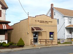
Tresckow's post office
USA Pennsylvania location map.svg
Red pog.svg
Tresckow, Pennsylvania
Location of Tresckow in Pennsylvania
Usa edcp location map.svg
Red pog.svg
Tresckow, Pennsylvania
Tresckow, Pennsylvania (the United States)
Coordinates: 40°54′56″N75°57′50″W / 40.91556°N 75.96389°W / 40.91556; -75.96389 Coordinates: 40°54′56″N75°57′50″W / 40.91556°N 75.96389°W / 40.91556; -75.96389
CountryUnited States
State Pennsylvania
County Carbon
Township Banks
Area
  Total1.8 sq mi (5 km2)
  Land1.8 sq mi (5 km2)
  Water0.0 sq mi (0 km2)
Elevation
1,778 ft (542 m)
Population
 (2010)
  Total880
  Density490/sq mi (190/km2)
Time zone UTC-5 (EST)
  Summer (DST) UTC-4 (EDT)
ZIP Code
18254
Area code 570

Tresckow, formerly known as Dutchtown, is an unincorporated community and census-designated place (CDP) in Carbon County, Pennsylvania. It is part of Northeastern Pennsylvania and is located west of Junedale and Beaver Meadows, which share the same road network. The community has deep roots in the anthracite coal mining and transportation industries.

Contents

Geography

Tresckow is located in the western corner of Carbon County at 40°54′56″N75°57′50″W / 40.91556°N 75.96389°W / 40.91556; -75.96389 (40.915631, -75.963881), [1] at an elevation of 1,778 feet (542 m) on a hill lying between Spring Mountain to the south and Pismire Ridge to the north. The city of Hazleton is 3 miles (5 km) to the north in Luzerne County, and the borough of Beaver Meadows is 2 miles (3 km) to the east.

According to the U.S. Census Bureau, the CDP has a total area of 1.8 square miles (4.6 km2), all of it land. While Tresckow has its own box post office with the ZIP code of 18254, surrounding areas use the Beaver Meadows ZIP code of 18216.

Education

Residents of Tresckow live in Carbon County; however, they attend school in Luzerne County and are served by the Hazleton Area School District. Many go to the Hazleton Area High School, located 7 miles (11 km) away, or Marian Catholic High School, located 8 miles (13 km) away.

Demographics

As of the census [2] of 2000, there were 964 people, 384 households, and 276 families residing in the CDP. The population density was 530.3 people per square mile (204.5/km2). There were 415 housing units at an average density of 228.3/sq mi (88.0/km2). The racial makeup of the CDP was 99.48% White and 0.52% African American. Hispanic or Latino of any race were 0.83% of the population.

There were 384 households, out of which 25.0% had children under the age of 18 living with them, 56.0% were married couples living together, 10.9% had a female householder with no husband present, and 27.9% were non-families. 26.0% of all households were made up of individuals, and 13.8% had someone living alone who was 65 years of age or older. The average household size was 2.44 and the average family size was 2.92.

In the CDP, the population was spread out, with 20.7% under the age of 18, 5.5% from 18 to 24, 26.2% from 25 to 44, 24.1% from 45 to 64, and 23.4% who were 65 years of age or older. The median age was 43 years. For every 100 females, there were 94.4 males. For every 100 females age 18 and over, there were 90.0 males.

The median income for a household in the CDP was $35,625, and the median income for a family was $41,103. Males had a median income of $32,639 versus $26,364 for females. The per capita income for the CDP was $16,693. About 4.8% of families and 6.4% of the population were below the poverty line, including 6.1% of those under age 18 and 9.7% of those age 65 or over.

Related Research Articles

<span class="mw-page-title-main">Carbon County, Pennsylvania</span> County in Pennsylvania, United States

Carbon County is a county in the Commonwealth of Pennsylvania. It is located in Northeastern Pennsylvania. As of the 2020 census, the population was 64,749. The county is also part of Pennsylvania's Coal Region and Northeastern Pennsylvania.

<span class="mw-page-title-main">Allenwood, New Jersey</span> Census-designated place in New Jersey, United States

Allenwood is an unincorporated community and census-designated place (CDP) located within Wall Township, in Monmouth County, New Jersey, United States. As of the 2010 United States Census, the CDP's population was 925.

<span class="mw-page-title-main">Neuse Forest, North Carolina</span> Census-designated place in North Carolina, United States

Neuse Forest is a census-designated place (CDP) in Craven County, North Carolina, United States. The population was 2,005 at the 2010 census. It is part of the New Bern, North Carolina Micropolitan Statistical Area.

<span class="mw-page-title-main">Banks Township, Carbon County, Pennsylvania</span> Township in Pennsylvania, United States

Banks Township is a township in Carbon County, Pennsylvania. It is part of Northeastern Pennsylvania.

<span class="mw-page-title-main">Beaver Meadows, Pennsylvania</span> Borough in Pennsylvania, United States

Beaver Meadows is a borough in Carbon County, Pennsylvania. It is part of Northeastern Pennsylvania. The population was 869 at the 2010 United States Census.

<span class="mw-page-title-main">East Side, Pennsylvania</span> Borough in Pennsylvania, United States

East Side is a borough in Carbon County, Pennsylvania. It is part of Northeastern Pennsylvania. The population was 317 at the 2010 census.

Weissport East is a census-designated place (CDP) in Franklin Township in Carbon County, Pennsylvania. It is part of Northeastern Pennsylvania. The population was 1,624 at the 2010 census, down from 1,936 at the 2000 census.

<span class="mw-page-title-main">Hiller, Pennsylvania</span> Census-designated place in Pennsylvania, United States

Hiller is an unincorporated community and census-designated place in Fayette County, Pennsylvania, United States. As of the 2010 census, it had a population of 1,155, down from 1,234 at the 2000 census. It is located in Luzerne Township.

<span class="mw-page-title-main">Schnecksville, Pennsylvania</span> Census-designated place in Pennsylvania, United States

Schnecksville is an unincorporated community and census-designated place (CDP) in North Whitehall Township in Lehigh County, Pennsylvania. The population of Schnecksville was 2,935 at the 2010 census.

<span class="mw-page-title-main">Butler Township, Luzerne County, Pennsylvania</span> Township in Pennsylvania, United States

Butler Township is a township in Luzerne County, Pennsylvania, United States. The population was 9,469 at the 2020 census.

<span class="mw-page-title-main">Hazle Township, Luzerne County, Pennsylvania</span> Township in Pennsylvania, United States

Hazle Township is a township in Luzerne County, Pennsylvania. The population was 10,150 at the time of the 2020 census. The township surrounds the city of Hazleton and the borough of West Hazleton.

<span class="mw-page-title-main">Hazleton, Pennsylvania</span> City in Pennsylvania, United States

Hazleton is a city in Luzerne County, Pennsylvania, United States. The population was 29,963 at the 2020 census. Hazleton is the second largest city in Luzerne County. It was incorporated as a borough on January 5, 1857, and as a city on December 4, 1891.

<span class="mw-page-title-main">Jeddo, Pennsylvania</span> Borough in Pennsylvania, United States

Jeddo is a borough in Luzerne County, Pennsylvania, United States. As of the 2020 census, the population was 109, making it the least populous borough in the county.

<span class="mw-page-title-main">Mountain Top, Pennsylvania</span> Census-designated place in Pennsylvania, United States

Mountain Top is an unincorporated area and census-designated place (CDP) in Luzerne County, Pennsylvania, United States. As of the 2010 census, the CDP population was 10,982.

<span class="mw-page-title-main">West Hazleton, Pennsylvania</span> Borough in Pennsylvania, United States

West Hazleton is a borough in Luzerne County, Pennsylvania. The borough is 31 miles (50 km) south of Wilkes Barre and had a population of 5,167 as of the 2020 census.

<span class="mw-page-title-main">Stowe, Pennsylvania</span> Census-designated place in Pennsylvania, United States

Stowe is a census-designated place (CDP) in Montgomery County, Pennsylvania, United States. The population was 3,695 at the 2010 census. It uses the Pottstown ZIP code of 19464.

<span class="mw-page-title-main">Hometown, Pennsylvania</span> CDP in Pennsylvania, United States

Hometown is a village in Rush Township, Schuylkill County, Pennsylvania, United States that sits astride a crossing point between important transportation corridors. The population was 1,399 at the 2000 census, and excepting for the area near the east–west PA 54 running mostly parallel to the tracks of the Reading, Blue Mountain, and Northern Railroad — once the important east-west shortline Nesquehoning & Mahanoy Railroad — and the PA 54 junction with PA 309.

<span class="mw-page-title-main">Kline Township, Schuylkill County, Pennsylvania</span> Township in Pennsylvania, United States

Kline Township is a township in Schuylkill County, Pennsylvania. The population was 1,473 at the 2020 census.

<span class="mw-page-title-main">Nuremberg, Pennsylvania</span> Census-designated place in Pennsylvania, United States

Nuremberg is a census-designated place (CDP) in Schuylkill and Luzerne counties, Pennsylvania, United States. The population was 434 at the 2010 census.

<span class="mw-page-title-main">Sun City Center, Florida</span> Census-designated place in Florida, United States

Sun City Center is an unincorporated census-designated place (CDP) in southern Hillsborough County, Florida, United States. It is located south of Tampa and north of Sarasota on I-75. As of the 2020 census, the population was 30,952. The ZIP Code serving the community is 33573.

References

  1. "US Gazetteer files: 2010, 2000, and 1990". United States Census Bureau. 2011-02-12. Retrieved 2011-04-23.
  2. "U.S. Census website". United States Census Bureau . Retrieved 2008-01-31.