East Penn Township, Carbon County, Pennsylvania

Last updated

East Penn Township
Riparian Lehigh River.jpg
The Lehigh River in East Penn Township in March 2010
East Penn Seal.png
Map of East Penn Township, Carbon County, Pennsylvania Highlighted.png
Location of East Penn Township in Carbon County, Pennsylvania
Map of Pennsylvania highlighting Carbon County.svg
Location of Carbon County in Pennsylvania
Coordinates: 40°44′30″N75°45′05″W / 40.74167°N 75.75139°W / 40.74167; -75.75139
Country United States
State Pennsylvania
County Carbon
Area
[1]
  Total22.84 sq mi (59.16 km2)
  Land22.71 sq mi (58.81 km2)
  Water0.14 sq mi (0.35 km2)
Elevation
535 ft (163 m)
Population
 (2010)
  Total2,881
  Estimate 
(2016) [2]
2,782
  Density122.52/sq mi (47.31/km2)
Time zone UTC-5 (EST)
  Summer (DST) UTC-4 (EDT)
ZIP Codes
18212, 18235, 18211
Area codes 570 and 610
FIPS code 42-025-21664
Website www.eastpenntownship.com

East Penn Township is a rural township in the rough uplands terrain of the eastern Mahoning Hills area of Carbon County, Pennsylvania. It is part of Northeastern Pennsylvania.

Contents

The township has a complementary or sister township, West Penn Township, directly to the west in Schuylkill County. The township sits between two ridgelines of the Ridge-and-Valley Appalachians, but with multiple hilltops, its terrain is unlike many nearby valley floors between similar ridgelines. The population was 2,881 at the 2010 United States Census, [3] up from 2,461 at the 2000 census.

Geography

The township is located in the southern corner of Carbon County and is bordered by Lehigh County to the south and Schuylkill County to the west. Older USGS topographic maps show the township in a region known as the Mahoning Hills, a geologically chaotic series of hilltops surmounting a long upland more cyclic in altitude than nearby valley bottoms. The township is drained by the Lehigh River, which flows along its northeastern boundary, with the largest tributary in the township being Lizard Creek. The southern boundary of the township follows the crest of Blue Mountain, a prominent ridge that runs across the eastern half of the state and reaches an elevation of 1,680 feet (510 m) in this area. The northern boundary runs near the broader and lower crest of Mahoning Mountain, elevation 1,150 feet (350 m). The valley floor of the township varies in elevation from 480 to 650 feet (150 to 200 m). Villages in the township include Ashfield, Germans, and West Bowmans.

According to the U.S. Census Bureau, the township has a total area of 22.9 square miles (59.2 km2), of which 22.7 square miles (58.8 km2) is land and 0.1 square miles (0.3 km2), or 0.59%, is water. [3]

Neighboring municipalities

Climate

East Penn has a humid continental climate (Dfa/Dfb) and the hardiness zone is mainly 6a with 6b along the river and in the Lizard Valley along 895. Average monthly temperatures in Ashfield range from 27.6 °F in January to 72.4 °F in July.

Demographics

Historical population
CensusPop.Note
2010 2,881
2016 (est.)2,782 [2] −3.4%
U.S. Decennial Census [4]

As of the 2000 census, [5] there were 2,461 people, 947 households, and 733 families residing in the township. The population density was 109.8 inhabitants per square mile (42.4/km2). There were 996 housing units at an average density of 44.4 per square mile (17.1/km2). The racial makeup of the township was 98.82% White, 0.20% African American, 0.12% Native American, 0.20% Asian, 0.45% from other races, and 0.20% from two or more races. Hispanic or Latino of any race were 0.69% of the population.

There were 947 households, out of which 32.7% had children under the age of 18 living with them, 67.1% were married couples living together, 6.3% had a female householder with no husband present, and 22.5% were non-families. 18.3% of all households were made up of individuals, and 7.8% had someone living alone who was 65 years of age or older. The average household size was 2.59 and the average family size was 2.93.

In the township, the population was spread out, with 21.7% under the age of 18, 6.7% from 18 to 24, 30.2% from 25 to 44, 26.4% from 45 to 64, and 15.1% who were 65 years of age or older. The median age was 41 years. For every 100 females, there were 97.7 males. For every 100 females age 18 and over, there were 99.2 males.

The median income for a household in the township was $42,147, and the median income for a family was $47,446. Males had a median income of $32,297 versus $20,459 for females. The per capita income for the township was $17,545. About 1.0% of families and 3.4% of the population were below the poverty line, including 1.4% of those under age 18 and 5.0% of those age 65 or over.

Transportation

I-476/Pennsylvania Turnpike Northeast Extension southbound in East Penn Township 2022-08-13 15 24 50 View south along Interstate 476 (Pennsylvania Turnpike Northeast Extension) from the overpass for Pennsylvania State Route 895 (Lizard Creek Road) in East Penn Township, Carbon County, Pennsylvania.jpg
I-476/Pennsylvania Turnpike Northeast Extension southbound in East Penn Township

As of 2013, there were 56.91 miles (91.59 km) of public roads in East Penn Township, of which 2.70 miles (4.35 km) were maintained by the Pennsylvania Turnpike Commission (PTC), 14.14 miles (22.76 km) were maintained by the Pennsylvania Department of Transportation (PennDOT) and 40.07 miles (64.49 km) were maintained by the township. [6]

Interstate 476 follows the Pennsylvania Turnpike's Northeast Extension along a northwest-southeast alignment through East Penn Township, entering the Lehigh Tunnel near the south edge of the township. However, the nearest interchange is in Franklin Township. Local access to the township is provided by Pennsylvania Route 895, which crosses the township from southwest to northeast after crossing the southern tier of Schuylkill County and ends at an interchange with Pennsylvania Route 248 across the Lehigh River in Bowmanstown. A small section of PA 248 also passes through the township, but this is an isolated segment due to a realignment of the Lehigh River near Palmerton, with no access to the rest of the township.

Related Research Articles

<span class="mw-page-title-main">Carbon County, Pennsylvania</span> County in Pennsylvania, United States

Carbon County is a county in the Commonwealth of Pennsylvania. It is located in Northeastern Pennsylvania. As of the 2020 census, the population was 64,749. The county is also part of Pennsylvania's Coal Region and Northeastern Pennsylvania.

<span class="mw-page-title-main">Longswamp Township, Berks County, Pennsylvania</span> Township in Pennsylvania, United States

Longswamp Township is a township in Berks County, Pennsylvania, United States. The population was 5,551 at the 2020 census.

<span class="mw-page-title-main">Banks Township, Carbon County, Pennsylvania</span> Township in Pennsylvania, United States

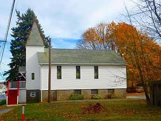
Banks Township is a township in Carbon County, Pennsylvania. It is part of Northeastern Pennsylvania.

<span class="mw-page-title-main">Beaver Meadows, Pennsylvania</span> Borough in Pennsylvania, United States

Beaver Meadows is a borough in Carbon County, Pennsylvania, United States. It is part of Northeastern Pennsylvania. The population was 897 at the 2020 U.S. census.

<span class="mw-page-title-main">Bowmanstown, Pennsylvania</span> Borough in Pennsylvania, United States

Bowmanstown is a borough in Carbon County, Pennsylvania. It is part of Northeastern Pennsylvania. The population was 937 at the 2010 census.

<span class="mw-page-title-main">Franklin Township, Carbon County, Pennsylvania</span> Place in Pennsylvania, United States

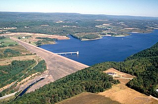
Franklin Township is a township in Carbon County, Pennsylvania. It is part of Northeastern Pennsylvania. The population was 4,262 at the 2010 census. A portion of Beltzville State Park is in Franklin Township.

<span class="mw-page-title-main">Jim Thorpe, Pennsylvania</span> Borough and county seat of Carbon County, Pennsylvania

Jim Thorpe is a borough and the county seat of Carbon County in the U.S. state of Pennsylvania. It is part of Northeastern Pennsylvania. It is historically known as the burial site of Native American sports legend Jim Thorpe.

<span class="mw-page-title-main">Lausanne Township, Carbon County, Pennsylvania</span> Place in Pennsylvania, United States

Lausanne Township is a township in Carbon County, Pennsylvania. It is part of Northeastern Pennsylvania. The township dates back to 1808 when the first Lausanne settlement was organized with a local frontier government.

<span class="mw-page-title-main">Lehighton, Pennsylvania</span> Borough in Pennsylvania, United States

Lehighton is a borough in Carbon County, Pennsylvania, United States. It is part of Northeastern Pennsylvania. Lehighton is located 28.9 miles (46.5 km) northwest of Allentown and 77.5 miles (124.7 km) northwest of Philadelphia.

<span class="mw-page-title-main">Lower Towamensing Township, Pennsylvania</span> Place in Pennsylvania, United States

Lower Towamensing Township is a township in Carbon County, Pennsylvania. It is part of Northeastern Pennsylvania. The Lenape Indian tribe name is eponymous and was once applied by the natives to the whole region of Carbon County and bits of the Poconos to the north and to Schuylkill County (southwest). The population was 3,228 at the 2010 census.

<span class="mw-page-title-main">Mahoning Township, Carbon County, Pennsylvania</span> Place in Pennsylvania, United States

Mahoning Township is a township in Carbon County, Pennsylvania. It is part of Northeastern Pennsylvania. The population was 4,305 at the 2010 census, up from 3,978 at the 2000 census.

<span class="mw-page-title-main">Packer Township, Pennsylvania</span> Place in Pennsylvania, United States

Packer Township is a township in Carbon County, Pennsylvania. It is part of Northeastern Pennsylvania. The population was 998 at the 2010 census.

<span class="mw-page-title-main">Palmerton, Pennsylvania</span> Borough in Pennsylvania, United States

Palmerton is a borough in Carbon County, Pennsylvania, United States. It is part of Northeastern Pennsylvania. The borough's population was 5,414 at the 2010 census.

<span class="mw-page-title-main">Penn Forest Township, Pennsylvania</span> Place in Pennsylvania, United States

Penn Forest Township is a township in Carbon County, Pennsylvania. It is part of Northeastern Pennsylvania. The population was 9,581 at the 2010 census, up from 5,439 at the 2000 census.

<span class="mw-page-title-main">Heidelberg Township, Lehigh County, Pennsylvania</span> Township in Pennsylvania, United States

Heidelberg Township is a township in Lehigh County, Pennsylvania. The population of Heidelberg Township was 3,416 at the 2010 census. It is a suburb of Allentown in the Lehigh Valley, which had a population of 861,899 and was the 68th-most populous metropolitan area in the U.S. as of the 2020 census.

<span class="mw-page-title-main">Lynn Township, Pennsylvania</span> Township in Pennsylvania, United States

Lynn Township is a township in Lehigh County, Pennsylvania. It is the largest township by area in Lehigh County and also the most rural and least densely populated township in the county. The population of Lynn Township was 4,229 at the 2010 census. It is a suburb of Allentown in the Lehigh Valley, which had a population of 861,899 and was the 68th-most populous metropolitan area in the U.S. as of the 2020 census.

<span class="mw-page-title-main">Upper Milford Township, Pennsylvania</span> Township in Pennsylvania, United States

Upper Milford Township is a township in Lehigh County, Pennsylvania. The township's population was 7,292 at the 2010 census. Upper Milford Township is a suburb of Allentown in the Lehigh Valley, which had a population of 861,899 and was the 68th most populous metropolitan area in the U.S. as of the 2020 census.

<span class="mw-page-title-main">Washington Township, Lehigh County, Pennsylvania</span> Township in Pennsylvania, United States

Washington Township is a township in Lehigh County, Pennsylvania. The population of Washington Township was 6,624 at the 2010 census. It is a suburb of Allentown in the Lehigh Valley, which had a population of 861,899 and was the 68th-most populous metropolitan area in the U.S. as of the 2020 census.

<span class="mw-page-title-main">Weisenberg Township, Pennsylvania</span> Township in Pennsylvania, United States

Weisenberg Township is a township in Lehigh County, Pennsylvania. The population of Weisenberg Township was 4,923 at the 2010 U.S. census. The township is a suburb of Allentown in the Lehigh Valley, which had a population of 861,899 and was the 68th-most populous metropolitan area in the U.S. as of the 2020 census.

<span class="mw-page-title-main">West Penn Township, Pennsylvania</span> Township in Pennsylvania, United States

West Penn Township is a township in Schuylkill County, Pennsylvania, United States. The population was 4,383 in the 2020 census.

References

  1. "2016 U.S. Gazetteer Files". United States Census Bureau. Retrieved August 13, 2017.
  2. 1 2 "Population and Housing Unit Estimates" . Retrieved June 9, 2017.
  3. 1 2 "Geographic Identifiers: 2010 Demographic Profile Data (G001): East Penn township, Carbon County, Pennsylvania". U.S. Census Bureau, American Factfinder. Archived from the original on April 6, 2015. Retrieved April 6, 2015.
  4. "Census of Population and Housing". Census.gov. Retrieved June 4, 2016.
  5. "U.S. Census website". United States Census Bureau . Retrieved January 31, 2008.
  6. "East Penn Township map" (PDF). PennDOT. Retrieved March 17, 2023.