Bhangura thana was established in 1980 and was turned into an upazila in 1981. Once Bhangura upazila was a noted jute growing area. For this reason a jute trading company called Chittagong Jute Company established business house on the bank of the river adjacent to the Baral Bridge. Still there exist a house of the extinct company.
Liberation War
During the Bangladesh Liberation War, several encounters between the Pakistan Army supported by Razakars against the Mukti Bahini were made at Baral Bridge and Dilpashar Bridge. A number of Razakars surrendered. Commander Abdul Hannan and Aslamul Islam led the Mukti Bahini.
Abu Muhammad Yunus Ali was elected Member of Legislative Assembly (MLA) from Atgharia-Chatmohor-Faridpur constituency of Pabna district. He was nominated by Awami League in the United Front election in 1954, and became the founder and main leader of the Awami League party politics in that area. He was also a popular language soldier, a close associate of Bangabandhu in the six-point demand movement, and an organizer of the 1971 Liberation War. He was a close friend of Bangabandhu Sheikh Mujibur Rahman, his only roommate in Baker Hostel in Kolkata, a classmate at Dhaka University and also a trusted political companion.
Abu Muhammad Yunus Ali served as an organizer of the liberation war in Shahzadpur, Baghabari, Nagarbari and in the remote areas of Chalanbil of Greater Pabna district in 1971, and was wounded in a battlefield. At one stage, members of Razakar-Al-Badr[lower-alpha 2] tortured him in an inhuman manner, and even destroyed his ancestral homestead at Sartutia of Bhangura upazila. In 1972, after the government treatment of his injury under the supervision of Bangabandhu, he gained limited mobility after surgery. On February 14, 2005, the “People’s MLA Yunus” breathed his last in his house at Bhangura.
Geography
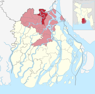
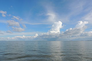
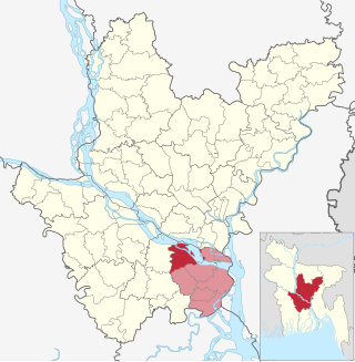
Bhangura is located at 24°13′30″N89°24′00″E / 24.2250°N 89.4000°E / 24.2250; 89.4000. It has 28,853 households and total area 138.36km2. It is bounded by Tarash upazila on the north, Faridpur (Pabna) upazila on the south, Ullapara upazila on the east, Chatmohar upazila on the west. The upazila is criss-crossed by two rivers named the Baral and the Gumani. The western part of this upazila is relatively higher than the eastern part which comprises a part of the great Chalan Bil. A very large number of small bills are also available in this area. The people here like the simple life.
According to the 2011 Census of Bangladesh, Bhangura Upazila had 28,853 households and a population of 124,433. 29,360 (23.60%) were under 10 years of age. Bhangura had a literacy rate (age 7 and over) of 43.98%, compared to the national average of 51.8%, and a sex ratio of 1010 females per 1000 males. 20,606 (16.56%) lived in urban areas.[5][6]
At the 2001 Bangladesh census, Bhangura had a population of 99,474 of which 50,486 were male and 48,988 were female. Average density of population was 731 per square kilometre. It had an average literacy rate of 38.3% (7+ years).
Main Occupations Agriculture but, agricultural labourer, wage labourer, commerce, service, fishing and others also present.
Economy
Total cultivable land 10,460 hectares, fallow land 2,786 hectares; single crop 36%, double crop 40% and treble crop 24%. The market value of the land of the first grade is about 7500 Taka per 0.01 hectare.
Main crops are Paddy, jute, wheat, onion, garlic, green chilly, khesari, musur and patal. Main fruits are Banana, mango, jackfruit, black berry, papaya and litchi. Extinct or nearly extinct crops are barley, chhola, kaun, china and bhura.
Other agriculture activities dairy 312, poultry 60, fishery 2. Bhangura upazila is notable for its milk and milk products. A number of people are involved in production of milk products that include butter, chern, chhana, sweets, etc. These products as well as raw materials are sent to different parts of Bangladesh. Several milk collection and chilling centres of different companies such as Milk Vita, BRAK, Amomilk, Akiz are actively present in this upazila.
Points of interest
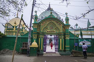
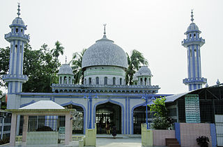
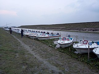
A part of Chalan Beel has passed through the northern part of the Upazila. It has a wonderful Upazila Parishad including a well-decorated Dak-Bangla. Three-domed mosque at Kazipara (Chandipur), Baral Bridge, Boro Bil, Pathorghata four-storied Jame Mosque, Patul Playground, Patul Excursion Beach Sonali Beach (kalikadah, Boro Bil), Nobi bari (Moydan dighi Noton rasta), Baonjan Dhow (famous for fishing).
Administration
Bhangura Upazila is divided into Bhangura Municipality and six union parishads: Austa Manisha, Bhangura, Dilpashar, Khanmarich, Parbhanguria and Mondotush union. The union parishads are subdivided into 67 mauzas and 122 villages.[5]
Bhangura Municipality is subdivided into 9 wards and 37 mahallas.[5]
Member of the Parliament (MP): Mokbul Hossain (Pabna-3 constitution)
Chairman: মোঃ বাকি বিল্লাহ্
Vice Chairman: মোঃ গোলাম হাফিজ
Woman Vice Chairman: মোছাঃ আজিদা খাতুন
Upazila Nirbahi Officer (UNO): নাহিদ হাসান খান
Bhangura Paurashava Mayor: Md.Golam Hasnain Rasel
Transport
Roads pucca 13km, semi pucca 4km and mud road 210km; waterways 17-nautical-mile (31km); railways 11km. Bus and train is the most popular means of transport for communication with other parts of the country. There are three railway stations in this upazila: Baral Bridge, Bhangura and Sharatnagar of them Baral Bridge is the most prominent one where several intercity trains have stoppage, which are: Silk City, Lalmoni, Dhumketu, Sundarban, Chitra etc. Bus services are: Shahzadpur Travels (Bhangura-Dhaka), Syamoli Paribahan (Bhangura-Chittagong), Uttara Paribahan (Bhangura-Rajshahi), B-Nagar (Bhangura-Bogra) and direct bus services also exist from Bhangura to Pabna, Ishurdi, Kushtia, Baghabari (Sirajgonj) etc. Traditional transport Palanquin, dhuli, horse carriage and bullock cart. These means of transport are either extinct or nearly extinct.
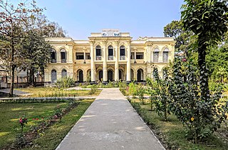
There are two colleges in the upazila: Haji Jamal Uddin Degree College, founded in 1970, and Bhangura Women's College (1998).[3] The former is the only honors level one.[7]
The madrasa education system includes two fazil madrasas: Sharatnagar Fazil Madrasa, founded in 1927, and Haji Gayez Uddin Women's Fazil Madrasa (1985).[3][8]
Media
Sachetan
Related Research Articles
Pabna District is a district in central Bangladesh. It is an economically important district. Its administrative capital is the eponymous Pabna town.
Sirajganj District is a district in the North Bengal region of Bangladesh, located in the Rajshahi Division. It is the 25th largest district by area and 9th largest district by population in Bangladesh. It is known as the gateway to North Bengal.
Baral river is one of the offshoots of the Ganges, starts its journey at Charghat Upazila of Rajshahi District of Bangladesh. The Baral, flowing through Natore and Pabna, meets with the Gumani River at the east of Bhangura and finally meets with the Hurasagar River after joining with the Karatoya south of Shahjadpur Upazila. The river is approximately 147 kilometres (91 mi) long, and 120 metres (410 ft) wide and 6 metres (20 ft) deep on average. The river receives water from the Ganges only in the monsoon season. But it maintains its flow throughout the year with local runoff water and water from Chalan Beel. Its drainage area is about 230 square kilometres (89 sq mi). Some important places located on the banks of the Baral are: Charghat, Baraigram, Bagatipara, Gurudaspur, Chatmohar, Bhangura and Bera upazilas of Bangladesh. The Baral Bridge is located on this river at Bhangura Upazila.
Muladi is an upazila of Barishal District in the Division of Barishal, Bangladesh.
Begumganj is an upazila of the Noakhali District in Bangladesh's Chittagong Division. Begumganj Thana, now an upazila, was established in 1892.
Dewanganj is an Upazila of Jamalpur District, Mymensingh Division, Bangladesh. It covers an area of 266.59 km2 (102.93 sq mi).
Bajitpur is an upazila of Kishoreganj District in Bangladesh. Bajitpur was created by Baizid Kha. Formerly Bhairab and Kuliarchar were included in this town. This place is full of canals and rivers. Dilalpur river port here was famous in the subcontinent during the British period.
Naria is an upazila of Shariatpur District of the Dhaka Division of Bangladesh. It is named after its administrative centre, the town of Naria.
Ghatail is an upazila located in Tangail District, Bangladesh. The upazila is bounded by Gopalpur and Madhupur upazilas on the north, Fulbaria and Bhaluka upazilas on the east, Kalihati and Sakhipur upazilas on the south, Bhuapur and Gopalpur upazilas on the west. Main rivers are Bangshai, Jhinai, Toak.
Morrelganj is an upazila of Bagerhat District in the Division of Khulna, Bangladesh. Morrelganj thana was established in 1909 and became an upazila in 1985.
Adamdighi Upazila is an upazila of Bogra District in the Division of Rajshahi, Bangladesh. Adamdighi Thana was established in 1821 and was converted into an upazila in 1983. It is named after its administrative center, the town of Adamdighi. Local legend has it that its name came from a Muslim saint, Baba Adam, who visited and dug a dighi (tank) for water storage.
Sherpur Upazila is an upazila of Bogra District in the Division of Rajshahi, Bangladesh. Sherpur Thana was established in 1962 and was converted into an upazila in 1983. It is named after its administrative center, the town of Sherpur. It is said that there once lived Sher family in the vicinity, from which the name "Sherpur" evolved.
Dhamoirhat is an upazila of Naogaon District in the Division of Rajshahi, Bangladesh. The main river of the Dhamoirhat Upazila is the Atrai.
Bera is an upazila of Pabna District in the Division of Rajshahi, Bangladesh.
Chatmohar is an upazila of Pabna District in the Division of Rajshahi, Bangladesh.
Mohanpur is an Upazila of Rajshahi District in the Division of Rajshahi, Bangladesh.
Belkuchi is an upazila, or sub-district of Sirajganj District, located in Rajshahi Division, Bangladesh.
Ullapara is an upazila, or sub-district of Sirajganj District, located in Rajshahi Division, Bangladesh.
Shahjadpur is an upazila, or sub-district of Sirajganj District, located in Rajshahi Division, Bangladesh.
Zajira is an upazila of Shariatpur District in the Division of Dhaka, Bangladesh. Zajira Thana was established in 1973 and was upgraded to an upazila in 1984. It was named after its administrative center, the town of Zajira.
↑ "Bangladesh Postal Code". Dhaka: Bangladesh Postal Department under the Department of Posts and Telecommunications of the Ministry of Posts, Telecommunications and Information Technology of the People's Republic of Bangladesh. 21 October 2024.
↑ Two groups that collaborated with Pakistan Army, these groups were also known for committing war crimes against Bengalis.
This page is based on this Wikipedia article Text is available under the CC BY-SA 4.0 license; additional terms may apply. Images, videos and audio are available under their respective licenses.