Bera Upazila

Last updated • 2 min readFrom Wikipedia, The Free Encyclopedia
Bera
বেড়া
kaajiirhaatt.jpg
Boats in Aminpur
Bera in Rajshahi division (Bangladesh).svg
Coordinates: 24°4′N89°37.5′E / 24.067°N 89.6250°E / 24.067; 89.6250
Country Flag of Bangladesh.svg  Bangladesh
Division Rajshahi
District Pabna
Area
  Total
243.43 km2 (93.99 sq mi)
Population
 (2022) [1]
  Total
301,494
  Density1,200/km2 (3,200/sq mi)
Time zone UTC+6 (BST)
Postal code
6680 [2]
Area code 0731 [3]
Website Official Map of Bera

Bera (Bengali : বেড়া) is an upazila of Pabna District in the Division of Rajshahi, Bangladesh. [4]

Contents

Geography

Bera is located at 24°04′00″N89°37′30″E / 24.0667°N 89.6250°E / 24.0667; 89.6250 . It has 57,436 households and a total area of 243.43 square kilometres (93.99 sq mi). It is known as 2nd Adamjee because there is big market for jute and different types of Jute Buildings are available here. It has also many milk-processing factories.

Bera has some small forests where there live some wild animals like foxes, mongooses, different types of wild cats etc. But these forests and animals are going to be vanished because of killing animals and trees.

Demographics

Religions in Bera Upazila (2022) [5]
ReligionPercent
Islam
96.49%
Hinduism
3.51%

According to the 2011 Census of Bangladesh, Bera Upazila had 57,436 households and a population of 256,793. 63,330 (24.66%) were under 10 years of age. Bera had a literacy rate (age 7 and over) of 41.23%, compared to the national average of 51.8%, and a sex ratio of 1000 females per 1000 males. 50,068 (19.50%) lived in urban areas. [6] [7]

As of the 1991 Bangladesh census, Bera has a population of 208,897. Males constitute 52.11% of the population, and females 47.89%. This Upazila's 18-up population is 100,253. Bera has an average literacy rate of 24.1% (7+ years), and the national average of 32.4% literate. [8]

Administration

Bera Upazila is divided into Bera Municipality and eight union parishads: Dhalar Char, Haturia Nakalia, Jatshakhni, Kytola, Masundia, Nutan Bharenga, Puran Bharenga, and Ruppur. The union parishads are subdivided into 163 mauzas and 162 villages. [6]

Bera Municipality is subdivided into 9 wards and 26 mahallas. [6]

Chairman: Muhammad Abdul kader

Vice Chairman: Md. Mijbah Mollah

Woman Vice Chairman: Most. Asma Khatun

Upazila Nirbahi Officer (UNO): Ashif Anam Siddique

Notable people

See also

Related Research Articles

<span class="mw-page-title-main">Pabna</span> Largest City as well as District headquarter of Pabna district

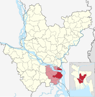
Pabna is a city of Pabna District, Bangladesh and the administrative capital of the eponymous Pabna District. It is on the north bank of the Padma River and has a population of about 300,109.

<span class="mw-page-title-main">Kumarkhali Upazila</span> Upazila in Khulna, Bangladesh

Kumarkhali is an upazila of Kushtia District in the Division of Khulna, Bangladesh. It is famous for the Shelaidaha area, where the poet Rabindranath Tagore spent a considerable time of his youth.

<span class="mw-page-title-main">Haimchar Upazila</span> Upazila in Chittagong, Bangladesh

Haimchar is an upazila of Chandpur District in the Division of Chittagong, Bangladesh.

<span class="mw-page-title-main">Nabiganj Upazila</span> Upazila in Sylhet, Bangladesh

Nabiganj (Bengali: নবীগঞ্জ, romanized: Nobīgonj, is an Upazila of Habiganj District in the Division of Sylhet, Bangladesh.

<span class="mw-page-title-main">Nagarkanda Upazila</span> Upazila in Dhaka, Bangladesh

Nagarkanda is an upazila of Faridpur District in the Division of Dhaka, Bangladesh.

<span class="mw-page-title-main">Daulatpur Upazila, Manikganj</span> Upazila in Dhaka, Bangladesh

Daulatpur is an upazila of Manikganj District in the Division of Dhaka, Bangladesh.

<span class="mw-page-title-main">Bhedarganj Upazila</span> Upazila in Dhaka, Bangladesh

Bhedarganj is an upazila (sub-district) of Shariatpur District in central Bangladesh, located in the Dhaka Division. It is a part of the Greater Faridpur region and is named after its administrative centre, the town of Bhedarganj.

<span class="mw-page-title-main">Abhaynagar Upazila</span> Upazila in Khulna, Bangladesh

Abhaynagar is an upazila of Jessore District in the Division of Khulna, Bangladesh.

<span class="mw-page-title-main">Bheramara Upazila</span> Upazila in Khulna, Bangladesh

Bheramara is an upazila of Kushtia District in the Division of Khulna, Bangladesh. The upazila lies along the Padma River, and the important Hardinge Bridge crosses the river between Bheramara Upazila and Ishwardi Upazila of Pabna District.

<span class="mw-page-title-main">Phulbari Upazila, Kurigram</span> Upazila in Rangpur, Bangladesh

Phulbari is an upazila of Kurigram District in the Division of Rangpur, Bangladesh.

<span class="mw-page-title-main">Baraigram Upazila</span> Upazila of Bangladesh in Rajshahi

Baraigram Upazila is an upazila of Natore District, located in the Rajshahi Division of Bangladesh.

<span class="mw-page-title-main">Atghoria Upazila</span> Upazila of Bangladesh in Rajshahi

Atghoria is an upazila of Pabna District in Rajshahi Division, Bangladesh.

<span class="mw-page-title-main">Faridpur Upazila</span> Upazila of Bangladesh in Rajshahi

Faridpur is an upazila of Pabna District in the Division of Rajshahi, Bangladesh. Faridpur is located at 24.1583°N 89.4528°E.

<span class="mw-page-title-main">Pabna Sadar Upazila</span> Upazila of Bangladesh in Rajshahi

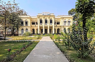
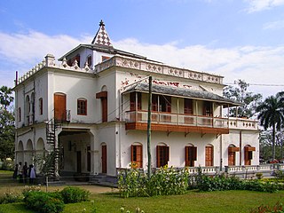
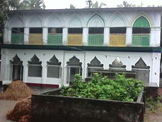
Pabna Sadar is an upazila of Pabna District in the Division of Rajshahi, Bangladesh.

<span class="mw-page-title-main">Santhia Upazila</span> Upazila of Bangladesh in Rajshahi

Santhia is an upazila of Pabna District in the Division of Rajshahi, Bangladesh.

<span class="mw-page-title-main">Sujanagar Upazila</span> Upazila of Bangladesh in Rajshahi

Sujanagar is an upazila of the Pabna District of northern Bangladesh's Rajshahi Division. It is the home of agriculture across the district, and the Onion Capital of the country.

<span class="mw-page-title-main">Chauhali Upazila</span> Upazila of Bangladesh in Rajshahi

Chauhali is an upazila, or sub-district of Sirajganj District, located in Rajshahi Division, Bangladesh.

<span class="mw-page-title-main">Tarash Upazila</span> Upazila of Bangladesh in Rajshahi

Tarash is an upazila, or sub-district of Sirajganj District, located in Rajshahi Division, Bangladesh.

<span class="mw-page-title-main">Ullahpara Upazila</span> Upazila of Bangladesh in Rajshahi

Ullapara is an upazila, or sub-district of Sirajganj District, located in Rajshahi Division, Bangladesh.

<span class="mw-page-title-main">Bhangura Upazila</span> Upazila of Bangladesh in Rajshahi

Bhangura or Bhangoora is an upazila of Pabna District in Rajshahi Division, Bangladesh.

References

  1. National Report (PDF). Population and Housing Census 2022. Vol. 1. Dhaka: Bangladesh Bureau of Statistics. November 2023. p. 402. ISBN   978-9844752016.
  2. "Bangladesh Postal Code". Dhaka: Bangladesh Postal Department under the Department of Posts and Telecommunications of the Ministry of Posts, Telecommunications and Information Technology of the People's Republic of Bangladesh. 21 October 2024.
  3. "Bangladesh Area Code". China: Chahaoba.com. 18 October 2024.
  4. Abdus Sattar (2012). "Bera Upazila". In Sirajul Islam and Ahmed A. Jamal (ed.). Banglapedia: National Encyclopedia of Bangladesh (Second ed.). Asiatic Society of Bangladesh.
  5. Population and Housing Census 2022 - District Report: Pabna (PDF). District Series. Dhaka: Bangladesh Bureau of Statistics. June 2024. ISBN   978-984-475-231-3.
  6. 1 2 3 "Bangladesh Population and Housing Census 2011 Zila Report – Pabna" (PDF). bbs.gov.bd. Bangladesh Bureau of Statistics.
  7. "Community Tables: Pabna district" (PDF). bbs.gov.bd. Bangladesh Bureau of Statistics. 2011.
  8. "Population Census Wing, BBS". Archived from the original on 2005-03-27. Retrieved November 10, 2006.