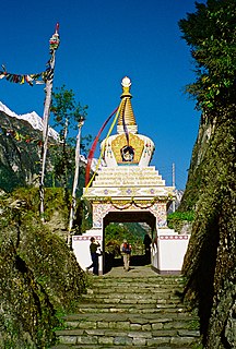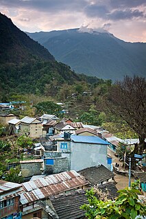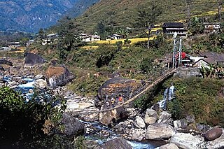
Lamjung District, a part of Gandaki Province, is one of the 77 districts of Nepal. The district, with Besisahar as its district headquarters, covers an area of 1,692 square kilometres (653 sq mi) and as of 2011 had a population of 167,724. Lamjung lies in the mid-hills of Nepal spanning tropical to trans-Himalayan geo-ecological belts, including the geographical midpoint of the country. It has mixed habitation of casts and ethnicities. It is host to probably the highest density of the Gurung ethnic population in the country.

Bidur is the capital of Nuwakot District in Bagmati Province, Nepal. At the time of the 1991 Nepal census it had a population of 18694 and had 3736 houses in it.

Besishahar is a municipality and the district headquarters of Lamjung District in Gandaki Province, Nepal. The Besishahar Municipality was formed by merging the existing Village Development Committees i.e. Besishahar, Gaunshahar, Udipur, Chandisthan, Baglungpani, Bajhakhet, Hiletaksar and Chiti and have 11 wards. Here are different castes and religions. So they have different culture. This municipality has a sub-tropical climate with deciduous forests. Annapurna II, Machhapuchhre, Lamjung Himal can be viewed from north of Besishahar Municipality.

Chame is the headquarters of Manang District in the Gandaki Zone of northern Nepal. At the time of the 2011 Nepal census it had a population of 1129 people living in 279 individual households. Manang District is the lowest populated district in Nepal.

Sangachok is a village and market center of Chautara Sangachokgadi Municipality in Sindhupalchok District in the Bagmati Zone of central Nepal. The formerly Village Development Committee was merged to form the new municipality on 2017. At the time of the 2013 Nepal census it had a population of 10,791 and had 1,828 houses in the village.

Tatopani is a village in Sindhupalchok District in the Bagmati Zone of central Nepal. At the time of the 1991 Nepal census it had a population of 3102 and had 613 houses in the village. Majority people are of ethnic Sherpa and Tamang. Historically and today, it is a huge trading post between Nepal and China. People living here speak Nepali and Tibetan.There is a inactive volcano in there as well. Shrestha Bipin is Mayor there in Tatopani.Babita Sherpa could be organizing a donation on her birthday instead of taking any gifts for the welfare of people in Tatopani. The actual border crossing is at Kodari. The village was visited by and served as pitstop for famous indian scholar and travelogue Rahul Sankrityayan multiple times on his way to Tibet.

Langtang was a village development committee (VDC) in Rasuwa District in the Bagmati Zone of northern Nepal. At the time of the 1991 Nepal census it had a population of 468 people living in 100 individual households.

Bahundanda is a village development committee in Lamjung District in the Gandaki Zone of northern-central Nepal. At the time of the 1991 Nepal census it had a population of 2114 people living in 433 individual households.

Bansar is a village development committee in Lamjung District in the Gandaki Zone of northern-central Nepal. At the time of the 1991 Nepal census it had a population of 2556.

Bhulbhule is a village development committee in Lamjung District in the Gandaki Zone of northern-central Nepal. At the time of the 1991 Nepal census it had a population of 3079 people living in 626 individual households.

Chakratirtha is a village development committee in Lamjung District in the Gandaki Zone of northern-central Nepal. At the time of the 1991 Nepal census it had a population of 3813 people living in 749 individual households.

Chandisthan is a town and market place at Besishahar Municipality in Lamjung District in Gandaki Province of northern-central Nepal. The Besishahar Municipality was formed by merging the existing Village Development Committees i.e. Besishahar, Gaunshahar, Udipur & Chandisthan in 15 May 2014.

Dudhpokhari (दूधपोखरी) is a village development committee in Lamjung District in the Gandaki Zone of northern-central Nepal. The name Dudhpokhari is derived from the lake which lies in the base of Himalchuli. At the time of the 2011 Nepal census it had a population of 4167 people living in 505 individual households. The highest elevation is Mount Himalchuli. Dudhpokhari kunda, which lies in the base of himalchuli, is a popular religious destination which attracts thousand of Hindus in Shrawan during Janai Purnima.

Gauda, Nepal is a village development committee in Lamjung District in the Gandaki Zone of northern-central Nepal. At the time of the 1991 Nepal census it had a population of 3325 people living in 650 individual households.

Ilampokhari is a village development committee in Lamjung District in the Gandaki Zone of northern-central Nepal. At the time of the 1991 Nepal census it had a population of 3197 people living in 620 individual households.

Khudi, Nepal is a village development committee in Lamjung District in the Gandaki Zone of northern-central Nepal. At the time of the 1991 Nepal census it had a population of 3212 people living in 664 individual households.

Kolki is a village development committee in Lamjung District in the Gandaki Zone of northern-central Nepal. At the time of the 1991 Nepal census it had a population of 1892 people living in 354 individual households.

Maling is a village development committee in Lamjung District in the Gandaki Zone of northern-central Nepal. At the time of the 1991 Nepal census it had a population of 1745 people living in 337 individual households.

Pyarjung is a village development committee in Lamjung District in the Gandaki Zone of northern-central Nepal. At the time of the 1991 Nepal census it had a population of 2256 people living in 443 individual households.

Archale is a village development committee in Palpa District in the Lumbini Zone of southern Nepal. At the time of the 1991 Nepal census it had a population of 2373 people living in 378 individual households.


