
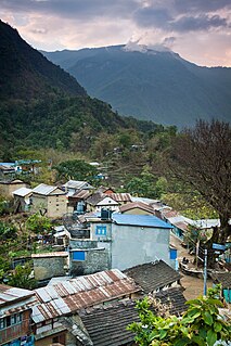
Lamjung District, a part of Gandaki Province, is one of the 77 districts of Nepal. The district, with Besisahar as its district headquarters, covers an area of 1,692 square kilometres (653 sq mi) and as of 2011 had a population of 167,724. Lamjung lies in the mid-hills of Nepal spanning tropical to trans-Himalayan geo-ecological belts, including the geographical midpoint of the country. It has mixed habitation of casts and ethnicities. It is host to probably the highest density of the Gurung ethnic population in the country.
Bahundanda is a village development committee in Lamjung District in the Gandaki Zone of northern-central Nepal. At the time of the 1991 Nepal census it had a population of 2114 people living in 433 individual households.
Bharte is a village development committee in Lamjung District in the Gandaki Zone of northern-central Nepal. At the time of the 1991 Nepal census it had a population of 2591 people living in 544 individual households.
Bhote Bazar is a village development committee in Lamjung District in the Gandaki Zone of northern-central Nepal. At the time of the 1991 Nepal census it had a population of 3630 people living in 785 individual households.

Bhulbhule is a village development committee in Lamjung District in the Gandaki Zone of northern-central Nepal. At the time of the 1991 Nepal census it had a population of 3079 people living in 626 individual households.
Bichaur is a village development committee in Lamjung District in the Gandaki Zone of northern-central Nepal. At the time of the 1991 Nepal census it had a population of 2462 people living in 488 individual households.
Gauda, Nepal is a village development committee in Lamjung District in the Gandaki Zone of northern-central Nepal. At the time of the 1991 Nepal census it had a population of 3325 people living in 650 individual households.
Ilampokhari is a village development committee in Lamjung District in the Gandaki Zone of northern-central Nepal. At the time of the 1991 Nepal census it had a population of 3197 people living in 620 individual households.
Ishaneshwar is a village development committee in Lamjung District in the Gandaki Zone of northern-central Nepal. At the time of the 1991 Nepal census it had a population of 2517 people living in 522 individual households.
Khudi, Nepal is a village development committee in Lamjung District in the Gandaki Zone of northern-central Nepal. At the time of the 1991 Nepal census it had a population of 3212 people living in 664 individual households.
Kolki is a village development committee in Lamjung District in the Gandaki Zone of northern-central Nepal. At the time of the 1991 Nepal census it had a population of 1892 people living in 354 individual households.
Maling is a village development committee in Lamjung District in the Gandaki Zone of northern-central Nepal. At the time of the 1991 Nepal census it had a population of 1745 people living in 337 individual households.
Mohoriyakot is a village development committee in Lamjung District in the Gandaki Zone of northern-central Nepal. At the time of the 1991 Nepal census it had a population of 2564 people living in 512 individual households.
Nauthar is a village development committee in Lamjung District in the Gandaki Zone of northern-central Nepal. At the time of the 1991 Nepal census it had a population of 2053 people living in 410 individual households.
Parewadanda is a village development committee in Lamjung District in the Gandaki Zone of northern-central Nepal. At the time of the 1991 Nepal census it had a population of 2633 people living in 528 individual households.
Pyarjung is a village development committee in Lamjung District in the Gandaki Zone of northern-central Nepal. At the time of the 1991 Nepal census it had a population of 2256 people living in 443 individual households.
Ramgha is a former village development committee now changed into MadhyaNepal Municipality in Lamjung District in the Gandaki Zone of northern-central Nepal. According to Geologist Dr.Harka Gurung this area lies in the centroid of Nepal.At the time of the 1991 Nepal census it had a population of 2327 people living in 446 individual households.
Sundarbazar is a Municipality in Lamjung District in the Gandaki Province of northern-central Nepal. The Sundarbazar Municipality was formed by merging the existing Village Development Committees i.e. Bhoteodar, Sundarbazar, Parewadanda, Tarku and Kuncha as one of the 61-municipalities category on 2071. As of 2011 Nepal census, it had 11,230 male population and 15,445 female population living in 7,512 households.
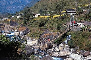
Tarkughat is a village development committee in Lamjung District in the Gandaki Zone of northern-central Nepal. At the time of the 1991 Nepal census it had a population of 2650 people living in 536 individual households. This village lies at the bank of Marsyangdi river.
Dhyaurali is a village development committee in Ramechhap District in the Janakpur Zone of north-eastern Nepal. At the time of the 1991 Nepal census it had a population of 3,111 people living in 616 individual households.
