
Baglung District, a part of Gandaki Province, is one of the seventy-seven districts of Nepal. The district, with Baglung as its district headquarters, covers an area of 1,784 km2 (689 sq mi) and has a population (2011) of 268,613.

Lamjung District, a part of Gandaki Province, is one of the 77 districts of Nepal. The district, with Besisahar as its district headquarters, covers an area of 1,692 square kilometres (653 sq mi) and as of 2011 had a population of 167,724. Lamjung lies in the mid-hills of Nepal spanning tropical to trans-Himalayan geo-ecological belts, including the geographical midpoint of the country. It has mixed habitation of casts and ethnicities. It is host to probably the highest density of the Gurung ethnic population in the country.

Sindhupalchowk District is a part of Bagmati Province and one of the seventy-seven districts of Nepal, with an area of 2,542 km2 (981 sq mi). The district's headquarters is in Chautara. In 2006, 336,478 people resided in 79 village development committees, in 2011 there were 287,798.

Chautara Sangachokgadhi is a municipality in Sindhupalchowk District in Bagmati Province of central Nepal. The municipality was established on 18 May 2014 by merging Pipaldanda, Chautara, Kubhinde, Sanusiruwari Village Development Committees as Chautara Municipality. Later on 2017 it was expended again merging Sangachok, Thulo Sirubari, Kadambas, Irkhu, Batase and Syaule Village Development Committees to form Chautara Sangachowkgadi Municipality. It is now divided to 14 wards. This is the district headquarters of the Sindhupalchowk District. The municipality stands at the elevation of approximately 1,600 m above sea level. Religious and cultural festivities form a major part of the lives of people residing in Chautara. There are people of various religious beliefs, Hinduism, Buddhism and Christianity as well, giving Chautara a cosmopolitan culture. Nepali is the most commonly spoken language in the municipality. Likewise, Newari and other languages such as Tamang is also spoken as the Newars and Tamangs dominate the settlement in population.

Besishahar is a municipality and the district headquarters of Lamjung District in Gandaki Province, Nepal. The Besishahar Municipality was formed by merging the existing Village Development Committees i.e. Besishahar, Gaunshahar, Udipur, Chandisthan, Baglungpani, Bajhakhet, Hiletaksar and Chiti and have 11 wards. This municipality has a sub-tropical climate with deciduous forests. Annapurna II, Machhapuchhre, Lamjung Himal can be viewed from north of Besishahar Municipality.
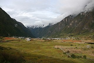
Sangachok is a village and market center of Chautara Sangachokgadi Municipality in Sindhupalchok District in the Bagmati Zone of central Nepal. The formerly Village Development Committee was merged to form the new municipality on 2017. At the time of the 2013 Nepal census it had a population of 10,791 and had 1,828 houses in the village.
Tatopani is a village in Sindhupalchok District in the Bagmati Zone of central Nepal. At the time of the 1991 Nepal census it had a population of 3102 and had 613 houses in the village. Majority people are of ethnic Sherpa and Tamang. Historically and today, it is a huge trading post between Nepal and China. People living here speak Nepali and Tibetan.There is a inactive volcano in there as well. Shrestha Bipin is mayor in Tatopani. The actual border crossing is at Kodari. The village was visited by and served as pitstop for famous indian scholar and travelogue Rahul Sankrityayan multiple times on his way to Tibet.
Kharanitar is a village development committee in Nuwakot District in the Bagmati Zone of central Nepal. At the time of the 1991 Nepal census it had a population of 1524 living in 298 individual households.
Langtang was a village development committee (VDC) in Rasuwa District in the Bagmati Zone of northern Nepal. It was located within the Langtang valley. At the time of the 1991 Nepal census it had a population of 468 people living in 100 individual households.
Bhujung is a village development committee in Lamjung District in the Gandaki Zone of northern-central Nepal. At the time of the 1991 Nepal census it had a population of 1621 people living in 339 individual households.
Bhulbhule is a village development committee in Lamjung District in the Gandaki Zone of northern-central Nepal. At the time of the 1991 Nepal census it had a population of 3079 people living in 626 individual households.
Bichaur is a village development committee in Lamjung District in the Gandaki Zone of northern-central Nepal. At the time of the 1991 Nepal census it had a population of 2462 people living in 488 individual households.
Dudhpokhari (दूधपोखरी) is a former village development committee in Lamjung District in the Gandaki Zone of northern-central Nepal. The name Dudhpokhari is derived from the lake which lies in the base of Himalchuli. At the time of the 2011 Nepal census it had a population of 4167 people living in 505 individual households. The highest elevation is Mount Himalchuli. Dudhpokhari kunda, which lies in the base of himalchuli, is a popular religious destination which attracts thousand of Hindus in Shrawan during Janai Purnima.
Ilampokhari is a village development committee in Lamjung District in the Gandaki Zone of northern-central Nepal. At the time of the 1991 Nepal census it had a population of 3197 people living in 620 individual households.
Kolki is a village development committee in Lamjung District in the Gandaki Zone of northern-central Nepal. At the time of the 1991 Nepal census it had a population of 1892 people living in 354 individual households.
Pyarjung is a village development committee in Lamjung District in the Gandaki Zone of northern-central Nepal. At the time of the 1991 Nepal census it had a population of 2256 people living in 443 individual households.

Manthali is a municipality and the headquarters of Ramechhap District in Bagmati Province, Nepal that was established on 2 December 2014 by merging the former village development committees Old-Manthali, Bhatauli, Chisapani, Kathjor, Bhaluwajor, Salupati and Sunarpani. It was declared the headquarters of the district on 9 March 1989. It lies on the bank of the Tamakoshi River. At the time of the 2011 Nepal census it had a population of 45,416 people living in 10,099 individual households.
Archale is a village development committee in Palpa District in the Lumbini Zone of southern Nepal. At the time of the 1991 Nepal census it had a population of 2373 people living in 378 individual households.

Majibari is a small village in Dudhpokhari VDC, in the east Lamjung.

Gandaki ProvinceListen (help·info)), is one of the seven federal provinces established by the current constitution of Nepal which was promulgated on 20 September 2015. Pokhara is the province's capital city. It borders the Tibet Autonomous Region of China to the north, Bagmati Province to the east, Karnali Province to the west, and Lumbini Province and Bihar of India to the south. The total area of the province is 21,504 km2 - about 14.57% of the country's total area. According to the latest census, the population of the province was 2,479,745. The newly elected Provincial Assembly adopted Gandaki Province as the permanent name by replacing its initial name Province no. 4 in July 2018. Krishna Chandra Nepali is the present chief minister of Gandaki Province.


