
Himachal Pradesh is a state in the northern part of India. Situated in the Western Himalayas, it is one of the thirteen mountain states and is characterized by an extreme landscape featuring several peaks and extensive river systems. Himachal Pradesh is the northernmost state of India and shares borders with the union territories of Jammu and Kashmir and Ladakh to the north, and the states of Punjab to the west, Haryana to the southwest, Uttarakhand to the southeast and a very narrow border with Uttar Pradesh to the south. The state also shares an international border to the east with the Tibet Autonomous Region in China. Himachal Pradesh is also known as Dev Bhoomi, meaning 'Land of Gods' and Veer Bhoomi which means 'Land of the Brave'.

India is a federal union comprising 28 states and 8 union territories, with a total of 36 entities. The states and union territories are further subdivided into districts and smaller administrative divisions.
The Patiala and East Punjab States Union (PEPSU) was a state of India, uniting eight princely states between 1948 and 1956. The capital and principal city was Patiala. The state covered an area of 26,208 km². Shimla, Kasauli, Kandaghat and Chail also became part of the PEPSU.

Vindhya Pradesh was a former state of India. It occupied an area of 61,131.5 km2. It was created in 1948 as Union of Baghelkhand and Bundelkhand States, shortly after Indian independence, from the territories of the princely states in the eastern portion of the former Central India Agency. It was named as Vindhya Pradesh on 25 January 1950 after the Vindhya Range, which runs through the centre of the province. The capital of the state Princily state Rewa. It lays between Uttar Pradesh to the north and Madhya Pradesh to the south, and the enclave of Datia, which lay a short distance to the west, was surrounded by the state of Madhya Bharat.

Kangra-Lambagraon was a historical princely estate (jagir) of British India located in the present-day state of Himachal Pradesh. In 1947, the estate comprised 437 villages, encompassing an area of 324 km2. It had with a Privy Purse of Rs 70,000/- and enjoyed a revenue of approx. Rs.1,76,000/-.
Bilaspur is a town and a municipal council in Bilaspur district in the Indian state of Himachal Pradesh.

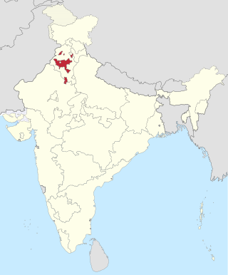
Bilaspur is a district of Himachal Pradesh, India. Its capital is in the town of Bilaspur. The district has an area of 1,167 km2, and a population of 381,956. As of 2011 it is the third least populous district of Himachal Pradesh, after Lahul and Spiti and Kinnaur.

Bilaspur State or Kahlur State, sometimes Kahloor Riyasat, was a kingdom (697–1849) and later princely state (1849–1948) in the Punjab Province ruled by a separate branch of Chandravanshi Chandel dynasty. Raja Bir Chand 697–730 was the founder of the state but it was named Kahlur only after the Construction of Kahlur Fort by Raja Kahal Chand around 890–930CE and Raja Anand Chand the 44th Raja was the last ruler.

East Punjab was a province and later a state of India from 1947 until 1966, consisting of the parts of the Punjab Province of British India that went to India following the partition of the province between India and Pakistan by the Radcliffe Commission in 1947. The mostly Muslim western parts of the old Punjab became Pakistan's West Punjab, later renamed as Punjab Province, while the mostly Hindu and Sikh eastern parts went to India.

Himachal Pradesh was established in 1948 as a Chief Commissioner's Province within the Union of India. The province comprised the hill districts around Shimla and southern hill areas of the former Punjab region. Himachal became a part C state on 1951 with the implementation of the Constitution of India. Himachal Pradesh became a Union Territory on 1 November 1956. On 18 December 1970 the State of Himachal Pradesh Act was passed by Parliament and the new state came into being on 25 January 1971. Thus Himachal emerged as the eighteenth state of the Indian Union.
The hill states in India also participated in the freedom struggle (1914–1947) against the British colonial rule.

The Himachal Pradesh Police is the law enforcement agency for the state of Himachal Pradesh in India. It has one state headquarters at Shimla and 12 district headquarters in the state.

Mandi State was a native state of British India, within the Punjab; with Mandi, Himachal Pradesh as its capital. The state of Mandi, which included two towns and 3,625 villages, was part of the States of the Punjab Hills. It was located in the Himalayan range, bordering to the west, north, and east on the British Punjabi district of Kangra; to the south, on Suket; and to the southwest, on Bilaspur. As of 1941, population of Mandi State was 232,598 and area of the state was 1,139 square kilometres (440 sq mi).

The States Reorganisation Act, 1956 was a major reform of the boundaries of India's states and territories, organising them along linguistic lines.
Mangal is a former princely state in north India ruled by Chandravanshi Sen Rajputs.Mangal state like Mandi State was an off shoot of Suket State. Rana Surender Singh is its present head.
His Highness Raja Sir Anand Chand was the 44th Raja of Bilaspur. He was a Member of Parliament, representing Bihar in the Rajya Sabha, the upper house of India's Parliament as a member of the Indian National Congress.
Jubbal State was a non-salute state of the Simla Hill States Superintendency of the Punjab States Agency. Thought to have been founded in the twelfth century, it merged with the Indian Union in 1948.
The State of Himachal Pradesh Act, 1970 is an Act of the Parliament of India by which Himachal Pradesh was given the status of a full state of India. According to this Act, on 25th January 1971, the Union Territory of Himachal Pradesh became the 18th state of India.
