
Bolton is an unincorporated town that is the most populous community in the town of Caledon, Ontario, Canada, in the Regional Municipality of Peel. It is located beside the Humber River, approximately 50 kilometres northwest of Toronto. In regional documents, it is referred to as a 'Rural Service Centre'. It has 26,795 residents in 9,158 total dwellings. The downtown area that historically defined the village is in a valley, through which flows the Humber River. The village extends on either side of the valley to the north and south.

Castle Hill is a location and a high country station in New Zealand's South Island. It is located at an altitude of 700 metres, close to State Highway 73 between Springfield and Arthur's Pass. It is private property and located within the Kura Tawhiti Conservation Area.

Ivančna Gorica is a settlement in central Slovenia. It is the seat of the Municipality of Ivančna Gorica. It is part of the traditional region of Lower Carniola and is now included in the Central Slovenia Statistical Region.
Anama is a sparsely populated locality in the Canterbury region of New Zealand's South Island. It is on the Hinds River, with the Ashburton River / Hakatere not far to the north in nearby Mount Somers. Other nearby settlements include Valetta to the east, Mayfield to the south, and Montalto to the west. Anama School celebrated its centenary in March 2002.

The Murray River is a river in the southwest of Western Australia. It played a significant part in the expansion of settlement in the area south of Perth after the arrival of British settlers at the Swan River Colony in 1829. It should not be confused with the Murray River in southeastern Australia, which is the longest river in the country.
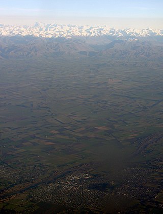
Mid Canterbury is a traditional, semi-official subregion of New Zealand's Canterbury Region extending inland from the Pacific coast to the Southern Alps. It is one of four traditional sub-regions of Canterbury, along with South Canterbury, North Canterbury, and Christchurch City.

Porters, is a commercial ski resort just over an hour's drive (98 km) west from Christchurch, in the South Island of New Zealand. Originally functioning as a club skifield, it has one beginner magic carpet, one platter tow, one chairlift and three t-bars. The difficulty of the slopes is distributed as 15% beginner, 35% intermediate and 50% advanced. Modern grooming equipment is used, and snowmaking facilities operate along the main pistes along the chairlift.

Mount Cheeseman is a club snowfield in New Zealand's South Island, near the town of Springfield, about an hour and a half (111 km) from Christchurch.
Valetta is a lightly populated locality in the mid-Canterbury region of New Zealand's South Island. It is located in an agricultural area on the southern side of the Ashburton River / Hakatere. Another river, the Hinds River, is to Valetta's southwest. Nearby settlements include Mount Somers to the northwest, Anama to the west, Mayfield to the southwest, and Punawai to the southeast. Its name is a misspelling of Valletta, the capital of Malta.

A banana peel, called banana skin in British English, is the outer covering of a banana. Banana peels are used as food for animals, an ingredient in cooking, in water purification, for manufacturing of several biochemical products as well as for jokes and comical situations.
The Hewson River is a river of New Zealand's South Island. It flows east and then south from the Ben McLeod Range of inland Canterbury before flowing into the upper reaches of the Orari River 5 kilometres (3 mi) west of Mount Peel.
The Phantom River is a river of the Canterbury region of New Zealand's South Island. It flows predominantly east from the ben McLeod Range north of Fairlie to reach the Orari River 20 kilometres (12 mi) northwest of Peel Forest.
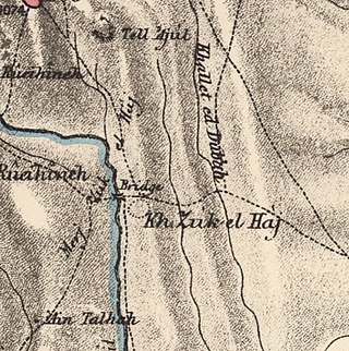
Al-Zuq al-Fawqani was a Palestinian Arab village in the Safad Subdistrict. It was depopulated during the 1948 Arab-Israeli War on May 21, 1948, by the Palmach's First Battalion of Operation Yiftach. It was located 32 km northeast of Safad.

The Cass River is an alpine river in the Canterbury region of the South Island of New Zealand. It rises near the Cass Saddle in the Craigieburn Forest Park and flows generally northeast alongside the Craigieburn Range before turning north to meet the Waimakariri River. State Highway 73 and the Midland Line both cross the lower reaches of the river near a farming locality named Cass.
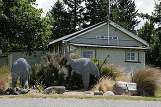
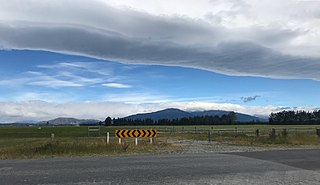
Alford Forest is a location in Ashburton District, Canterbury, New Zealand.
Trillium Health Partners is a hospital system which serves Mississauga and western Toronto in the Canadian province of Ontario. It comprises the Credit Valley Hospital, Mississauga Hospital, and Queensway Health Centre. Trillium Health Partners is Canada's largest community-based, academically affiliated hospital, and has the largest emergency department in the country. Trillium Health Partners is affiliated with the University of Toronto and, in partnership with the University of Toronto Mississauga, jointly created the Mississauga Academy of Medicine.

Mount Peel is a mountain located in South Canterbury, New Zealand. It consists of three peaks, Mount Peel, Middle Mt Peel and Little Mt Peel/Huatekerekere. Mt Peel is 1,743 metres (5,719 ft) tall and is owned by the Department of Conservation and Mt Peel Station. It lies just south of the Rangitata river and is 22 kilometres (14 mi) north-west of Geraldine.

Hakatere Conservation Park is a protected area between the Rakaia River and the Rangitata River in the Ashburton District of New Zealand. The park was established in 2007. It covers 60,000 hectares of rugged mountains and mountain basins, tussocklands and beech forest. It includes the Ashburton Lakes, such as Lake Heron and Lake Clearwater, popular tramping area Mount Somers / Te Kiekie, and Mount Hutt skifield. The closest town is Mount Somers.

Korowai / Torlesse Tussocklands Park is a protected area in Canterbury, New Zealand. Covering around 21,000 hectares, it is located on both sides of State Highway 73, from east of Porters Pass to south of Castle Hill Village.

The Peel Estate was an area of land in the south of Perth, Western Australia, predominantly in what is now the City of Kwinana, City of Rockingham and the Shire of Serpentine–Jarrahdale. The estate twice featured prominently in Western Australian history.