
Geraldine is a town in the Canterbury region in the South Island of New Zealand. It is about 140 km south of Christchurch, and inland from Timaru, which is 38 km to the south. Geraldine is located on State Highway 79 between the Orari and Hae Hae Te Moana Rivers and 45 kilometres to the east of Fairlie.

Tīrau is a small town in the Waikato region of the North Island of New Zealand, 50 kilometres southeast of Hamilton. The town has a population of 804. In the Māori language, "Tīrau" means "place of many cabbage trees."

Te Rapa is a mixed light industrial, large-scale retail and semi-rural suburb to the northwest of central Hamilton, New Zealand that is built on a flat area that was previously the bed of an ancient river, the forerunner to the present Waikato River.
Alton is a small rural community in south Taranaki, in the western North Island of New Zealand. It is located between the towns of Hāwera and Patea.

Hikutaia is a locality on the Hauraki Plains of New Zealand. It lies on State Highway 26, south east of Thames and north of Paeroa. The Hikutaia River runs from the Coromandel Range through the area to join the Waihou River.

The Thames Branch railway line connected Thames, New Zealand, with Hamilton and was originally part of the East Coast Main Trunk railway. Part of the line between Morrinsville and Waitoa remains open and is in use as the Waitoa Branch line, connecting to the Fonterra Dairy Factory at Waitoa.
The Ōpārau River is a river of the Waikato Region of New Zealand's North Island in the area occupied by Ngāti Hikairo. It flows southwest from its sources in the Pirongia Forest Park, the highest being The Cone, and flows into the Kawhia Harbour, 5 kilometres (3 mi) east of Kawhia. The river has about 171 km (106 mi) of tributaries.

Longburn railway station was a station in Longburn, on the North Island Main Trunk in New Zealand. The platform, which is across from the Fonterra Factory, remains but the structure has been demolished.

Te Kuiti railway station is a station on the North Island Main Trunk in New Zealand. The station was important in the growth of Te Kūiti.
Matangi is a settlement in the Waikato District on the eastern border of Hamilton. It is surrounded by many lifestyle blocks, but the village centre has Matangi School, a garage, Four Square, takeaway and café, Matangi Hall, St David’s church and Matangi recreation reserve.
TeMoana is a locality in the Canterbury Region of the South Island of New Zealand. It is located about 15 kilometres (9.3 mi) west of Geraldine and bordered by Gapes Valley and Pleasant Valley to the south and Four Peaks to the north. The south branch of the Hae Hae Te Moana River runs through the area.
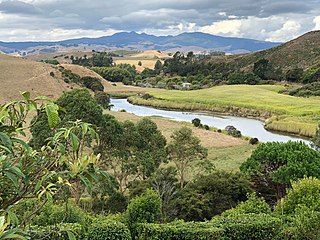
Kakahu is a locality in the Canterbury region in the South Island of New Zealand. It is located about 22 kilometers (13.6 mi) west of Geraldine. It is well known for its rich historical and geological history.
Lichfield is a rural settlement in the South Waikato District and Waikato region of New Zealand's North Island.
Kiwitahi is a rural community in the Matamata-Piako District and Waikato region of New Zealand's North Island, located directly south of Morrinsville.
Orini is a rural community in the Waikato District and Waikato region of New Zealand's North Island. It is located east of Taupiri

Motumaoho is a small village in the Waikato region of New Zealand's North Island, just to the west of the Pakaroa Range. It is on SH26, 25 km (16 mi) east of Hamilton and 7 km (4.3 mi) west of Morrinsville. The village is bordered by the Waitakaruru Stream to the east. Motumaoho can be translated as an intruding clump of trees.
Ballance is a farming community in Tararua District and Manawatū-Whanganui region of New Zealand's North Island. The main settlement is located on the west back of the Mangahao River, south and west of Woodville and 11 km north-west of Pahiatua.

Piriaka was a station on the North Island Main Trunk line, in the Ruapehu District of New Zealand, serving Piriaka. It was 5.27 km (3.27 mi) north of Kakahi and 4.63 km (2.88 mi) south of Manunui. It formally opened on 9 November 1908, though it was renamed from Pirihaka on 25 April 1902 and work was well advanced by 1903, with the rails laid south of Piriaka by May 1904. Goods traffic started on 11 October 1904. By 10 November 1908 a passing loop could take 48 wagons and there was a 6th class station, with water supply, privies and urinals, a 300 ft (91 m) x 20 ft (6.1 m) passenger platform, loading bank, cattle yards and a 30 ft (9.1 m) x 20 ft (6.1 m) goods shed.

Rangiwahia is a small, elevated, farming settlement in the North Island, New Zealand, 26 km (16 mi) northeast of Kimbolton in the Manawatū-Whanganui region. It is in the Kiwitea valley, near the Whanahuia Range of the Ruahines. Due to its height and the nearby ranges, Rangiwahia has a mean annual rainfall of 1267mm; 309mm more than Feilding's.
