Glenavy is a small town in the South Island of New Zealand. It is located at the southern extreme of the Canterbury region on the alluvial fan of the Waitaki River, three kilometres from the river's outflow into the Pacific Ocean.

Hurunui District is a territorial local government district within the Canterbury Region on the east coast of New Zealand's South Island, north of Christchurch. It stretches from the east coast to the Main Divide. Its land area is 8,640.96 square kilometres (3,336.29 sq mi).

Cave is a town located in the Timaru District, South Island, New Zealand. It is approximately 23 kilometres (14 mi) north-west of Timaru on State Highway 8. St. David's Memorial Church was commissioned by Thomas Burnett and designed by Herbert W. Hall. Built in 1930, it is registered as a category I heritage building with Heritage New Zealand.
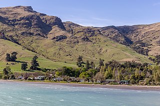
Purau is a small town in Canterbury, New Zealand, facing Lyttelton Harbour.

Waikari is a small town in the Canterbury region of New Zealand's South Island.

Lake Hood is a man-made recreational lake, located 6 km south-east of Tinwald in the locality of Huntingdon, Canterbury, New Zealand. It was opened in 2001 by the Right Honourable Jenny Shipley. It is 2.3 km long by 1 km wide and is more than 80 hectares (0.80 km2) in area. It features an eight lane rowing course and separate waterskiing and jet skiing areas, and is home to Water Ski Lake Hood. It is increasing in popularity for rowing, as it is not as susceptible to wind as the main South Island rowing venue, Lake Ruataniwha.

Hinds is a small town in the Mid-Canterbury region of New Zealand's South Island. It is located on the Canterbury Plains on the south bank of the Hinds River, which reaches the Pacific Ocean between the nearby localities of Longbeach and Lowcliffe. Other localities around Hinds include Ealing to the west, Willowby, Windermere, and Winslow to the northeast, and Eiffelton to the southeast.

Dunsandel is a small rural town in the Canterbury region of the South Island, New Zealand. The town is located on the Canterbury Plains just south of the Selwyn River / Waikirikiri and about 40 km south of Christchurch. Dunsandel is a junction town on SH1, halfway between Christchurch and Ashburton, with roads leading to Leeston, Southbridge and Hororata. The town provides an important refreshment stop for main road travellers with eateries and coffee shops, as well as acting as a support town for the rural hinterland.
Orari is a small town in the South Canterbury region of New Zealand's South Island, roughly midway between Ashburton to the north, and Timaru to the south it is the northernmost town of South Canterbury.

Winchester is a small town in the South-Canterbury region of New Zealand's South Island. Winchester is 6.9 kilometres north of Temuka and 51 kilometres southwest of Ashburton.

The Pines Beach is a small town situated roughly 4 km east of Kaiapoi in the Canterbury region of the South Island of New Zealand. It is 1 km north of the mouth of the Waimakariri River. It takes its name from its close proximity to both a pine forest and the beach.

Timaru District is a local government district on New Zealand's South Island, administered by the Timaru District Council. It is part of the larger Canterbury Region. Timaru district was formed in 1989 from the amalgamation of Timaru City, Geraldine district, Temuka district and Stratham district.

Ashburton District is a territorial authority district in the Canterbury Region of the South Island of New Zealand. It encompasses the town of Ashburton, a number of small towns and settlements and the surrounding rural area, roughly coterminous with Mid Canterbury. The district had a population of 36,800 as of June 2023.

St Andrews is a small town in the south Canterbury region of New Zealand's South Island. It is located on State Highway 1 five kilometres south of Pareora and 17 kilometres south of Timaru. It was linked to Timaru by rail in 1876, and grew after the subdivision of the Pareora Run. It remains a rural service town.

Ashley is a small town in North Canterbury, in the South Island of New Zealand. It used to have a railway station on the Main North Line that runs through the village.
Waimate is a town in Canterbury, New Zealand and the seat of Waimate District. It is situated just inland from the eastern coast of the South Island. The town is reached via a short detour west when travelling on State Highway One, the main North/South road. Waimate is 45.7 km south of Timaru, Canterbury's second city, 20 km north of the Waitaki River, which forms the border between Canterbury and the Otago province to the south and 47.5 km north of Oamaru, the main town of the Waitaki District.

Waimate District is a territorial authority district located in the Canterbury Region of the South Island of New Zealand. The main town is Waimate, while there are many smaller rural communities dispersed throughout the area. Its boundary to the south is the Waitaki River, to the west Lake Benmore and to the north-east the Pareora River.
Milford Huts is a bach community in the Timaru district and Canterbury region of New Zealand's South Island. Milford Huts is on the northern side of the Ōpihi River mouth, 7.5 kilometres southeast of Temuka by road.
Fairview is a rural community in the Timaru District, New Zealand. It is located southwest of Timaru.

Fairview or Fairview Estate is a rural settlement in the Western Bay of Plenty District and Bay of Plenty Region of New Zealand's North Island. It is about 5.5 km south of Katikati, and is marketed as a lifestyle subdivision.
