
Geraldine is a town in the Canterbury region in the South Island of New Zealand. It is about 140 km south of Christchurch, and inland from Timaru, which is 38 km to the south. Geraldine is located on State Highway 79 between the Orari and Hae Hae Te Moana Rivers and 45 kilometres to the east of Fairlie.

Cromwell is a town in the Central Otago region of New Zealand's South Island, located on the shore of Lake Dunstan. Established at the confluence of the Clutha / Mata-Au and Kawarau Rivers after gold was discovered nearby during the Otago Gold Rush of the 1860s, Cromwell's location saw it become a junction for travel between Dunedin and areas further inland, such as Wānaka and Queenstown. As gold mining declined, the town developed to service farms and orchards in the surrounding area, becoming known for stone fruit and as part of the Central Otago wine region. The town remains a hub for people travelling throughout the region, with State Highway 8B running through the town and acting as a main route for travellers to Queenstown.

Motueka is a town in the South Island of New Zealand, close to the mouth of the Motueka River on the western shore of Tasman Bay. It is the second largest in the Tasman Region, with a population of 8,300 as of June 2024.

Temuka is a town on New Zealand's Canterbury Plains, 15 kilometres north of Timaru and 142 km south of Christchurch. It is located at the centre of a rich sheep and dairy farming region, for which it is a service town. It lies on the north bank of the Temuka River, just above its confluence with the Ōpihi River.
Te Manatū WakaMinistry of Transport is the public service department of New Zealand charged with advising the New Zealand Government on transport policy. The Ministry works closely with other government transport partners, including the New Zealand Transport Agency (NZTA) to advance their strategic objectives.

Christchurch Girls' High School in Christchurch, New Zealand, was established in 1877 and is the second oldest girls-only secondary school in the country, after Otago Girls' High School.
Waikuku is a small town in the Canterbury region of New Zealand, which sits 28 km north of central Christchurch. Waikuku lies 11.8 km (7.3 mi) south of Leithfield on state highway 1 and 3 km (1.9 mi) north of Woodend. In 1901 there were 86 people resident in Waikuku according to that year's census. Waikuku settlement had a population of 156 people at the time of the 2018 Census. It is popular with both those that commute into work in Christchurch each day and with owners of holiday houses. Waikuku was home to rope and twine works. This business started off using flax from local swamps. It closed in 1987. The nearby sandy beach and pine forests are popular with surfers, swimmers, campers and horse-riders, and the large estuary of the Ashley River hosts many species of birds.

Woodend is a town in the Waimakariri District, in the Canterbury Region of the South Island of New Zealand. It may have been named because it was on the edge of what was then called the Maori Bush, or after an early settler, Thomas Wooding. It is situated with both the Waimakariri and Ashley / Rakahuri Rivers running either side. Woodend is 6.6 kilometres north of Kaiapoi and 6.3 kilometres to the east of Rangiora. Woodend is within walking distance of the town of Pegasus.
NZ Transport Agency Waka Kotahi (NZTA) is a New Zealand Crown entity tasked with promoting safe and functional transport by land, including the responsibility for driver and vehicle licensing, and administering the New Zealand state highway network. Waka Kotahi means 'one vessel' and is intended to convey the concept of "travelling together as one".
Sir Hugh John Dyke Acland was a New Zealand politician of the National Party.

French New Zealanders are New Zealanders who are of French ancestors or a French-born person who resides in New Zealand.

The temperance movement in New Zealand originated as a social movement in the late-19th century. In general, the temperance movement aims at curbing the consumption of alcohol. Although it met with local success, it narrowly failed to impose national prohibition on a number of occasions in the early-20th century. Temperance organisations remain active in New Zealand today.
Stella Marjorie Jones was a New Zealand playwright and writer.
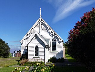
Woodbury is a small township in the Canterbury Region in the South Island of New Zealand. It is about 8 kilometres (5.0 mi) inland from Geraldine and is the gateway to the nearby Waihi and Orari River Gorges and the Four Peaks. The township is home to various small local businesses.

Housing in New Zealand was traditionally based on the quarter-acre block, detached suburban home, but many historical exceptions and alternative modern trends exist. New Zealand has largely followed international designs. From the time of organised European colonisation in the mid-19th century there has been a general chronological development in the types of homes built in New Zealand, and examples of each generation are still commonly occupied.

Mental health in New Zealand generally follows the trends of mental health in other OECD countries. New Zealand's 'outdoor life style' and high standard of living are balanced by isolation and a self-reliant culture, which discourages asking for help. Historically, people with mental health problems were institutionalised, whereas now the focus is on care in the wider community. The stigma around poor mental health has been lessened in recent years as a result of this change and public education campaigns. However, New Zealand's minorities and youth continue to be over-represented in the negative mental health statistics.
The Third Fox Ministry was a responsible government which held power in New Zealand from June 1869 to September 1872. Although William Fox was the head of the government, he was never appointed Premier as that office had yet to be established, although he did resign the office at the end of his tenure. The Ministry was also known as the Fox-Vogel Ministry as most of the agenda was set by the Treasurer, while Fox busied himself with administrative affairs and moral crusades such as the attempted introduction of local option polls for liquor licensing.
The First Vogel Ministry was a responsible government which held power in New Zealand from April 1873 to July 1875.

Motumaoho is a small village in the Waikato region of New Zealand's North Island, just to the west of the Pakaroa Range. It is on SH26, 25 km (16 mi) east of Hamilton and 7 km (4.3 mi) west of Morrinsville. The village is bordered by the Waitakaruru Stream to the east. Motumaoho can be translated as an intruding clump of trees.

