Ashburton is a large town in the Canterbury Region, on the east coast of the South Island of New Zealand. The town is the seat of the Ashburton District. It is 85 kilometres (53 mi) south west of Christchurch and is sometimes regarded as a satellite town of Christchurch.

Timaru is a port city in the southern Canterbury Region of New Zealand, located 157 km (98 mi) southwest of Christchurch and about 196 km (122 mi) northeast of Dunedin on the eastern Pacific coast of the South Island. The Timaru urban area is home to 28,900 people, and is the largest urban area in South Canterbury, and the third-largest in the Canterbury Region overall, after Christchurch and Rolleston. The town is the seat of the Timaru District, which includes the surrounding rural area and the towns of Geraldine, Pleasant Point and Temuka, which combined have a total population of 48,900.

Geraldine is a town in the Canterbury region in the South Island of New Zealand. It is about 140 km south of Christchurch, and inland from Timaru, which is 38 km to the south. Geraldine is located on State Highway 79 between the Orari and Hae Hae Te Moana Rivers and 45 kilometres to the east of Fairlie.

Temuka is a town on New Zealand's Canterbury Plains, 15 kilometres north of Timaru and 142 km south of Christchurch. It is located at the centre of a rich sheep and dairy farming region, for which it is a service town. It lies on the north bank of the Temuka River, just above its confluence with the Ōpihi River.

Rolleston is the seat and largest town in the Selwyn District, in the Canterbury region of New Zealand's South Island. It is located on the Canterbury Plains 22 kilometres (14 mi) south-west of Christchurch, and is part of the wider Christchurch metropolitan area.
The Timaru Herald is a daily provincial newspaper serving the Timaru, South Canterbury and North Otago districts of New Zealand. The current audited daily circulation is about 14,500 copies, with a readership of about 31,000 people. The paper is owned by media company Stuff Ltd.

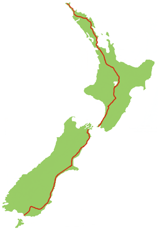
State Highway 1 is the longest and most significant road in the New Zealand road network, running the length of both main islands. It appears on road maps as SH 1 and on road signs as a white number 1 on a red shield, but it has the official designations SH 1N in the North Island, SH 1S in the South Island.

Public transport in Christchurch, New Zealand, consists of bus services operated by two bus companies supported by a ferry, all jointly marketed as Metro, a division of Environment Canterbury (ECan).

Winchester is a small town in the South-Canterbury region of New Zealand's South Island. Winchester is 6.9 kilometres north of Temuka and 51 kilometres southwest of Ashburton.

Timaru District is a local government district on New Zealand's South Island, administered by the Timaru District Council. It is part of the larger Canterbury Region. Timaru district was formed in 1989 from the amalgamation of Timaru City, Geraldine district, Temuka district and Stratham district.

Allan James Hubbard was a businessman who lived in Timaru in the South Island of New Zealand, and was the founder of South Canterbury Finance, New Zealand's largest locally owned finance company. In 2006, the New Zealand Listener described Hubbard as the most powerful businessman in the South Island.
State Highway 79 (SH 79) is a New Zealand state highway connecting the South Canterbury communities of Rangitata, Geraldine, and Fairlie. Starting at State Highway 1 the highway is 61 kilometres in length and runs in a general east–west direction. 6.3 km of the highway through Geraldine runs concurrently with the Inland Scenic Route, formerly State Highway 72. The road is a two-lane single carriageway, with a one-lane bridge crossing the Orari River.
Waimate is a town in Canterbury, New Zealand and the seat of Waimate District. It is situated just inland from the eastern coast of the South Island. The town is reached via a short detour west when travelling on State Highway One, the main North/South road. Waimate is 45.7 km south of Timaru, Canterbury's second city, 20 km north of the Waitaki River, which forms the border between Canterbury and the Otago province to the south and 47.5 km north of Oamaru, the main town of the Waitaki District.
Kakahu is a locality in the Canterbury region in the South Island of New Zealand. It is located about 22 kilometers (13.6 mi) west of Geraldine. It is well known for its rich historical and geological history.
Izone is an industrial suburb of Rolleston in Selwyn District, Canterbury Region, New Zealand.

Waimataitai is a suburb of Timaru, in the South Canterbury district and Canterbury region of New Zealand's South Island.

Parkside is a suburb of Timaru, in the Timaru District and Canterbury Region of New Zealand's South Island.

West End is a suburb of Timaru, in the South Canterbury area and Canterbury region of New Zealand's South Island. It is located west of the town centre.
Watlington is a suburb of Timaru, in the South Canterbury area and Canterbury region of New Zealand's South Island. It is located southwest of the town centre.
The South Canterbury cricket team represents the South Canterbury region of New Zealand. It competes in the Hawke Cup. Its headquarters are at Aorangi Oval in Timaru, where South Canterbury play most of their home matches.