Coombe is a settlement in Gwennap civil parish, Cornwall, England, United Kingdom. It is situated approximately three-and-a-half miles (6 km) southeast of Redruth at grid reference SW 763 409.

Bodanna is a farmstead in mid Cornwall, England, United Kingdom. It is situated in the civil parish of St Enoder north of the village of Summercourt about four miles (6.5 km) south-west of Newquay.

Bodrean and Frogmore are farmstead settlements in Cornwall, England, United Kingdom, situated two miles north-northeast of Truro.

The River Allen in north Cornwall is one of two rivers of the same name in Cornwall which share this name. In this case the name is the result of a mistake made in 1888 by Ordnance Survey, replacing the name Layne with Allen which is the old name for the lower reaches of the Camel. The other River Allen runs through Truro.
Castle Gate is a hamlet in west Cornwall, England, United Kingdom. It is situated approximately three miles (4.5 km) north-northeast of Penzance at OS grid ref SW491342 in a former mining area.

Tregirls is a farmstead in Cornwall, United Kingdom. It is situated approximately half-a-mile (1 km) north of Padstow. The settlement consists of a farm and converted cottages which are let as holiday accommodation.
Lank is a settlement in Cornwall, England, United Kingdom. It is situated approximately one mile (1.6 km) south of St Breward and six miles (10 km) east-northeast of Wadebridge in St Breward civil parish. It is in the civil parish of Blisland.

New Mills is a hamlet in Cornwall, England, United Kingdom. It is situated in a wooded valley north of Ladock approximately seven miles (11 km) northeast of Truro at OS grid reference SW899523.

Porthilly is a small coastal settlement on the east side of the River Camel estuary in Cornwall, England, United Kingdom. It is situated immediately south of the larger village of Rock approximately four miles (6.5 km) northwest of Wadebridge.

Chynhale is a house near Callestick in mid Cornwall, England. Chynhale is in the civil parish of Perranzabuloe and is situated 3.7 miles (6.0 km) east of St Agnes.

Clowance Wood is a hamlet in the civil parish of Crowan in west Cornwall, England. Clowance Wood is situated 1 mile (1.6 km) east of Leedstown and 4.7 miles (7.6 km) north-west of Helston.
Cockwells is a hamlet in the civil parish of Ludgvan in Cornwall, England and situated on the A30 road north-east of the village of Crowlas.

Demelza is a hamlet in the parish of St Wenn, Cornwall, England, UK. Demelza is situated 1 mile (1.6 km) south-east of St Wenn and lies at around 114 metres (374 ft) above sea level.
Garker is a hamlet situated 3 miles (4.8 km) north-east of St Austell in Cornwall, England. Garker lies close to the western edge of the Eden Project visitor attraction. Garker is in the civil parish of Carlyon.

Grimscott is a village in north Cornwall, England, UK. It is situated in the civil parish of Launcells, 3 miles (4.8 km) east of the town of Bude.
Kelly is a hamlet in the parish of Egloshayle, Cornwall, England.

Lower Boscaswell is a hamlet near Pendeen in Cornwall, England.
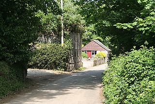
Maudlin is a hamlet in Cornwall, England situated about 1 km south of Lanhydrock.
Paul's Green is a hamlet between Leedstown and Townshend in west Cornwall, England, UK.
Penwartha Coombe is a hamlet south of Perranporth, Cornwall, England.
