Dean Village is a former village immediately northwest of the city centre of Edinburgh, Scotland. It is bounded by Belford Road to the south and west, Belgrave Crescent Gardens to the north and below the Dean Bridge to the east. It was formerly known as the "Water of Leith Village" and was a successful grain milling area for more than 800 years. At one time there were no fewer than eleven working mills there, driven by water from the Water of Leith.

Newhaven is a district in Edinburgh, Scotland, between Leith and Granton and about 2 miles (3.2 km) north of the city centre, just north of the Victoria Park district. Formerly a village and harbour on the Firth of Forth, it had a population of approximately 5,000 inhabitants at the 1991 census. Newhaven was designated a conservation area, one of 40 such areas in Edinburgh, in 1977.

New Lanark is a village on the River Clyde, approximately 1.4 miles from Lanark, in Lanarkshire, and some 25 miles (40 km) southeast of Glasgow, Scotland. It was founded in 1785 and opened in 1786 by David Dale, who built cotton mills and housing for the mill workers. Dale built the mills there in a brief partnership with the English inventor and entrepreneur Richard Arkwright to take advantage of the water power provided by the only waterfalls on the River Clyde. Under the ownership of a partnership that included Dale's son-in-law, Robert Owen, a Welsh utopian socialist and philanthropist, New Lanark became a successful business and an early example of a planned settlement and so an important milestone in the historical development of urban planning.
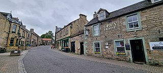
Balerno is a village on the outskirts of Edinburgh, Scotland situated 8 miles south-west of the city centre, next to Currie and then Juniper Green. Traditionally in the county of Midlothian it now administratively falls within the jurisdiction of the City of Edinburgh Council. The village lies at the confluence of the Water of Leith and the Bavelaw Burn. In the 18th and 19th century, the area was home to several mills using waterpower. In the 20th century, the mills closed and the village now forms a residential suburb of Edinburgh.
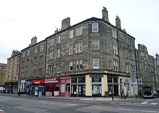
Dalry is an area of the Scottish capital city of Edinburgh. It is located close to the city centre, between Haymarket and Gorgie. The area is now primarily residential. It is centred around Dalry Road, which has numerous shops, restaurants and small businesses. Lying outside the old city walls and west of the castle, the area began as part of the agricultural estate of Dalry House, the exception being the Dalry Mill, recorded as the oldest paper mill in Scotland, now demolished.

Granton is a district in the north of Edinburgh, Scotland. Granton forms part of Edinburgh's waterfront along the Firth of Forth and is, historically, an industrial area having a large harbour. Granton is part of Edinburgh's large scale waterfront regeneration programme.

Trinity is a district of northern Edinburgh, Scotland, once a part of the burgh of Leith. It is one of the outer villa suburbs of Edinburgh mainly created in the 19th century. It is bordered by Wardie to the west and north-west, Newhaven to the north-east, Victoria Park to the east and Bangholm to the south.
Powderhall is an area lying between Broughton Road and Warriston Road in the north of Edinburgh, the Scottish capital. Until recently it was best known for Powderhall Stadium, a greyhound racing track, which has now closed. The stadium also played host to motorcycle speedway racing from 1977 to 1995, as home to the Edinburgh Monarchs, who have since relocated to Armadale. The Powderhall Sprint, first held in 1870, was a professional footrace with handicapping of the runners. It continues, since 1999, as the New Year Sprint and is now held at Musselburgh Racecourse.
Tollcross is a major road junction to the south west of the city centre of Edinburgh, Scotland which takes its name from a local historical land area.
Easter Road is an arterial road in north Edinburgh, the capital of Scotland. The road is so called as it was known as the "Easter (eastern) road to Leith". As maps of Edinburgh in the late 18th century show, it had a counterpart in "Wester Road". Until the creation of Leith Walk in the middle of the 17th century these were the two main routes from Leith to Edinburgh. Historic personages who have ridden up Easter Road have included Mary, Queen of Scots (1561) and Oliver Cromwell.

Pilrig is an area of Edinburgh, the capital of Scotland. The name probably derives from the long field (rig) on which a peel tower (pil/peel) stood. There is evidence of a peel tower situated on an area of higher ground above the Water of Leith.
Slateford is an area of Edinburgh, the capital of Scotland. It is east of the Water of Leith.

Great Junction Street is a street in Leith, on the northern outskirts of Edinburgh, Scotland. It runs southeast to northwest following approximately the southwestmost line of the old town walls around Leith.

Leith Walk is one of the longest streets in Edinburgh, Scotland, and is the main road connecting the east end of the city centre to Leith.
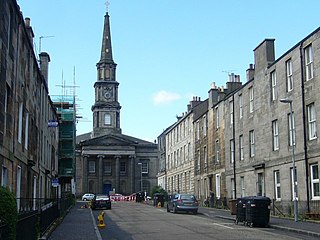
North Leith Parish Church was a congregation of the Church of Scotland, within the Presbytery of Edinburgh. It served part of Leith, formerly an independent burgh and since 1920 a part of the city of Edinburgh, Scotland.

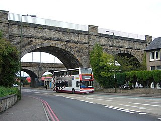
The Dean Bridge spans the Water of Leith in the city of Edinburgh on the A90 road to Queensferry on the Firth of Forth. It carries the roadway, 447 feet (136 m) long and 39 feet (12 m) broad, on four arches rising 106 feet (32 m) above the river. The bridge was one of the last major works before retirement of the bridge designer, civil engineer Thomas Telford, and was completed in 1831 when he was seventy-three years old.
William Notman (1809-1893) was a 19th-century Scottish architect. Early work assisting Playfair focussed on country houses, but his later independent work was more commercial in nature.
Victoria Park is a district in north Edinburgh south of Newhaven and lying between Trinity and Leith. The area was given Conservation Area status in March 1998.
The Bonnington Chemical Works was a pioneer coal tar processing plant established in Edinburgh. It was probably the first successful independent facility established for the integrated treatment of gasworks waste, and manufactured the residues of the Edinburgh gasworks into useful products for over half a century.

James Simpson (1830–1894) was a 19th century Scottish architect. He is particularly associated with Leith. He served as the Burgh Assessor and Town Architect of Leith and created and oversaw the Leith Improvement Plan of 1888.


