
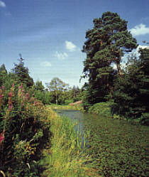
Bingham is a suburb of Edinburgh, the capital of Scotland. It is east of Duddingston, west of Magdalene, south of Portobello and north of Niddrie. The main A1 road skirts Bingham to the north. [1]
Bingham is a suburb of Edinburgh, the capital of Scotland. It is east of Duddingston, west of Magdalene, south of Portobello and north of Niddrie. The main A1 road skirts Bingham to the north. [1]

The Royal Scottish Academy building, the home of the Royal Scottish Academy, is situated on The Mound in the centre of Edinburgh, was built by William Henry Playfair in 1822-6 and extended in 1831-6 for the Board of Manufactures and Fisheries. Along with the adjacent National Gallery of Scotland, their neo-classical design helped transform Edinburgh into a modern-day Athens of the North.

Balgreen is a suburb of Edinburgh, located approximately two miles west of the city centre, most commonly known for its primary school, Balgreen Primary. It is located to the west of Murrayfield and Saughtonhall, to the east of Corstorphine, and to the north of Gorgie. It is bound to the north by Corstorphine Hill, to the west by Carrick Knowe Golf Course, and roughly to the east by Water of Leith.

Bankhead is a non-residential area of western Edinburgh, Scotland. It borders the Edinburgh City Bypass (A720) and Hermiston Gait to the west, the Calders neighbourhood to the south – accessed via a pedestrian underpass, Sighthill to the east, and South Gyle/Edinburgh Park to the north. It is mostly occupied by a large industrial park. Amongst the companies here, Royal Mail and Burtons Biscuits have a large presence. Ethicon also had a plant here, but it has closed, and will reportedly be replaced by a sports facilities. Edinburgh College, the former Stevenson College and the Sighthill campus of Napier University are just to the west.

Craigcrook is a suburb of Edinburgh, Scotland, best known for Craigcrook Castle. It is fairly affluent, and lies on the north east slopes of Corstorphine Hill. It is near Clerwood, and Blackhall. Davidson's Mains lies to the north, separated from the district by the A90 - Queensferry Road.

Polwarth is a mainly residential area of Edinburgh, Scotland. It is bounded by Bruntsfield and Merchiston to the east and south, Gorgie and Dalry to the north, Fountainbridge to the north and east, and Craiglockhart to the west.
Cammo is a northwestern suburb of Edinburgh, the capital of Scotland. It is south of A90, at the edge of the city, approximately 6 miles from the city centre.
Chesser is a mainly residential suburb of Edinburgh, Scotland, east of the Water of Leith. It, with Longstone, is to the south-west, Allan Park and Craiglockhart to the south, Slateford, Hutchison and Moat to the east, and Gorgie Road to the north.

Curriehill is a suburb of Edinburgh, the capital of Scotland. It is north-west of Currie.

Hermiston is a hamlet formerly in the County of Midlothian and now part of Edinburgh, the capital of Scotland. It is north of the Heriot-Watt University Riccarton Campus and west of the Hermiston Quay commercial development. Hermiston is bounded by the A71 Calder Road to the south and the Union Canal to the north with the M8 motorway just beyond. The hamlet forms the Hermiston Conservation Area.
Moredun is a district in the south-east of Edinburgh, the capital of Scotland. It is east of Liberton, while Craigour is situated just to its north.
Parkgrove is a suburb of Edinburgh, the capital of Scotland. Approximately 4 miles north-west of Edinburgh city centre. The suburb is located between the neighbouring areas of Clermiston, Barnton and Davidson's Mains.
West Coates or Wester Coates is a residential district of central Edinburgh, the capital of Scotland. It is on the A8, in proximity to Haymarket railway station and Roseburn, west of the city centre, bounded by the Water of Leith on its north side.

Church Hill is a street and small surrounding area in Edinburgh, Scotland.

Burghmuirhead is an area of Edinburgh, Scotland.

The A701 is a major road in Scotland that runs from Dumfries to Edinburgh.

Chambers Street is a street in Edinburgh, Scotland, in the southern extremity of the Old Town. The street is named after William Chambers of Glenormiston, the Lord Provost of Edinburgh who was the main proponent of the Edinburgh Improvement Act (1867) which led to its creation in 1870. A narrow lane named North College Street and three residential squares built in the 18th century—Adam Square, Argyle Square and Brown Square—disappeared in the process. The street is dominated by University and museum buildings. It also hosts a variety of restaurants and venues.

Abbeyhill railway station was a railway station located in the Abbeyhill area of Edinburgh. It was served by trains on several Edinburgh local rail services. The station was on the line that branched off the East Coast Main Line at Abbeyhill Junction.

South Bridge is a road bridge and street in Edinburgh, Scotland, between the High Street and Chambers Street/Infirmary Street. It extends to North Bridge at the north and Nicolson Street at the south, forming a level roadway over the steep valley scoured parallel to the High Street when the crag and tail landscape was formed. The Cowgate roadway along the bottom of the valley runs under the largest arch of the bridge.
The Bingham Military School was the state of North Carolina's first military school, founded in 1826 by Capt. D.H. Bingham, with the intention of providing more accessible training for military officers. The school opened its doors in January 1827, with D.H. Bingham as its superintendent and Capt. Patridge, who had served in the French army, as its head instructor. The school relocated twice, first from Williamsborough to Littleton in 1829, and then later that year from Littleton to Oxford.
The General Post Office (GPO) is a former post office building in Edinburgh, Scotland. It was built 1861–65 on the site of the Old Theatre Royal, between Waterloo Place and North Bridge, Edinburgh, to the design of architect and Clerk of Works for Scotland, Robert Matheson. In 1861, Albert, Prince Consort laid the foundation stone. The ceremony took place on the same day as the first stone was laid for the new Royal Museum of Scotland.
| | This Edinburgh location article is a stub. You can help Wikipedia by expanding it. |
Coordinates: 55°56′15.73″N3°7′28.51″W / 55.9377028°N 3.1245861°W
