Hurtsboro is a town in Russell County, Alabama, United States. At the 2010 census the population was 553, down from 592 in 2000. It was founded in 1857 as Hurtsville and named for Joel Hurt, Sr.. A railroad spur from Columbus, Georgia was completed the next year. It was incorporated in 1872 and in 1883 the town name was changed to Hurtsboro.

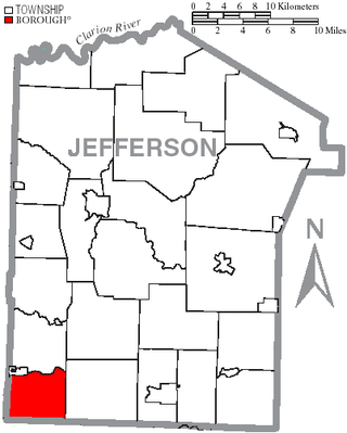
Porter Township is a township in Jefferson County, Pennsylvania, United States. The population was 292 at the 2020 census.
Braeside is a neighbourhood situated on the far west side of Greenock, in Inverclyde, Scotland.

Zestoa is a town located in the province of Gipuzkoa, in the autonomous community of the Basque Country, northern Spain.

Taylor is an unincorporated community in northeastern Marion County, Missouri, United States. Taylor is located at the northern junction of U.S. Routes 24 and 61, approximately five miles west of Quincy, Illinois and eight miles north of Palmyra. The community is part of the Hannibal Micropolitan Statistical Area.

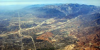
Lytle Creek, California, is an approximately 18-mile-long (29 km) stream in southwestern San Bernardino County near the city of San Bernardino. It is a tributary of Warm Creek, a tributary of the Santa Ana River. The Mormon settlers of San Bernardino named the stream "Lytle Creek" after their leader, Captain Andrew Lytle. The Tongva village of Wa’aachnga was located along Lytle Creek.

Al-Maktoum Stadium is a multi-purpose stadium in Oud Metha, Dubai, United Arab Emirates. It is currently used mostly for football matches and is the home ground of Al Nasr SC. The stadium holds roughly 15,000 people.

WEOA is a radio station licensed to and serving the Evansville, Indiana market. The transmitter is located near the interchange of I-69 and Weinbach Avenue in Evansville.
Braehead is the name of three villages and hamlets in South Lanarkshire, Scotland.

Unthank is a village in Dumfries and Galloway, Scotland.
The Narraguagus River is a river located in the U.S. state of Maine with its mouth in the Narraguagus Bay of the Gulf of Maine. It flows through the town of Cherryfield and was formerly well known for its sport fly fishing for Atlantic salmon. This was a traditional highlight of late spring with anglers gathering from afar for the Memorial Day weekend fishing kick-off. The native salmon run has been much reduced due to many different factors.
El Ghaire is a town and commune in Mauritania.

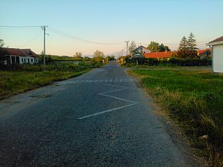
Gornja Jajina is a village in the municipality of Leskovac, Serbia. According to the 2002 census, the village has a population of 637 people.
The Chapel of the Resurrection is a Roman Catholic chapel in the Roman Catholic Archdiocese of New York, located at 276 West 151st Street, Manhattan, New York City.

Castelo de Juromenha is a castle in Portugal located in Juromenha. It is classified by IGESPAR as a Site of Public Interest.
Toyei is a census-designated place (CDP) in Apache County, Arizona, United States. The population was 13 at the 2010 census.
KICG is a radio station licensed to Perry, Iowa, United States. The station airs a Classical music format as part of Iowa Public Radio's Classical network, and is currently owned by Iowa Public Radio, Inc. The transmitting tower is located approximately 25 miles northeast of Perry on Lamb Lane in Boone County, a little over a mile west of Boone, Iowa. On the FCC website, this station rebroadcasts KHKE.

Fay Island is a small, partially submerged island in the San Joaquin River delta, in California. It is part of San Joaquin County, and managed by Reclamation District 2113. Its coordinates are 37.9485348°N 121.5652291°W. It appears, almost completely submerged, on a 1952 United States Geological Survey map of the area.

French Island is a small island in the Sacramento–San Joaquin River Delta. It is part of Solano County, California. Its coordinates are 38°15′51″N121°41′38″W, and the United States Geological Survey measured its elevation as 0 ft (0 m) in 1981. It appears on USGS maps in 1952 and 1978, with the same shape and elevation.

Ogilvie Island is a patch of mud in San Francisco Bay. It is within the limits of the city of San Jose, in Santa Clara County, California, and named for county planner Arthur Ogilvie. Its coordinates are 37°27′55″N122°00′37″W, and the United States Geological Survey gave its elevation as 0 ft (0 m) in 2012. It appears on a 2012 USGS map of the area.


