
Bruce Peebles & Co. Ltd. was an Edinburgh industrial electrical engineering company.

Edinburgh West was a constituency of the Scottish Parliament (Holyrood) from 1999 until 2011. It elected one Member of the Scottish Parliament (MSP) by the plurality method of election. It was also one of nine constituencies in the Lothians electoral region, which elected seven additional members, in addition to nine constituency MSPs, to produce a form of proportional representation for the region as a whole.
Silverknowes is a district of Edinburgh, Scotland. Silverknowes lies to the northwest of the city. The district contains over 2000 homes, ranging in size from bungalow to semi-detached housing, much of it built during the mid-twentieth century.

Davidson's Mains is a former village and now a district in the north-west of Edinburgh, Scotland. It is adjacent to the districts of Barnton, Cramond, Silverknowes, Blackhall and Corbiehill/House O'Hill. It was absorbed into Edinburgh as part of the boundary changes in 1920 and is part of the EH4 postcode area.
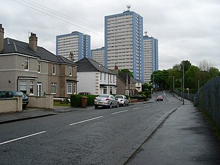
Sandyhills is an area of the Scottish city of Glasgow. It is situated north of the River Clyde and has fallen within the Shettleston ward of Glasgow City Council since 2007.
Sighthill is a suburb in the west of Edinburgh, Scotland. The area is bordered by Broomhouse and Parkhead to the east, South Gyle to the north, the industrial suburb of Bankhead and the Calders neighbourhood to the west, and Wester Hailes to the south. It is sometimes included in the Wester Hailes area, while the Calders, Bankhead and Parkhead are sometimes considered parts of Sighthill. Administratively it has formed a core part of the City of Edinburgh Council's Sighthill/Gorgie ward since 2007.

Granton is a district in the north of Edinburgh, Scotland. Granton forms part of Edinburgh's waterfront along the Firth of Forth and is, historically, an industrial area having a large harbour. Granton is part of Edinburgh's large scale waterfront regeneration programme.

The Calders is a residential neighbourhood in Edinburgh, Scotland – not to be confused with the Calders of West Lothian aka West Calder, Mid Calder and East Calder, three separate villages. It is sometimes considered to be part of Wester Hailes or Sighthill, larger developments to its south and east respectively. From 2007 to 2017, it fell within the Sighthill/Gorgie multi-member ward of the City of Edinburgh Council administration along with Sighthill, but following a boundary change has been in the Pentland Hills ward since then, along with Wester Hailes.
Niddrie is a residential suburb in Edinburgh, Scotland. It is situated in the south-east of the city, south-west of the seaside area of Portobello, and west of Musselburgh in East Lothian near Fort Kinnaird retail park. The western section of Niddrie is also known by the alternative name of Craigmillar.

Greendykes is a neighbourhood of Edinburgh, the capital of Scotland. It was originally a council scheme, consisting mostly of low-rise flats but also two 15-storey tower blocks. It is sometimes considered to be part of Craigmillar; areas such as Niddrie, Niddrie Mains and Newcraighall are also situated nearby.
Moredun is a district in the south-east of Edinburgh, the capital of Scotland. It is east of Liberton, while Craigour is situated just to its north.
Muirhouse is a housing estate in the north of Edinburgh, the capital of Scotland.

Bavelaw Castle is a historic house in the City of Edinburgh Council area, Scotland. It is north of Hare Hill in the Pentland Hills, four miles west of Penicuik, and two miles south of Balerno, above Threipmuir Reservoir. It was designated as a Category A listed building in 1971.

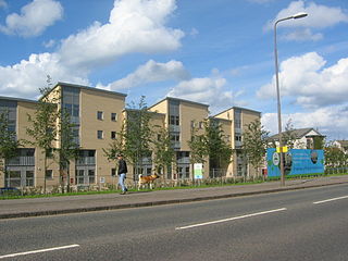
Glasgow, the largest city in Scotland, has several distinct styles of residential buildings. Building styles reflect historical trends, such as rapid population growth in the 18th and 19th centuries, deindustrialisation and growing poverty in the late 20th century, and civic rebound in the 21st century.

Muirhouse is a residential suburb in the south-east of Motherwell, North Lanarkshire, Scotland, coming under the Motherwell South East & Ravenscraig council ward and bordering the Flemington neighbourhood in the town, plus the Craigneuk and Netherton areas of Wishaw. It consists of thirteen tower blocks, amidst low rise flats and numerous houses.

Cavers is a parish in the Scottish Borders area of Scotland, in the former county of Roxburghshire, south and east of Hawick. The largest village in the parish is Denholm.
Ebenezer James MacRae was a Scottish architect serving as City Architect for Edinburgh for most of his active life.

Forth is one of the seventeen wards used to elect members of the City of Edinburgh Council. Established in 2007 along with the other wards, it currently elects four Councillors. Its territory covers communities in the north of the city between Ferry Road and the coast on the Firth of Forth, including Granton, Newhaven, Pilton, Trinity, Victoria Park and Wardie, some of which historically fell within the boundaries of Leith. A 2017 boundary change caused the loss of the Muirhouse neighbourhood, but housebuilding elsewhere meant the overall population increased slightly. In 2019, the ward had a population of 31,823.

Gracemount is a neighbourhood in the south of Edinburgh, Scotland, bordering Alnwickhill and Kaimes to the west, Liberton to the north, Gilmerton to the east and Southhouse to the south.
