
Craigievar Castle is a pinkish harled castle or fortified country house 6 miles (9.7 km) south of Alford, Aberdeenshire, Scotland. It was the seat of Clan Sempill and the Forbes family resided here for 350 years until 1963, when the property was given to the National Trust for Scotland by William Forbes-Sempill, 19th Lord Sempill. The setting is among scenic rolling foothills of the Grampian Mountains, and the contrast of its massive lower storey structure to the finely sculpted multiple turrets, gargoyles and high corbelling work to create a classic fairytale appearance.
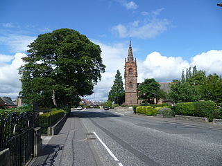
Craiglockhart is a suburb in the south west of Edinburgh, Scotland, lying between Colinton to the south, Morningside to the east Merchiston to the north east, and Longstone and Kingsknowe to the west. The Water of Leith is also to the west.
Silverknowes is a district of Edinburgh, Scotland. Silverknowes lies to the northwest of the city. The district contains over 2000 homes, ranging in size from bungalow to semi-detached housing, much of it built during the mid-twentieth century.

Cameron Toll is a suburb located to the south of Edinburgh, Scotland. Originally it was the site of a toll house built in the early 19th century, which was located on a stretch of road between Edinburgh and Dalkeith. Today the area is home to Cameron Toll Shopping Centre, which opened in 1984. The meaning of the name Cameron is suggested to be 'crooked hill', derived from the Scots Gaelic 'cam', crooked, and Old Irish 'brun' meaning hill, believed to refer to Arthur's Seat clearly visible nearby; the original name may have been Pictish. There are a few small housing estates to the east of the area.

Mortonhall is an area of Edinburgh, Scotland, on the south edge of the city.

East Craigs is a residential district of Edinburgh located in the north-west of the city, on the western flanks of Corstorphine Hill. It lies next to the green belt, and prior to development was a working farm.

The Calders is a residential neighbourhood in Edinburgh, Scotland – not to be confused with the Calders of West Lothian aka West Calder, Mid Calder and East Calder, three separate villages. It is sometimes considered to be part of Wester Hailes or Sighthill, larger developments to its south and east respectively. From 2007 to 2017, it fell within the Sighthill/Gorgie multi-member ward of the City of Edinburgh Council administration along with Sighthill, but following a boundary change has been in the Pentland Hills ward since then, along with Wester Hailes.
Pilton is a residential area of northern Edinburgh, Scotland. It is to the north of Ferry Road, immediately east of Muirhouse, and to the west and south of Granton.

The Braid Hills form an area towards the south-western edge of Edinburgh, Scotland.
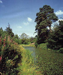
Cammo is a northwestern suburb of Edinburgh, the capital of Scotland. It is south of A90, at the edge of the city, approximately 6 miles from the city centre.
Easter Road is an arterial road in north Edinburgh, the capital of Scotland. The road is so called as it was known as the "Easter (eastern) road to Leith". As maps of Edinburgh in the late 18th century show, it had a counterpart in "Wester Road". Until the creation of Leith Walk in the middle of the 17th century these were the two main routes from Leith to Edinburgh. Historic personages who have ridden up Easter Road have included Mary, Queen of Scots (1561) and Oliver Cromwell.

Greenhill is a small area of Edinburgh, the capital of Scotland. Situated south of the city centre, Greenhill is normally taken to be part of Bruntsfield, which skirts it to the north. Greenhill borders Marchmont and The Grange to the east, Morningside to the south, and Merchiston, beyond Holy Corner, to the west. It comprises a mixture of Georgian and Victorian villas and some tenement housing.
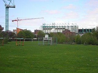
Lochend is a mainly residential suburb of Edinburgh, the capital of Scotland. It is named after Lochend Castle and the adjacent Lochend Loch, located in the western part of Restalrig on the boundary between Leith and The Canongate, approximately two miles from Edinburgh city centre. The suburb consists largely of a 1930s public housing estate, and is bounded on the west by Easter Road.
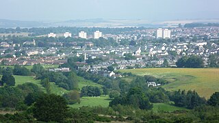
Moredun is a district in the south-east of Edinburgh, the capital of Scotland. It is east of Liberton, while Craigour is situated just to its north.
Muirhouse is a housing estate in the north of Edinburgh, the capital of Scotland.
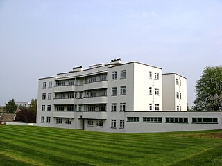
Ravelston is an area of Edinburgh, Scotland, to the west of the city centre, the east of Corstorphine and Clermiston, the north of Murrayfield, West End and Roseburn and to the south of Queensferry Road. Ravelston is often considered to be part of the larger neighbouring area of Murrayfield.
Carrick Knowe is a suburb in the west of Edinburgh in Scotland, located approximately 3 miles from the city centre. It is bordered by Tyler's Acre to the north, the Glasgow/Aberdeen railway line to the south, Carrick Knowe Golf Course to the east, and Saughton Road North to the west. The catchment area for the primary school encompasses this entire area. It is often considered part of Corstorphine, however it has its own shopping areas, primary school, parish church and public park.

Murieston is a primarily residential district on the southern edge of Livingston, West Lothian, Scotland. It lies to the south-east of Bellsquarry.
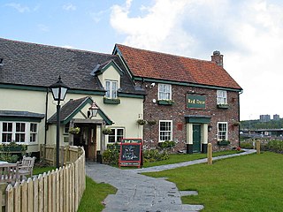
Balloch is an area of Cumbernauld, Scotland, located north of the M80 motorway and west of Cumbernauld Town Centre. It is also known as Eastfield or Balloch Eastfield. Nearby neighbourhoods include Smithstone, Westfield and Craigmarloch.

Craig House is a historic house and estate located on Easter Craiglockhart Hill, between the Craiglockhart and Morningside areas of Edinburgh, Scotland. Old Craig House dates from the 16th century, and succeeded an earlier building. In the late 19th century it was purchased by the Royal Edinburgh Hospital, and the site was developed as Craig House Hospital, a psychiatric hospital, including substantial new buildings. Following refurbishment, the site was opened in 1996 as the Craighouse Campus of Edinburgh Napier University.


