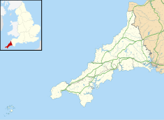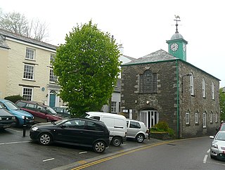
Camelford is a town and civil parish in north Cornwall, England, United Kingdom, situated in the River Camel valley northwest of Bodmin Moor. The town is approximately ten miles (16 km) north of Bodmin and is governed by Camelford Town Council. Lanteglos-by-Camelford is the ecclesiastical parish in which the town is situated. The ward population at the 2011 Census was 4,001. The town population at the same census was 865.

St Erth is a civil parish and village in Cornwall, England.

St Just, known as St Just in Penwith, is a town and civil parish in the Penwith district of Cornwall, England, United Kingdom. It lies along the B3306 road which connects St Ives to the A30 road. The parish encompasses the town of St Just and the nearby settlements of Trewellard, Pendeen and Kelynack: it is bounded by the parishes of Morvah to the north-east, Sancreed and Madron to the east, St Buryan and Sennen to the south and by the sea in the west. The parish consists of 7,622 acres (3,085 ha) of land, 12 acres (4.9 ha) of water and 117 acres (47.3 ha) of foreshore. The town of St Just is the most westerly town in mainland Britain and is situated approximately 8 miles (13 km) west of Penzance along the A3071. St Just parish, which includes Pendeen and the surrounding area, has a population of 4,637. An electoral ward of the same name also exists: the population of this ward at the same census was 4,812.

St Columb Major is a town and civil parish in Cornwall, England, United Kingdom. Often referred to locally as St Columb, it is approximately seven miles (11 km) southwest of Wadebridge and six miles (10 km) east of Newquay The designation Major distinguishes it from the nearby settlement and parish of St Columb Minor on the coast. An electoral ward simply named St Columb exists with a population at the 2011 census of 5,050. The town is named after the 6th-century AD Saint Columba of Cornwall, also known as Columb.

St Levan is a civil parish in Cornwall, England, United Kingdom. The parish is rural with a number of hamlets of varying size with Porthcurno probably being the best known. Hewn out of the cliff at Minack Point and overlooking the sea to the Logan Rock is the open-air Minack Theatre, the inspiration of Rowena Cade in the early 1930s.

St Buryan is a village and former civil parish, now in the parish of St Buryan, Lamorna and Paul in Cornwall, England, United Kingdom.

Ludgvan is a civil parish and village in Cornwall, England, UK, 2+1⁄2 miles (4.0 km) northeast of Penzance. Ludgvan village is split between Churchtown, on the hill, and Lower Quarter to the east, adjoining Crowlas. For the purposes of local government, Ludgvan elects a parish council every four years; the town elects a member to Cornwall Council under the Ludgvan division.

Altarnun is a village and civil parish in Cornwall, England, United Kingdom. It is located 7 miles (11 km) west of Launceston on the north-eastern edge of Bodmin Moor at grid reference SX 223 811.

St Agnes is a civil parish and a large village on the north coast of Cornwall, UK. The village is about five miles (8 km) north of Redruth and ten miles (16 km) southwest of Newquay. An electoral ward exists stretching as far south as Blackwater. The population at the 2011 census was 7,565.
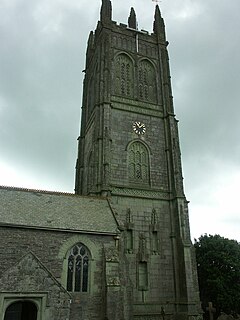
Probus is a civil parish and village in Cornwall, England, in the United Kingdom. It has the tallest church tower in Cornwall. The tower is 129 feet (39 m) high, and richly decorated with carvings. The place name originates from the church's dedication to Saint Probus. The parish population at the 2011 census was 2,299, whereas the ward population taken at the same census was 3,953.

Cury is a civil parish and village in southwest Cornwall, England, United Kingdom. It is situated approximately four miles (6 km) south of Helston on The Lizard peninsula. The parish is named for St Corentin and is recorded in the Domesday Book as Chori.

Sithney is a village and civil parish in West Cornwall, England, United Kingdom. Sithney is north of Porthleven. The population including Boscadjack and Crowntown at the 2011 census was 841.

The Church of St Buryan is a late-15th-century Church of England parish church in St Buryan in Cornwall, England.
St Kew is a village in Cornwall, England, United Kingdom. It is also the name of the civil parish, which includes the church town, St Kew, and nearby St Kew Highway.

Cardinham is a civil parish and a village in mid Cornwall, England, United Kingdom. The village is situated approximately three-and-a-half miles (6 km), east-northeast of Bodmin. The hamlets of Fletchersbridge, Millpool, Milltown, Mount, Old Cardinham Castle and Welltown are in the parish.
James Paynter was the leader of a Jacobite uprising in Cornwall in the 18th century.

St Breward is a civil parish and village in Cornwall, England, United Kingdom. It is on the western side of Bodmin Moor, about 6 miles (10 km) north of Bodmin. At the 2011 census the parish population including Cooksland and Fentonadle was 919.

Merther is a small hamlet 2 miles (3 km) east of Truro in Cornwall, England. It lies on the eastern side of the Tresillian River in the civil parish of St Michael Penkevil. It was formerly the churchtown of the small parish of Merther, and also the site of a manor house and medieval chapel dedicated to St Cohan. The former parish church is now in ruins.
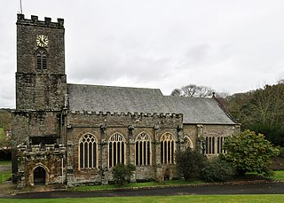
Christianity in Cornwall began in the 4th or 5th century AD when Western Christianity was introduced into Cornwall along with the rest of Roman Britain. Over time it became the official religion, superseding previous Celtic and Roman practices. Early Christianity in Cornwall was spread largely by the saints, including Saint Piran, the patron of the county. Cornwall, like other parts of Britain, is sometimes associated with the distinct collection of practices known as Celtic Christianity but was always in communion with the wider Catholic Church. The Cornish saints are commemorated in legends, churches and placenames.
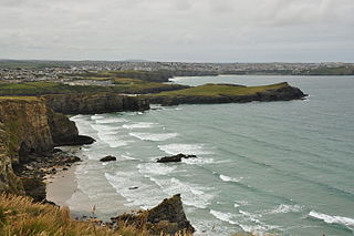
Cornish promontory forts, commonly known in Cornwall as cliff castles, are coastal equivalents of the hill forts and Cornish "rounds" found on Cornish hilltops and slopes. Similar coastal forts are found on the north–west European seaboard, in Normandy, Brittany and around the coastlines of the British Isles, especially in Wales, Scotland and Ireland. Many are known in southwest England, particularly in Cornwall and its neighbouring county, Devon. Two have been identified immediately west of Cornwall, in the Isles of Scilly.

