
Dillingham, also known as Curyung, is a city in Dillingham Census Area, Alaska, United States. Incorporated in 1963, it is an important commercial fishing port on Nushagak Bay. As of the 2020 census, the population of the city was 2,249, down from 2,329 in 2010.

Cordova is a city in Chugach Census Area, Alaska, United States. It lies near the mouth of the Copper River, at the head of Orca Inlet on the east side of Prince William Sound. The population was 2,609 at the 2020 census, up from 2,239 in 2010.
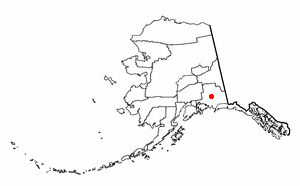
Glennallen is a census-designated place (CDP) in the Copper River Census Area in the Unorganized Borough of the U.S. state of Alaska. As of the 2020 census, the population of the CDP was 439, down from 483 in 2010. It is the most populated community in the census area.

The Copper River or Ahtna River, Ahtna Athabascan ‘Atna’tuu, "river of the Ahtnas", Tlingit Eeḵhéeni, "river of copper", is a 290-mile (470 km) river in south-central Alaska in the United States. It drains a large region of the Wrangell Mountains and Chugach Mountains into the Gulf of Alaska. It is known for its extensive delta ecosystem, as well as for its prolific runs of wild salmon, which are among the most highly prized stocks in the world. The river is the tenth largest in the United States, as ranked by average discharge volume at its mouth.

Glacier Bay National Park and Preserve is an American national park located in Southeast Alaska west of Juneau. President Calvin Coolidge proclaimed the area around Glacier Bay a national monument under the Antiquities Act on February 26, 1925. Subsequent to an expansion of the monument by President Jimmy Carter in 1978, the Alaska National Interest Lands Conservation Act (ANILCA) enlarged the national monument by 523,000 acres on December 2, 1980, and created Glacier Bay National Park and Preserve. The national preserve encompasses 58,406 acres of public land to the immediate northwest of the park, protecting a portion of the Alsek River with its fish and wildlife habitats, while allowing sport hunting.

Wrangell–St. Elias National Park and Preserve is an American national park and preserve managed by the National Park Service in south central Alaska. The park and preserve were established in 1980 by the Alaska National Interest Lands Conservation Act. The protected areas are included in an International Biosphere Reserve and are part of the Kluane/Wrangell–St. Elias/Glacier Bay/Tatshenshini-Alsek UNESCO World Heritage Site. The park and preserve form the largest area managed by the National Park Service with a total of 13,175,799.07 acres, an expanse larger than nine U.S. states and around the same size as Bosnia and Herzegovina or Croatia. 8,323,147.59 acres are designated as the national park, and the remaining 4,852,652.14 acres are designated as the preserve. The area designated as the national park alone is larger than the 47 smallest American national parks combined and is more than twice the size of all but two other national parks. Its area makes up over 15% of all national park designated land in the United States.

The Copper River and Northwestern Railway (CR&NW) consisted of two rail lines, the Copper River line and the Northwestern line. Michael James Heney had secured the right-of-way up the Copper River in 1904. He started building the railway from Cordova, Alaska in 1906. The town of Cordova, Alaska, was actually named by Heney on March 13, 1906, based on the original name given by Salvador Fidalgo. Both these railroads were abandoned and little remains of them. A 0-4-0 locomotive, "Ole", located near Goose City on a siding of the Alaska Anthracite Railroad Company is the only equipment left. Many of the holdings of the CR&NW railroad including Ole were acquired for this railroad by Mr. Clark Davis and his partners in 1908 after a major storm destroyed the Katalla area facilities in 1907. The town of Cordova would like to move Ole to a memorial site in Cordova to celebrate its role in these railroads. Ole was declared eligible for the National Register of Historic Places in 1988.

Wood-Tikchik State Park is a state park in the U.S. state of Alaska north of Dillingham. Over 1,600,000 acres (650,000 ha) (6,500 km2) in area—about the size of the state of Delaware—, comprising more than half of all state park land in Alaska and 15% of the total state park land in the country. Despite being the largest state park in the nation, the park had no staff whatsoever for its first five years, and even now at times only a single ranger is in charge of patrolling the entire park, usually by aircraft.

Southwest Alaska is a region of the U.S. state of Alaska. The area is not exactly defined by any governmental administrative region(s); nor does it always have a clear geographic boundary.

Hinchinbrook Island is an island in the Gulf of Alaska lying at the entrance to Prince William Sound in the state of Alaska, United States. The island has a land area of 171.98 sq mi (445.438 km²), making it the 37th largest island in the United States. There was a population of five permanent residents as of the 2000 census.

Pebble Mine is the common name of a proposed copper-gold-molybdenum mining project in the Bristol Bay region of Southwest Alaska, near Lake Iliamna and Lake Clark. Discovered in 1987, optioned by Northern Dynasty Minerals in 2001, explored in 2002, drilled from 2002-2013 with discovery in 2005. Preparing for the permitting process began and administrative review lasted over 13 years.
Gold mining in Alaska, a state of the United States, has been a major industry and impetus for exploration and settlement since a few years after the United States acquired the territory in 1867 from the Russian Empire. Russian explorers discovered placer gold in the Kenai River in 1848, but no gold was produced. Gold mining started in 1870 from placers southeast of Juneau, Alaska.
Boswell Bay Airport is owned by the U.S. Forest Service and is located near Boswell Bay, in the Valdez–Cordova Census Area, Alaska of the U.S. state of Alaska. The airfield was constructed in 1968 to serve the nearby White Alice radar site, now abandoned.
Day Harbor is a bay on the Kenai Peninsula of Alaska, United States. It received its name in 1787 from Captain Portlock, due to the fact that travel to the head of the bay from Seward typically takes 12 hours. The bay is 25 miles from Seward, and is accessible only by boat. It is a gently curving J-shaped bay separated on the west from nearby Resurrection Bay by the Resurrection Peninsula. Recreational boaters often anchor at one of the two State Marine Parks due to the often choppy seas and unstable weather of outer Day Harbor. Lesser used anchorages on the eastern shore include Anchor Cove and Bowen Anchorage. Popular activities in the bay include hiking to Ellsworth Lake at the head of the bay where the retreating Ellsworth Glacier calves.

Chilkat State Park is a 9,837-acre Alaska state park on a peninsula south of the town of Haines, Alaska between the Chilkat and Chilkoot inlets. Remote and known for the steep 14% grade gravel access road, the park offers campsites with minimal amenities and is open to fishing, hiking, boating, sea kayaking, and sightseeing. The campground is closed from October to mid-May due to winter concerns.
Bettles Bay State Marine Park is a 679-acre undeveloped Alaska state marine park. There is no road access to the park. The park can be accessed from the lagoon northeast of the islands. The park offers great views of Bettles Glacier. Attractions include an old stamp press and gold mine, just southeast of the park.
Canoe Passage State Marine Park is an undeveloped 2,507 acre Alaska State Park on Hawkins Island. The state park is 8 miles west of Cordova. There is no road access to the island. Popular activities include boating, fishing, hunting, camping, and kayaking. The park is surrounded by forested uplands and wetlands.
Shoup Bay is an inlet of Port Valdez inside the Valdez Arm of Prince William Sound in Alaska. steep-walled, flat-bottomed basin with a depth of approximately 200 ft. described as a hanging valley that formed during more extensive Pleistocene glaciation. Located eight miles west of Valdez, Alaska, United States, it is fed by Shoup Glacier, as well as McCallister Creek, Palmer Creek, and Uno Creek. The bay itself opens into the Valdez Narrows and is included as part of the Shoup Bay State Marine Park.
