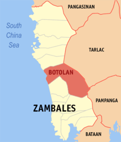
Botolan, officially the Municipality of Botolan, is a municipality in the province of Zambales, Philippines. According to the 2024 census, it has a population of 70,340 people.[6]
The name Botolan came from the a native variety of banana common in the area called "Boto-an". The word "Boto-an" is a Sambal word which combines the word botol which means "seeds" and the locative prefix -an, referring to a place with many seeded bananas.[7]
In the 2020 census, the population of Botolan was 66,739 people,[16] with a density of 91 inhabitants per square kilometre or 240 inhabitants per square mile.
The beach at Barangay Beneg, looking south towards the Bucao River
The barangay of Binoclutan is the "Beach Capital" of Botolan, featuring several first class resorts. The area is a habitat of sea turtles, as is all of the Zambales coastline. Olive Ridley, Green turtles and Hawksbill turtles nest along the beaches of Botolan every year between September and January. A turtle hatchery located is located in Binoklutan. The area also has many other attractions, beach resorts, waterfalls, hiking paths, views of the lahar fields left by the 1991 eruption of Mount Pinatubo, and views of Mount Pinatubo itself.
The Fiesta Poon Bato, held January 23–24, is a religious festival that attracts up to 500,000 devotees. Features include cultural dancing from local Aeta tribes in the town plaza on the first night.
The Domorokdok Festival, held May 3–4, includes street parades, street dancing, a beauty pageant and displays of Botolan products and industries.
Ina Poon Bato
Left: Original Statue of Apo Apang (Aglipayan Church), Right: Replica Statue of Ina Poon Bato (Roman Catholic).
The Ina Poón Bató is a purportedly miraculous, syncretised image of the Blessed Virgin Mary.[25] Legend has it that before the arrival of the Spanish in the area sometime in the 17th century, local Aeta peoples had discovered a carved wooden statue on a large rock and began worshipping the image. On the arrival of Recollect missionaries in 1607, the natives associated the statue with the Roman Catholic depictions of the Virgin Mary, and the image was subsequently Christianised as Ina Poonbato (Our Lady of Poonbato) .[25] The original image was previously in the Recollect missionaries’ custody. During the Philippine Revolution, the Filipino revolutionaries took the image and enshrined it in an Aglipayan Church.
The Catholic image was canonically blessed by Pope John Paul II in 1985 at a ceremony in Vatican City.[26] After the 1991 eruption of Mount Pinatubo destroyed the original village of Poonbato, the patio image (which was found intact and buried chest-deep in lahar)[27] and its shrine were moved to the nearby resettlement area of Loob-Bunga.[28] The feast of Ina Poón Bató is celebrated every late January, with devotees flocking to the original image inside a chapel belonging to the Aglipayan Church, and the 1976 replica enshrined in the Catholic chapel.[27]
Education
There are two schools district offices which govern all educational institutions within the municipality. They oversee the management and operations of all private and public, from primary to secondary schools.[29]
Primary and elementary schools
Alao Elementary School
Baquilan I Resettlement School
Baquilan II Resettlement School
Batonlapoc Elementary School
Belbel Elementary School
Beneg Elementary School
Bihawo Elementary School
Binoclutan Elementary School
Botolan South Central School
Burgos Elementary School
Casa Mambog Learning Center
Danacbunga Elementary School
Fountain of Blessings Development Center
Kainomayan Village Elementary School
Loob-Bunga I Elementary School
Loob-Bunga II Elementary School
Loob-Bunga III Elementary School
Moraza Elementary School
New Taugtog I Elementary School
New Taugtog II Elementary School
Owaog-Nebloc Elementary School
Paitan Elementary School
Palis Elementary School
Panan Elementary School
Paudpod Elementary School
Parel Elementary School
San Isidro Elementary School
Sta. Monica Parochial Institute (Elementary)
Secondary schools
Bancal Integrated School
Bangan-Capayawan Integrated School
Baquilan Resettlement High School
Beneg National High School
Botolan National High School
Botolan North Integrated School
Bucao Integrated School
Dojoc Balite Integrated School
Cabatuan Integrated School
Carael Integrated School
Lakas High School
Loob Bunga High School (Resettlement School)
Lyceum of Central Luzon
Lyceum of Western Luzon
Maguisguis Integrated School
Mambog Integrated School
Nacolcol Integrated School
New Taugtog National High School
Panan National High School
Poonbato Integrated School
Porac Integrated School
San Juan Integrated School
Santiago Integrated School
Sta. Monica Parochial Institute
Villar Integrated School
Higher educational institutions
Columban College
Micro Asia College of Science and Technology
Mother Theresa Collegio de Zambales
Technological College
References
12"Municipalities". Zambales Now, Official Website of Zambales. Retrieved on 2012-05-24.
This page is based on this Wikipedia article Text is available under the CC BY-SA 4.0 license; additional terms may apply. Images, videos and audio are available under their respective licenses.