San Narciso, officially the Municipality of San Narciso (Ilocano: Ili ti San Narciso; Tagalog: Bayan ng San Narciso; Sambal: Babali nin San Narciso), is a municipality in the province of Zambales, Philippines. According to the 2024 census, it has a population of 32,180 people.[5]
The Municipality of San Narciso was founded in the early part of 18th century. The migrants from the Ilocandia arrived in the area and established their settlement in Alusiis which was the first name of the pueblo that later became San Narciso.
San Narciso became the official name of the town by a Royal Decree issued by the Spanish Governor General Narciso Claveria and Archbishop Jose Soque on February 12, 1846.
The people of San Narciso participated in the Philippine Revolution against Spain. When the Katipunan was organized by Andres Bonifacio and sent his representatives to San Narciso, many prominent men of the town became members. Pantaleon Dumlao became the head of the local organization.
Geography
San Narciso is located in a relatively flat plain. West of the town is the South China Sea and to the east is bordered by the Sto. Tomas river are the Zambales Mountain Ranges. Average elevation is 3.6 metres (12ft) above sea level and the highest elevation is 800 metres (2,600ft) above sea level.
It is 41 kilometres (25mi) from Iba, 37 kilometres (23mi) from Olongapo, and 163 kilometres (101mi) from Manila.
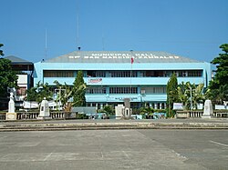
Barangays
San Narciso is subdivided into 17 barangays, as indicated below.[6] Each barangay consists of puroks and some have sitios.
San Narciso has a tropical monsoon climate (Am) with little to no rainfall from November to April and heavy to extremely heavy rainfall from May to October.
In the 2020 census, the population of San Narciso, Zambales, was 30,759 people,[13] with a density of 430 inhabitants per square kilometre or 1,100 inhabitants per square mile.
The town is mostly agricultural with most families owning farmland to plant rice and other crops such as string beans, onions and other vegetables. Commerce is centered in the town center and the public market. There are also a number of poultry and pig farms in the municipality mostly located in the outskirts. In recent years, tourism has increased in the municipality. Due to its close proximity to Manila which is just a 3-hour drive away, many residents of the capital visit its beaches specially around summertime. This in effect has increased the economic activity in the municipality and have provided jobs and opportunities to its residents.
Culture
The first settlers of San Narciso came from Paoay, Ilocos Norte and Agno, Pangasinan which was then a part of Zambales. They brought forth with them customs and traditions such as honoring their dead thru prayers and novenas. Family members and relatives come together to offer prayers and recite names of deceased relatives. One unique part about these practices is the serving of food, usually pancit, puto and ginataang bilo-bilo or what locals call tambo-tambong. It is a local delicacy made from glutinous rice balls, cassava, banana, jackfruit, coconut milk and tapioca pearls.
June 1906-Jan. 8, 1908 Simeon Villanueva Presidente Municipal
June 9, 1908-Dec. 1909 Angle Dumlao Presidente Municipal
1910–1912 Victor Amos Presidente Municipal
1912–1916 Mariano Villanueva Presidente Municipal
1916–1919 Marcos Fuerte Presidente Municipal
1919–1922 Severino Fuertes Presidente Municipal
1922–1925 Paulino Delos Santos Presidente Municipal
1926–1931 Esteban Florita Presidente Municipal
1932–1934 Donato Amon Presidente Municipal
Commonwealth
1934–1940 Ireneo Delos Reyes Municipal Mayor
1941-Oct. 1942 Pacifico Fuerte Municipal Mayor
Japanese Occupation
Oct. 1942–1944 Sebastian Fogata Municipal Mayor
Liberation Military Government
February 1945 Gerardo Evangelista Municipal Mayor
May 1945 – July 1946 Pacifico Fuerte Municipal Mayor
1947–1948 Severino Fuertes Municipal Mayor
Republic of the Philippines
Aug. 1948–1955 Sebastian Fogata Municipal Mayor
Jan. 1956–1960 Jose Delos Santos Municipal Mayor
Jan. 1960–1963 Sebastian Fogata Municipal Mayor
Jan. 1963–1986 Francisco A. Galvez, Jr. Municipal Mayor
1986–1989 Quirico F. Abrajano, Jr. Municipal Mayor
1989–1992 Francisco A. Galvez, Jr. Municipal Mayor
1992–2001 Quirico F. Abrajano, Jr. Municipal Mayor
2001 – 2010 William T. Lim Municipal Mayor
2010 - 2016 Peter T. Lim Municipal Mayor
2016 to 2019 La Rainne Abad-Sarmiento Municipal Mayor
2019 to 2022 William T. Lim Municipal Mayor
2022 to present La Rainne Abad-Sarmiento Municipal Mayor
Tourism
San Narciso is famous for its beaches located in the west coast of Luzon, facing the South China Sea that are suited for surfing.
Education
The San Narciso Schools District Office governs all educational institutions within the municipality. It oversees the management and operations of all private and public, from primary to secondary schools.[22]
The Philippine Merchant Marine Academy or PMMA is located here. San Narciso also houses the Magsaysay Memorial College of Zambales,Inc, which offers elementary and secondary education, bachelors courses and other 2-year courses. Also located in San Narciso is the Zambales Academy, one of the oldest secondary education institutions in the province. It is where former president Ramon Magsaysay took his secondary education.
This page is based on this Wikipedia article Text is available under the CC BY-SA 4.0 license; additional terms may apply. Images, videos and audio are available under their respective licenses.