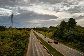
Autoroute 5 is a short controlled-access Autoroute in the Outaouais region of western Quebec. It connects the central urban area of Gatineau with the recreational areas of Gatineau Park and the exurban rural areas of Chelsea and La Pêche. The southern terminus provides access to the Macdonald-Cartier Bridge, which continues into downtown Ottawa. The A-5 generally has four lanes of traffic with the exception of southernmost section across the Macdonald-Cartier Bridge where A-5 widens to six lanes.
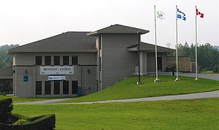
Cantley is a rural municipality in Quebec, Canada, north of the city of Gatineau, east of the Gatineau River, located within Canada's National Capital Region approximately 17 km (11 mi) from Parliament Hill. Cantley is one of six municipalities within the Collines-de-l'Outaouais Regional County Municipality. Its roots are in farmland and mining, but recent housing projects since its creation in 1989 have resulted in a high rate of population growth. The population at the 2021 Canadian Census was 11,449, an increase of 7.0% from the 2016 population of 10,699. French is the first language of 86.7% of Cantley's residents.

Mont-Tremblant is a city in the Laurentian Mountains of Quebec, Canada, approximately 130 kilometres (81 mi) northwest of Montreal and 140 kilometres (87 mi) northeast of Ottawa, Ontario. The current municipality with city status was formed in 2000. Mont-Tremblant is most famous for its ski resort, the Mont-Tremblant Ski Resort, which is seven kilometres from the village proper, at the foot of a mountain called Mont Tremblant.
Boulevard Gréber is an important principal arterial road in Gatineau, Quebec. It runs from Montee Paiement to the Gatineau River. It is named after French urban planner Jacques Gréber. It was once part of Route 148 of the provincial network.
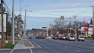
Boulevard Maloney is one of Gatineau's main commercial roads. It starts at Autoroute 50 via an incomplete interchange and ends at the boundary with the former city of Masson-Angers. It is also known as Route 148. However, one may notice a blue shield sign of the highway on the westbound lane at Boulevard Gréber even if it is not the highway itself as the western portion previous terminated at Maloney before more extensions towards Masson-Angers were made in 1986. Route 148 continues further east through Buckingham towards Laval. Prior to the construction of A-50, was the main roadway through the urban community towards Montreal, the Papineau region and the Laurentides.
Boulevard Saint-Joseph is a commercial boulevard in the former city of Hull, Quebec. It runs from Boulevard Alexandre-Taché to the boundaries of the Gatineau and the suburban town of Chelsea.

The Rapibus is a bus rapid transit system for the Société de Transport de l'Outaouais (STO) in the city of Gatineau, Quebec. Construction was completed in the summer of 2013 with service beginning in the fall. The Rapibus aims to speed up the service for commuters in growing sub-divisions in the northern and eastern areas of the city by alleviating the congestion on key arteries currently served by bus-designated lanes. A direct link to Ottawa is included.
Boulevard Alexandre-Taché is an east-west road located in the city of Gatineau, Quebec. It is named in honour of former member for the Hull electoral district, Alexandre Taché, who served for 15 years with the Union Nationale when the political party was in power under the leadership of Maurice Duplessis.

Boulevard des Allumettières is a major 13.7 km arterial road in Gatineau, Quebec, Canada, that connects Aylmer and Hull sectors of the city running from Eardley Road to the Alexandra Bridge towards Ottawa. It is the most recent east-west arterial connection from the West to the downtown core and construction of the entire length was completed during the fall of 2007.
Boulevard Saint-Raymond is a major boulevard located in Gatineau, Quebec. It starts at Boulevard Saint-Joseph and ends at Boulevard Alexandre-Tache just west of the limits between the Hull and Aylmer sectors. Before 2003, it ended at Chemin Pink but since then it includes the former section of Chemin de la Montagne Sud.

Route 117, the Trans Canada Highway Northern Route, is a provincial highway within the Canadian province of Quebec, running between Montreal and the Quebec/Ontario border where it continues as Highway 66 east of McGarry, Ontario. It is an important road since it is the only direct route between southern Quebec and the Abitibi-Témiscamingue region.
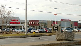
Les Promenades Gatineau is a major shopping centre located in Canada's National Capital Region in the city of Gatineau, Quebec. The mall is the intersection of Gréber and Maloney Boulevards, one of the city's busiest intersections, and is just off Autoroute 50. It is the city's largest shopping mall by retail space and by shoppers.

List of neighbourhoods in the City of Gatineau, Quebec, Canada.

The École Polyvalente Le Carrefour is a public high school located in Gatineau, Quebec. It is run by the Commission Scolaire des Draveurs school board in Gatineau and enrolls over 2 300 students and employs a staff of about 175 including teachers, administration and custodial staff.
École Secondaire Mont-Bleu is a French-language public secondary school located in Gatineau, Quebec. It is located on Boulevard Cité des Jeunes in the Hull sector just on the eastern flank of the Gatineau Park, one of the National Capital Region's touristic destination. This school is among several other educational institutions located on Cite des Jeunes along with the CEGEP de l'Outaouais, Heritage College and Asticou Centre. Its facilities opened in 1976 and is run by the Commission Scolaire des Portages-de-l'Outaouais school board.

The Centre de services scolaire des Draveurs is one of 4 public Francophone school service centres operating in the Outaouais region, Quebec. The school board was created in 1986 in the old city of Gatineau about 15 years before amalgamation. The board is responsible for primary, secondary and adult schools located in the former city of Gatineau as well as in the municipalities of Val-des-Monts and Cantley located north of Gatineau. Its current president is Christine Emond-Lapointe, a former Bloc Québécois candidate for the riding of Pontiac in the 2006 Canadian federal elections. The general manager is Francois Jette.
The Centre de services scolaire des Portages-de-l'Outaouais (CSSPO) is one of 4 public school service centres operating in the Outaouais, Quebec.
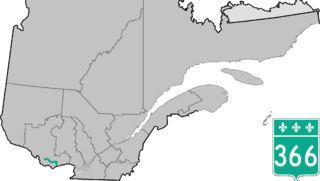
Route 366 is a secondary highway in the Outaouais region of Quebec. It runs from Route 301 near Creemorne in the Pontiac to Route 148 in the city of Gatineau.
The Commission scolaire de la Seigneurie-des-Mille-Îles (CSSMI) is a former francophone school district in the Canadian province of Quebec. It comprises several primary schools and high schools across municipalities in the Laurentides region. The commission is overseen by a board of elected school trustees.