Alexandre Gustave Eiffel was a French civil engineer. A graduate of École Centrale des Arts et Manufactures, he made his name with various bridges for the French railway network, most famously the Garabit Viaduct. He is best known for the world-famous Eiffel Tower, designed by his company and built for the 1889 Universal Exposition in Paris, and his contribution to building the Statue of Liberty in New York. After his retirement from engineering, Eiffel focused on research into meteorology and aerodynamics, making significant contributions in both fields.

Wakefield is one of many villages of the municipality of La Pêche, with the village centre on the western shore of the Gatineau River, at the confluence of the La Pêche River in the Outaouais region of the province of Quebec in Canada. It is thirty-five kilometres northwest of Ottawa, Ontario. The village, named after the city of Wakefield in West Yorkshire, England, is now the southern edge of the municipality of La Pêche, and was founded in 1830 by Irish, Scottish, and English immigrants. Wakefield is approximately a twenty-five-minute drive north of the Macdonald-Cartier Bridge that divides Gatineau and Ottawa (Ontario), along the Autoroute 5, a modern four lane divided highway which has recently been extended to the village. Wakefield is unique as a primarily Anglophone town in a primarily Francophone province.
Bytown is the former name of Ottawa, Ontario, Canada. It was founded on September 26, 1826, incorporated as a town on January 1, 1850, and superseded by the incorporation of the City of Ottawa on January 1, 1855. The founding was marked by a sod turning, and a letter from Governor General Dalhousie which authorized Lieutenant Colonel John By to divide up the town into lots. Bytown came about as a result of the construction of the Rideau Canal and grew largely due to the Ottawa River timber trade. Bytown's first mayor was John Scott, elected in 1847.

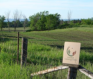
The Greenbelt is a 203.5-square-kilometre (78.6 sq mi) protected green belt traversing Ottawa, Ontario, Canada. It includes green space, forests, farms, and wetlands from Shirleys Bay in the west and to Green's Creek in the east. It is the largest publicly owned green belt in the world and the most ecologically diverse area in Eastern Ontario. The National Capital Commission (NCC) owns and manages 149.5 square kilometres (57.7 sq mi), and the rest is held by other federal government departments and private interests. Real estate development within the Greenbelt is strictly controlled.

The Senate of Canada Building is a government building and former railway station that serves as the temporary seat of the Senate of Canada. Located at 2 Rideau Street in downtown Ottawa, it was known as Ottawa Union Station and served as the city's central railway station from 1912 until 1966. From 1966 to 2018, it was operated by the Government of Canada as the Government Conference Centre. The building currently includes a temporary Senate chamber, as well as some Senate offices and committee rooms.

Billings Bridge is a bridge over the Rideau River in Ottawa. Bank Street passes over the river by way of this bridge. The bridge was named after Braddish Billings, who settled in this area and established a farm nearby in 1812. The first bridge, originally called Farmers Bridge, was built over the river here in 1830. The current bridge was built in 1916.

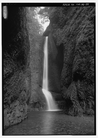
Oneonta Gorge is a scenic gorge located in the Columbia River Gorge area of the American state of Oregon. The U.S. Forest Service has designated it as a botanical area because of the unique aquatic and woodland plants that grow there. Exposed walls of 25-million-year-old basalt are home to a wide variety of ferns, mosses, hepatics, and lichens, many of which grow only in the Columbia River Gorge. Oneonta Gorge with its 50 species of wildflowers, flowering shrubs and trees has been described as "one of the true dramatic chasms in the state." The Oneonta Gorge Creek Bridge is listed on the National Register of Historic Places.

The Chaudière Falls, also known as the Kana:tso or Akikodjiwan Falls, are a set of cascades and waterfall in the centre of the Ottawa-Gatineau metropolitan area in Canada where the Ottawa River narrows between a rocky escarpment on both sides of the river. The location is just west of the Chaudière Bridge and Booth-Eddy streets corridor, northwest of the Canadian War Museum at LeBreton Flats and adjacent to the historic industrial E. B. Eddy complex. The islands surrounding the Chaudière Falls, counter-clockwise, are Chaudière Island, Albert Island, little Coffin Island was just south of Albert Island but is now submerged, Victoria Island and Amelia Island,, Philemon Island was originally called the Peninsular Village by the Wrights but became an island when the timber slide was built in 1829 it is now fused to south shore of City of Gatineau, and Russell Island, now submerged, was at the head of the Falls before the Ring dam was built. The falls are about 60 metres (200 ft) wide and drop 15 metres (49 ft). The area around the falls was once heavily industrialized, especially in the 19th century, driving growth of the surrounding cities.

Ruisseau de la Brasserie is a small creek that forms the northern and western shores of Île Hull. It circles the downtown of the Hull sector, of Gatineau, Quebec. It runs from the Ottawa River just west of downtown Hull. Running west of Montcalm Street it turns east north of the highway, running up to Jacques Cartier Park where it rejoins the Ottawa River. In the 1980s the area was refurbished by the National Capital Commission. The former water works on a small island in the creek became the Théâtre de l'Île and the Montcalm Street Bridge was replaced by the ornate Tour Eiffel Bridge. Its pollution removed, it has become a popular location for birders.
The Hull-Ottawa fire of 1900 was a devastating fire in 1900 that destroyed much of Hull, Quebec, and large portions of Ottawa, Ontario.

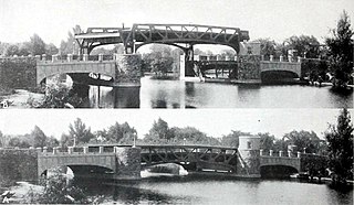
The Cornwall Railway company constructed a railway line between Plymouth and Truro in the United Kingdom, opening in 1859, and extended it to Falmouth in 1863. The topography of Cornwall is such that the route, which is generally east–west, cuts across numerous deep river valleys that generally run north–south. At the time of construction of the line, money was in short supply due to the collapse in confidence following the railway mania, and the company sought ways of reducing expenditure.

The Archdiocese of Gatineau is a Latin Church ecclesiastical territory or diocese situated in the province of Quebec. The Archdiocese of Gatineau is the metropolitan of its ecclesiastical province, which also contains three suffragan dioceses: Dioceses of Amos, Mont-Laurier and Rouyn-Noranda. It is currently led by Archbishop Paul-André Durocher.

The Phoenix Iron Works, located in Phoenixville, Pennsylvania, was a manufacturer of iron and related products during the 19th century and early 20th century. Phoenix Iron Company was a major producer of cannon for the Union Army during the American Civil War. The company also produced the Phoenix column, an advance in construction material. Company facilities are a core component of the Phoenixville Historic District, a National Register of Historic Places site that was in 2006 recognized as a historic landmark by ASM International.

Findlay Creek is a suburban neighbourhood in Riverside South-Findlay Creek Ward in the south end of Ottawa, Ontario, Canada. According to the 2021 Canadian Census, the population of the community was 14,089 and there were 4,395 dwellings.

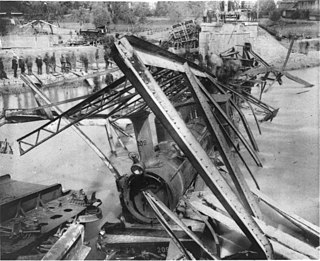
The Münchenstein rail disaster on 14 June 1891 was historically the worst railway accident ever to affect Switzerland. A crowded passenger train fell through a girder bridge, killing more than seventy people and injuring many others. The accident occurred on the railway line between Basel and Delémont, near the Bruckgut just below the village centre of Münchenstein, as the train was traversing the bridge across the river Birs.
The Plaza Bridge in Ottawa, Ontario, Canada, is an automotive and pedestrian bridge that crosses the Rideau Canal just south of the Ottawa locks. It joins Wellington Street and Elgin Street in the Downtown core to the west with Rideau Street to the east. The Chateau Laurier abuts the bridge at the east end, while Parliament Hill is just beyond the west end. It is the northernmost bridge over the canal, just north of the Mackenzie King Bridge.

The Robert Guertin Centre is a multi-purpose arena in the Hull sector of Gatineau, Quebec, with a capacity of 4,000 capacity. It was built in 1957.


