Buffalo Head Prairie | |
|---|---|
 Insignia of the Buffalo Head Prairie Co-op | |
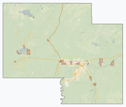 Buffalo Head Prairie Location in Mackenzie County  Buffalo Head Prairie Location in Alberta  Buffalo Head Prairie Buffalo Head Prairie (Canada)  Buffalo Head Prairie Buffalo Head Prairie (North America) | |
| Coordinates: 58°03′03″N116°20′58″W / 58.05083°N 116.34944°W | |
| Country | Canada |
| Province | Alberta |
| Region | Northern Alberta |
| Planning region | Lower Peace |
| Specialized municipality | Mackenzie |
| Government | |
| • Type | Unincorporated |
| • Governing body | Mackenzie County Council |
| Time zone | UTC−7 (MST) |
| • Summer (DST) | UTC−6 (MDT) |
| Postal code | T0H 4A0 |
| Area code | 780 |
Buffalo Head Prairie is an unincorporated community in Mackenzie County, Alberta, Canada. It is part of the Fort Vermilion School Division. [1] Schools in the area include Buffalo Head Prairie School and Blue Hills Community School. [2] [3]
It is approximately 64 kilometres (40 mi) west of Highway 88 and 64 kilometres (40 mi) southeast of High Level. It is named for the nearby Buffalo Head Hills.[ citation needed ]