Bull Creek, Western Australia

Last updated

Bull Creek
Perth,  Western Australia
Bull Creek, Western Australia, April 2006.JPG
Bull Creek
Bull Creek, Western Australia
Coordinates 32°03′23″S115°51′45″E / 32.0562543°S 115.8624527°E / -32.0562543; 115.8624527
Population8,030 (SAL 2021) [1]
Established1968
Postcode(s) 6149
LGA(s) City of Melville
State electorate(s) Riverton
Federal division(s) Tangney
Suburbs around Bull Creek:
Booragoon Brentwood Rossmoyne
Bateman Bull Creek Willetton
Murdoch Leeming Canning Vale

Bull Creek is a suburb of Perth, Western Australia, located within the local government area of City of Melville. The suburb lies to the south of a creek of the same name, which flows into the Canning River. [2]

Contents

History

Prior to European settlement, Bull Creek was inhabited by Aboriginal people from the Wadjuk Beeliar tribe. They used the wetlands as a summer source of food and fresh water. The area is significant to the Beeliar and is referred to as Gabbiljee, the watery place at the end of the river. [3]

Source of Bull Creek, Western Australia Source of Bull Creek, Western Australia.jpg
Source of Bull Creek, Western Australia
Bull Creek in the afternoon Bull Creek in the afternoon.jpg
Bull Creek in the afternoon
Grasemere Homestead, one of the oldest buildings in Western Australia. Grasmere Homestead, Brentwood, Western Australia.jpg
Grasemere Homestead, one of the oldest buildings in Western Australia.

The name was adopted by the City of Melville Council in December 1968. The creek was named after an early settler, Henry Bull [4] to whom a grant of 1.20 square kilometres (300 acres) of nearby land was made in 1830. A larger grant of 5.20 square kilometres (1,280 acres) later in that year was made to Thomas Middleton; it is this land that today makes up the largest part of the suburb. The name, Bull Creek is also often, but incorrectly, written as the single word "Bullcreek".

Education

Bull Creek is served by both government and private schools. The suburb has two state primary schools, Bull Creek Primary and Oberthur Primary. All Saints' College is a private school situated on the northern side of the suburb. Bull Creek is served by three state government high schools; Rossmoyne Senior High School takes students residing north of Parry Avenue, [5] Leeming Senior High School takes students from south of Parry Avenue. [6] Students living south of Parry Avenue and east of Wheatley Drive (both sides) can also choose to go to Willetton Senior High School. [7] There are also a number of private schools in the nearby suburbs of Bateman, Murdoch and Winthrop. Bull Creek is 2 kilometres (1.2 mi) from Murdoch University.

Transport

Bull Creek railway station is situated in the Kwinana Freeway median strip at Leach Highway, the inter-suburban Mandurah railway line running perpendicular to Leach Highway. The station features integrated bus services on the concourse level; this level operates as a bus station. The station officially opened on 23 December 2007 and services both the Perth CBD and the neighbouring city of Mandurah.

Bus

Bus routes serving Bull Creek Station only:

Bus routes serving South Street:

Rail

Facilities

On the southern side of Bull Creek on South Street, is the Stockland Bull Creek shopping centre. It has a wide range of shops including a supermarket, a large discount department store, large liquor store and bar as well as about 50 smaller speciality shops. There are also a number of fast food restaurants and banks in its vicinity. A smaller shopping area is also located in Parry Avenue and comprises an independent supermarket (open 7 days a week), chemist, newsagency, a number of small eateries and real estate agents.

The Aviation Heritage Museum is located on Bull Creek Drive. It is operated by the RAAF Association of Western Australia. [32]

Parkland

Bull Creek has numerous parks, including John Creaney Park. The reserve is named after a manager of Hooker and Rex Estates, who established the park when subdividing. [3]

Related Research Articles

<span class="mw-page-title-main">Ferndale, Western Australia</span> Suburb of Perth, Western Australia

Ferndale is a southeastern suburb of Perth, Western Australia. Its local government area is the City of Canning. It is approximately 15 kilometres (9 mi) from Perth's central business district.

<span class="mw-page-title-main">Como, Western Australia</span> Suburb of Perth, Western Australia

Como is a suburb of Perth, Western Australia. Its local government area is the City of South Perth. The suburb has a population of 12,423. Canning Highway divides the suburb.

<span class="mw-page-title-main">Booragoon, Western Australia</span> Suburb of Perth, Western Australia

Booragoon is a southern suburb of Perth, Western Australia, located within the City of Melville.

<span class="mw-page-title-main">Riverton, Western Australia</span> Suburb of Perth, Western Australia

Riverton is a southeastern suburb of Perth, the capital city of Western Australia. Its local government area is the City of Canning.

Bateman is a suburb of Perth, Western Australia, located within the City of Melville.
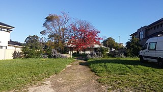
<span class="mw-page-title-main">Brentwood, Western Australia</span> Suburb of Perth, Western Australia

Brentwood is a suburb of Perth, Western Australia, located within the City of Melville and approximately 10 kilometres (6.2 mi) from the Perth CBD. The nearest airport is Perth Airport and the nearest railway station is Bull Creek.

<span class="mw-page-title-main">Murdoch, Western Australia</span> Suburb of Perth, Western Australia, Western Australia

Murdoch is a suburb of Perth, Western Australia, located within the City of Melville. Murdoch University, St John of God Hospital Murdoch and Fiona Stanley Hospital are located in Murdoch. The suburb is named after Sir Walter Murdoch.

<span class="mw-page-title-main">Winthrop, Western Australia</span> Suburb of Perth, Western Australia

Winthrop is a southern suburb of Perth, Western Australia, located within the City of Melville.

<span class="mw-page-title-main">Kewdale, Western Australia</span> Suburb of Perth, Western Australia

Kewdale is a suburb of Perth, Western Australia within the City of Belmont. Kew Street was one of the first roads in this district, hence the naming of the suburb.

<span class="mw-page-title-main">Bentley, Western Australia</span> Suburb of Perth, Western Australia

Bentley is a southern suburb of Perth, the capital city of Western Australia, 8 kilometres (5.0 mi) southeast of Perth's central business district. Its local government areas are the City of Canning and the Town of Victoria Park. Bentley is home to the main campus of Curtin University and Technology Park.

<span class="mw-page-title-main">Cannington, Western Australia</span> Suburb of Perth, Western Australia

Cannington is a southern suburb of Perth, Western Australia. Its local government area is the City of Canning.

Rossmoyne is a suburb of Perth, Western Australia, within the City of Canning. Rossmoyne is located 14 kilometres (8.7 mi) south of central Perth, and is bounded by Leach Highway to the south, the Bull Creek to the west, the Canning River to the north, and Shelley to the east. The area has a beautiful river front and many parks to walk your dogs. There is a small arcade of local shops with the popular Rossmoyne IGA, Flames Restaurant, hairdresser, newsagency, pharmacy, bottle shop and Chinese restaurant.

Shelley is a suburb of Perth, Western Australia, located within the City of Canning.

St James is a suburb shared between the Town of Victoria Park and the City of Canning in the Perth metropolitan area.

<span class="mw-page-title-main">Willetton, Western Australia</span> Suburb of Perth, Western Australia

Willetton is a large southern suburb of Perth, Western Australia. Its local government area is the City of Canning.
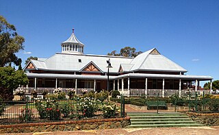
<span class="mw-page-title-main">Wilson, Western Australia</span> Suburb of Perth, Western Australia

Wilson is a suburb of Perth, Western Australia, located within the City of Canning on the north bank of the Canning River. It is a fairly old suburb with parks and close proximity to prominent shopping centres in South Perth. It is favoured by Curtin University students, the reason being its convenient access to the university. Bus numbers 72 and 75 travel through this suburb. The suburb contains Castledare, Kent Street Weir, Canning River and Lo Quay River Cafe. Wilson is located quite closely to various park, some of those being Cetenary Park, Thomas Moore Park, and Alderley Park.

<span class="mw-page-title-main">White Gum Valley, Western Australia</span> Suburb of Perth, Western Australia

White Gum Valley is a suburb of Perth, Western Australia located within the City of Fremantle. It is situated behind the main ridge that lies east of Fremantle.

<span class="mw-page-title-main">Bull Creek railway station</span> Railway station in Perth, Western Australia

Bull Creek railway station is a railway station on the Transperth network. It is located on the Mandurah line, 11.7 kilometres from Perth station inside the median strip of the Kwinana Freeway serving the suburb of Bull Creek.

<span class="mw-page-title-main">Murdoch railway station</span> Railway station in Perth, Western Australia

Murdoch railway station is a railway and bus station on the Transperth network. It is located on the Mandurah line, 13.8 kilometres (8.6 mi) from Perth station inside the median strip of the Kwinana Freeway serving the suburb of Murdoch.

<span class="mw-page-title-main">Fremantle (suburb)</span> Suburb of Perth, Western Australia

Fremantle is a Western Australian suburb located in Perth at the mouth of the Swan River, and is situated 18 kilometres (11 mi) from the Perth central business district. One of the original settlements of the Swan River Colony established in 1829 is within the area known today as this suburb.

References

  1. Australian Bureau of Statistics (28 June 2022). "Bull Creek (WA) (suburb and locality)". Australian Census 2021 QuickStats. Retrieved 28 June 2022.  OOjs UI icon edit-ltr-progressive.svg
  2. Emma Wynne (20 August 2015). "Bull Creek: From camel stop to traffic hub in Perth suburbs". Australian Broadcasting Corporation. Retrieved 27 April 2016.
  3. 1 2 "Bull Creek". City of Melville. Retrieved 10 December 2017.
  4. "History of metropolitan suburb names – B". Western Australian Land Information Authority. Archived from the original on 16 March 2022. Retrieved 27 May 2013.
  5. "Rossmoyne Senior High School: Local Intake Area". Schools Online. Department of Education, Government of Western Australia. 2022. Retrieved 28 June 2022.
  6. "Leeming Senior High School: Local Intake Area". Schools Online. Department of Education, Government of Western Australia. 2022. Retrieved 28 June 2022.
  7. "Willetton Senior High School: Local Intake Area". Schools Online. Department of Education, Government of Western Australia. 2022. Retrieved 28 June 2022.
  8. "Route 178". Bus Timetable 9 (PDF). Transperth. 17 May 2024 [effective from 15 July 2024].
  9. "Route 179". Bus Timetable 13 (PDF). Transperth. 11 June 2024 [effective from 15 July 2024].
  10. "Route 506". Bus Timetable 2 (PDF). Transperth. 17 June 2024 [effective from 15 July 2024].
  11. "Route 507". Bus Timetable 2 (PDF). Transperth. 17 June 2024 [effective from 15 July 2024].
  12. "Route 508". Bus Timetable 13 (PDF). Transperth. 11 June 2024 [effective from 15 July 2024].
  13. "Route 509". Bus Timetable 13 (PDF). Transperth. 11 June 2024 [effective from 15 July 2024].
  14. "Route 998". CircleRoute Timetable 200 (PDF) (CircleRoute). Transperth. 12 June 2024 [effective from 15 July 2024].
  15. "Route 999". CircleRoute Timetable 200 (PDF) (CircleRoute). Transperth. 12 June 2024 [effective from 15 July 2024].
  16. "Route 500". Bus Timetable 35 (PDF). Transperth. 30 May 2024 [effective from 15 July 2024].
  17. "Route 502". Bus Timetable 38 (PDF). Transperth. 8 May 2024 [effective from 15 July 2024].
  18. "Route 503". Bus Timetable 47 (PDF). Transperth. 9 May 2024 [effective from 15 July 2024].
  19. "Route 504". Bus Timetable 47 (PDF). Transperth. 9 May 2024 [effective from 15 July 2024].
  20. "Route 505". Bus Timetable 47 (PDF). Transperth. 9 May 2024 [effective from 15 July 2024].
  21. "Route 915". Bus Timetable 212 (PDF). Transperth. 10 June 2024 [effective from 15 July 2024].
  22. "Route 204". Bus Timetable 1 (PDF). Transperth. 22 May 2024 [effective from 15 July 2024].
  23. "Route 205". Bus Timetable 1 (PDF). Transperth. 22 May 2024 [effective from 15 July 2024].
  24. "Route 206". Bus Timetable 18 (PDF). Transperth. 4 June 2024 [effective from 15 July 2024].
  25. "Route 207". Bus Timetable 18 (PDF). Transperth. 4 June 2024 [effective from 15 July 2024].
  26. "Route 208". Bus Timetable 18 (PDF). Transperth. 4 June 2024 [effective from 15 July 2024].
  27. "Route 515". Bus Timetable 117 (PDF). Transperth. 17 May 2024 [effective from 15 July 2024].
  28. "Route 516". Bus Timetable 117 (PDF). Transperth. 17 May 2024 [effective from 15 July 2024].
  29. "Route 517". Bus Timetable 4 (PDF). Transperth. 11 June 2024 [effective from 15 July 2024].
  30. "Route 518". Bus Timetable 17 (PDF). Transperth. 4 June 2024 [effective from 15 July 2024].
  31. "Route 519". Bus Timetable 17 (PDF). Transperth. 4 June 2024 [effective from 15 July 2024].
  32. Welcome to the Aviation Heritage Museum , retrieved 27 October 2013

Commons-logo.svg Media related to Bull Creek, Western Australia at Wikimedia Commons